
The European Space Agency (ESA) has published satellite images taken by the Sentinel-2C spacecraft. They show the eruption of Mount Etna.
Etna is located on the island of Sicily and is the highest active volcano in Europe. It usually erupts several times a year. However, the eruption that occurred on June 2, 2025, was stronger than usual. Etna emitted a thick column of ash and smoke into the atmosphere, reaching a height of 6,500 meters.
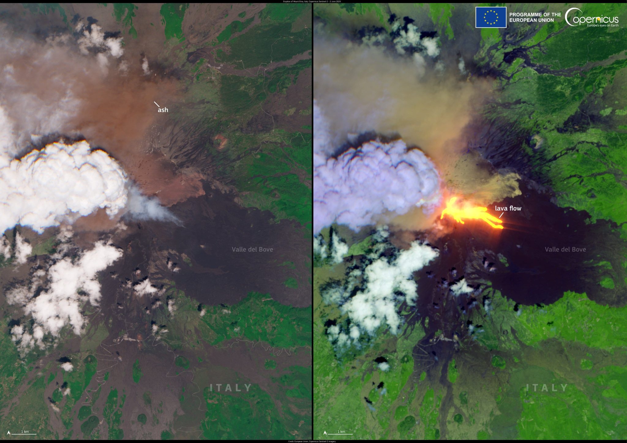
According to the Italian National Institute of Geophysics and Volcanology, the eruption occurred in the southeastern crater, one of the most active in recent years. It was accompanied by a pyroclastic flow (an avalanche of hot rock, ash, and gas), which was probably caused by material falling from the slope.
The Sentinel-2C image was taken just a few minutes after the eruption began. On the left side of the image, in natural colors, a dense column of ash is clearly visible in the area of the summit crater, partially obscured by a pyroclastic cloud moving westward into Sicily. On the right side of the composite false-color image obtained using shortwave infrared channels, you can see the intense thermal signature of active lava flows flowing into the Valle del Bove.
Scientists continue to monitor Etna’s activity. Despite the fact that the eruption caused minor disruptions to operations at Catania airport, there are currently no signs of any immediate threat to local residents.
Earlier, we reported on how melting ice in Antarctica could lead to increased volcanic activity.
According to Сopernicus.eu
