On October 9, a volcanic eruption began on the Italian island of Stromboli. One of the Sentinel-2 project satellites owned by ESA photographed the consequences of the event. Its picture was taken five hours after the eruption began.
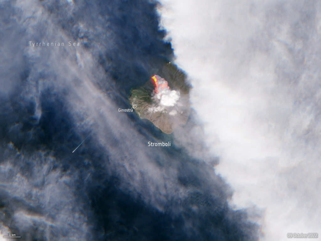
According to eyewitnesses and reports from local authorities, the eruption turned out to be quite powerful. It destroyed part of the volcanic crater, after which lava flows poured into the resulting breach. In addition, a significant amount of gas and ash was released into the atmosphere. The height of the volcanic plume above Stromboli was several hundred meters.
The Sentinel-2 image clearly demonstrates the processes taking place on the island. The image was made in natural colors, but data from the infrared channel were also added to it. This was done in order to better distinguish lava flows running into the sea. The photo also clearly shows the clouds of ash and gas emitted by the volcano.
According to geologists, the Stromboli volcano was formed about 150 thousand years ago. It is famous for the fact that it has been erupting almost continuously for the past few thousand years. Fortunately, they usually don’t pose much of a threat. As a rule, Stromboli eruptions are limited to gas and ash emissions. Cases when a volcano emits lava are extremely rare.
You can also read about how the Earth’s atmosphere “boiled” due to the eruption of the Tonga volcano.
Follow us on Twitter to get the most interesting space news in time
https://twitter.com/ust_magazine
