

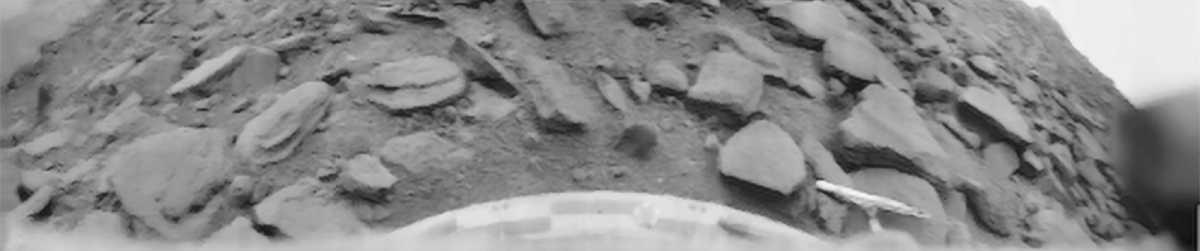
The first high-quality photograph taken from the surface of another planet was received on October 22, 1975. The image was transmitted by the Venera 9 lander shortly after it touched down on Venus. Although some scientists had anticipated seeing fog and dust, the image revealed a rocky slope. Since then, only a few panoramic views have been received from Venus, and new close-up images are not expected until the 2030s.
What was observed
The landing occurred at 8:13 a.m. Kyiv time. Near the surface of Venus, temperatures exceed 450 °C, while atmospheric pressure reaches 90 atmospheres — approximately equivalent to the pressure at a depth of 900 meters in the ocean. Long-term operation under these conditions was not expected. Communication lasted 53 minutes, during which one image was transmitted to Earth, according to NASA.
Two cameras were installed on board; however, the protective cover on one camera did not open. The image captured by the second camera shows a pile of angular rocks, ranging in size from 30 to 40 cm and partially covered by soil. The horizon is visible in the upper corners of the frame, and the distortion was caused by the camera system.
Visibility of 100 meters
Before the landing, some researchers had speculated that a dense veil existed near the surface. However, the footage indicated otherwise. Visibility was approximately 100 meters, and the lighting resembled that of a cloudy day on Earth, according to the Guinness Book of World Records.
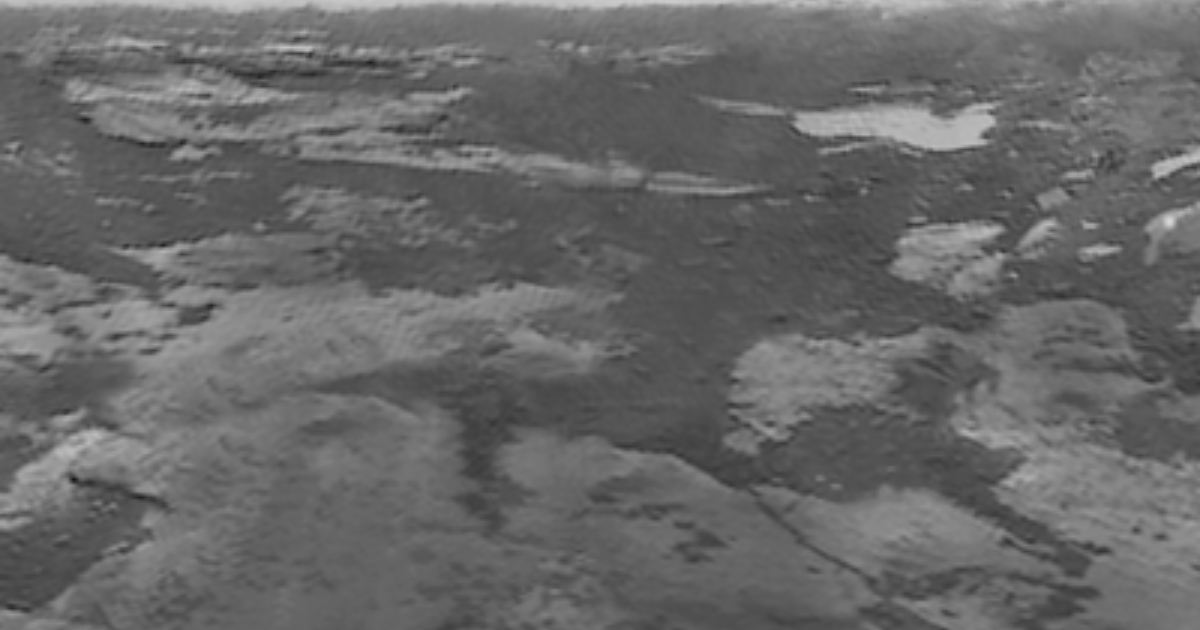
Three days later, the “Venera 10” spacecraft landed 2,200 km from the first landing site. Communication with the spacecraft lasted 65 minutes, and the terrain at the landing site proved to be flatter. According to ESA, both images are in black and white.
Color panoramas and radar maps
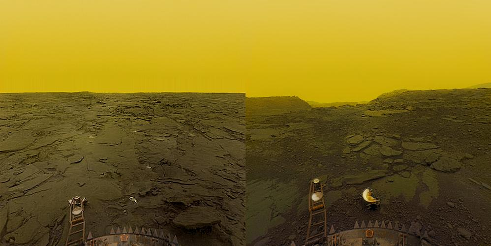
Color panoramas were obtained only on March 1 and 5, 1982, following the landings of the Venera 13 and Venera 14 probes. No new images of the planet itself have been received since then; therefore, these remain the most recent images to date.
Venus was subsequently studied from orbit. In the early 1990s, the Magellan spacecraft was used to produce a radar map of nearly the entire planet, as radio waves can penetrate clouds that are opaque to visible light. These archived data continue to yield new discoveries. In 2023, researchers observed a change in the crater of Maat Mons, a volcano, which is regarded as the first direct evidence of an eruption on Venus.

The Parker Solar Probe, designed to study the Sun, produced unexpected findings during its flybys of Venus in 2020 and 2021. Images captured by its camera revealed a faint glow emanating from the planet’s scorching surface on its night side. These images also made it possible to distinguish the outlines of highlands and plains.
Return to the surface

New close-up images are expected to be captured during the DAVINCI mission. NASA plans to launch the mission in December 2030. In the fall of 2032, the descent probe is expected to pass through the atmosphere and capture images of one of the planet’s highlands during its descent, according to Ars Technica. If the schedule remains unchanged, half a century will have elapsed between the last panorama captured from Venus’s surface and the new images taken from a low altitude. The probe’s launch and descent dates remain subject to budgetary decisions.
Two orbital spacecraft — NASA’s VERITAS and ESA’s EnVision — are also scheduled to launch in 2032. Scientists plan to use VERITAS’s radar to map the terrain and search for evidence of geological activity, while EnVision will also study Venus’s atmosphere and internal structure.
