

The DRAGO-2 infrared camera has revealed an oil slick around the tanker Caroline Bezengi, which ran aground near Al-Kibla Island off the coast of Oman. What makes this news particularly interesting is that the spacecraft was created by a small team from the Canary Islands.
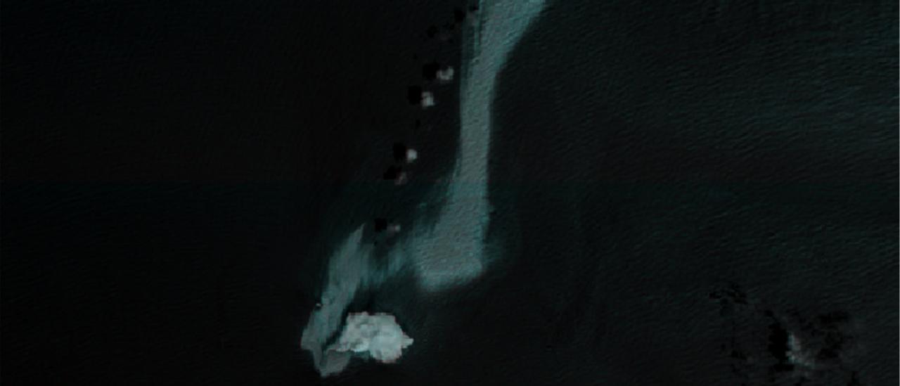
Oil Slick Around the Tanker
An oil slick is expanding in the sea near Al-Kibla Island off the coast of Oman. Its source is the tanker Caroline Bezengi. As the website of the Institute of Astrophysics of the Canary Islands reports, the situation is being closely monitored from orbit by the ALISIO-1 satellite.
The tanker itself ran aground back in June 2026. Since then, Omani authorities have been trying to eliminate the oil leaks from it. They have been partly successful, but not completely. Overall, the area of oil spilled across the ocean surface is estimated at 400 km². However, the most important aspect of all this is not the tanker itself, which is being monitored by many observers and whose situation remains consistently unpleasant, but the satellite.
Design of ALISIO-1
ALISIO-1 stands for Advanced Land-Imaging Satellite for Infrared Observations. It belongs to the Institute of Astrophysics of the Canary Islands and the company Open Cosmos, while its developer is IACTEC-Espacio. European space-technology manufacturers such as Deimos and D-Orbit also participated in the creation of the spacecraft.
The main payload of the spacecraft is the DRAGO-2 infrared camera, which operates at wavelengths from 1,100 to 1,600 nm. Its resolution is 50 m per pixel, which is, of course, better than that of its predecessor DRAGO-1, but by modern standards is fairly modest.
This makes the comparison between the Caroline Bezengi images obtained by DRAGO-2 and those produced by satellites of the European Sentinel system even more important. It confirms that DRAGO-2 provides a comparable amount of information to these spacecraft, even though their optics are significantly better.
The point is that Sentinel was created by the entire European Union, while IACTEC-Espacio is a small team operating not even at the level of all of Spain, but only the Canary Islands. This means that in the future, satellite technologies may become accessible even to small communities, allowing them to independently assess the scale of natural disasters.