The Mars Express spacecraft photographed the Ascraeus Mons on its surface from the Martian orbit. The slopes of this huge volcano are covered with deep cracks, the origin of which is sometimes unclear even to scientists.
Mars Express photographed the Ascraeus Mons
The ESA Mars Express spacecraft, which has been operating in Mars orbit since 2003, can still surprise with images taken by a high-resolution camera on board. It is able to show the smallest details, such as the crests of dunes, small impact craters and the beds of ancient rivers.
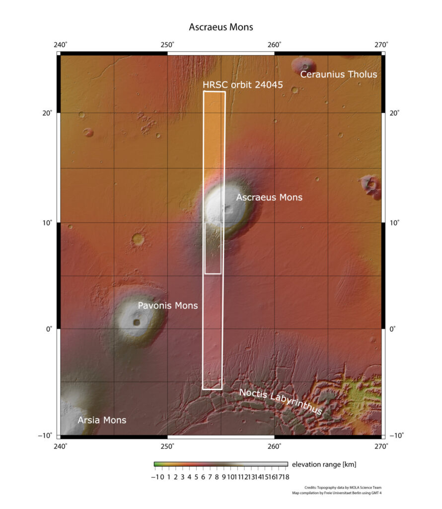
This time Mars Express photographed a Martian volcano. But not the famous Olympus Mons, which is the highest mountain in the Solar System, but the Ascraeus Mons. It is the northernmost and highest of the three peaks rising above the Tharsis Bulge.
The height of the Ascraeus Mons is as much as 18 km, that is, it is twice as high as Everest. However, the angle of inclination of its slopes is only 7 degrees. Because of this, its base has a huge diameter. The area of the volcano is approximately equal to the area of Romania.
Slopes of a giant volcano
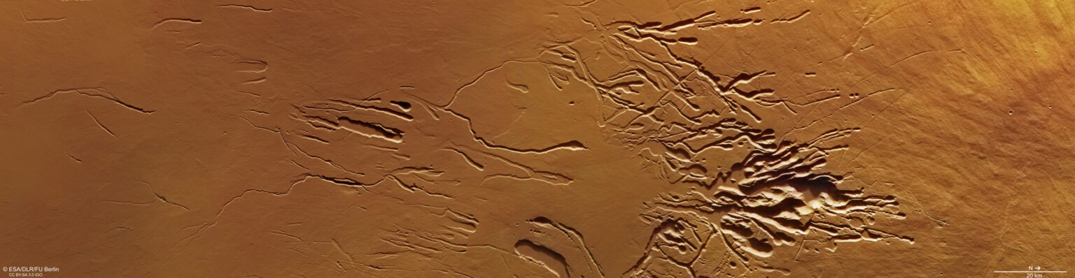
The image shows the southern slope of the Ascraeus Mons, while the left (southern) side of the frame is about 10 km lower than the right (northern) side. The top of the volcano is located even further to the right outside the image.
The main decoration of the picture is the Ascraeus Chasmata, which covers an area 70 km across. They are a system of lava flows and pipes, chains of craters and huge cracks stretching for tens of kilometers.
Ascraeus Mons and its cracks
All of them have different ages and origins, but harmoniously merge into a surreal picture resembling flows of ink in water. The image resolution is 16 meters per pixel. The entire right side of the image is occupied by wrinkled lava flows, around which rows of “craters” stretch.
The latter are the superposition of individual craters on top of each other in such a way that they form one elongated depression. A few similar ones can be seen on Earth, for example, cenotes on the Yucatan Peninsula.
This similarity makes scientists suspect that these formations are not of meteoritic origin. They are formed due to dips when there is a cavity under the surface. It is believed that they form when the surface layer of the lava flow cools and hardens rapidly; the lava flow from below stops and eventually disappears, leaving tube-shaped pockets.
The ground to the left of the pit crater chains is marked by the so-called “sinuous rilles”: smaller, sinuous channels without rims, often found on the slopes of volcanoes. It is still unclear how they are formed, but their occurrence may be due to lava flows, ash or water, or a combination of them.
In the leftmost part of the image, large cracks with a length of up to 40 km prevail. Intertwining and intertwining channels branch off from them, isolating pieces of Martian terrain, forming “islands” and terraces. Probably, they were formed by water. It probably flowed here back in the days when the slopes of the Ascraeus Mons were covered with snow and ice.
According to phys.org
Follow us on Twitter to get the most interesting space news in time
https://twitter.com/ust_magazine
