
The ancient monument of Rujm el-Hiri (“Wheel of Ghosts”) on the Golan Heights plateau in southwestern Syria has long been considered an astronomical observatory. Previous studies have been based on the orientation of the monument relative to night sky objects. However, a new study published in Remote Sensing challenges this theory, revealing new aspects of the purpose of this unique megalithic structure.
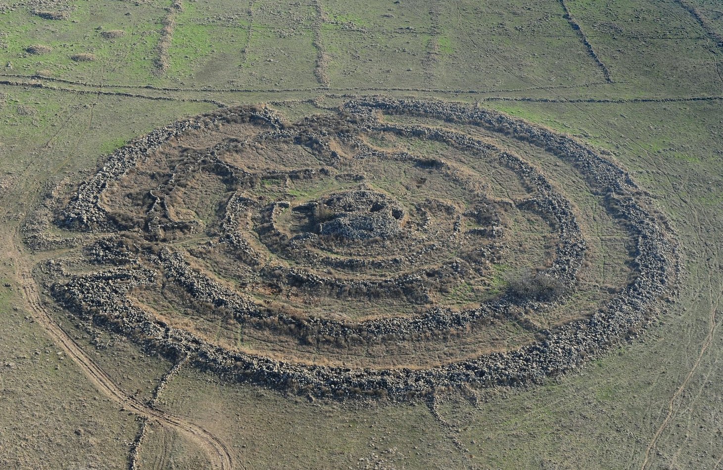
Researchers from Tel Aviv University and Ben-Gurion University of the Negev in Israel have discovered that Rujm el-Hiri has changed its position over the past millennia. This calls into question its original astronomical orientation. Using geomagnetic analysis, tectonic reconstruction and remote sensing, the research team concluded that the region’s tectonic activity caused blocks of the Earth’s surface to rotate. As a consequence, the central mound and radial walls of the monument have shifted.
“The geologic structure of the area has undergone changes due to tectonic evolution, which has affected the location of the main entrance and radial walls,” the researchers said. According to their data, Rujm el-Hiri turned counterclockwise and shifted dozens of meters from its original location.
Construction of the structure began around 4500 BC. Its individual parts were rebuilt and added to until the Bronze Age (3600-2300 BC), with possible modifications in subsequent centuries. There is speculation that the monument may have served as a fort or meeting place.
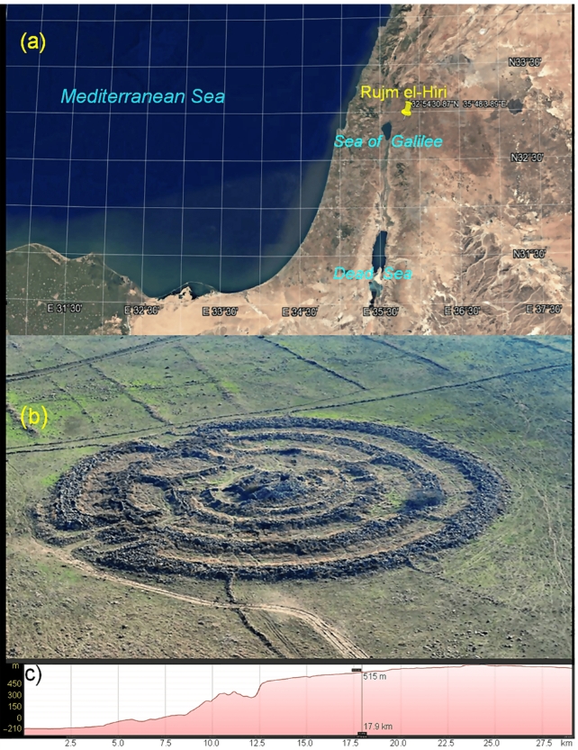
Rujm el-Hiri consists of a central mound surrounded by concentric circles of basalt stone that extend for 150 meters. Researchers have also found other structures, walls and mounds nearby.
“Most of the region’s archaeological sites were reused. New elements were added to old structures, changing their original appearance,” the scientists emphasize. Rujm el-Hiri is a prime example of this complex evolution.
This is the first time geomagnetic analysis, tectonic reconstruction and remote sensing have been applied to sites in the Southern Levant. Scientists believe that this region hides many more secrets. Analyzing the changes in the landscape helps to better understand the history of the monument. In the future, these methods could be used to train artificial intelligence models capable of detecting similar structures in satellite images that are difficult to see from the ground.
“The results of the study have global significance, creating an opportunity for comparison with other megalithic structures of the world,” the authors said.
Earlier, we reported on what the La Silla Observatory looked like from a bird’s eye view.
