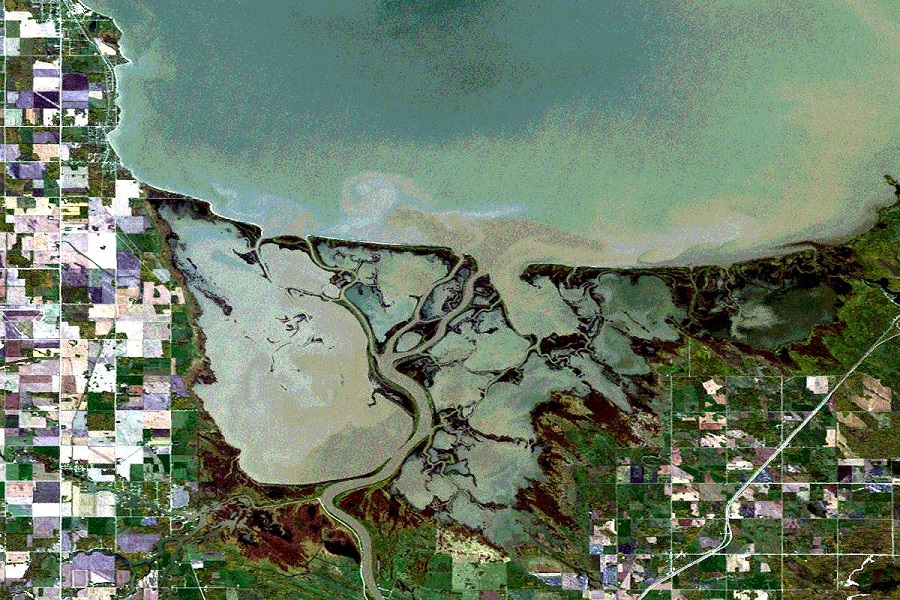
Analysis of satellite images has shown that over the past 20 years, the area of wetlands in the world has decreased by 4,000 square kilometers. Coastal wetlands disappear especially quickly in Southeast Asia.
Satellite data indicate a change in landscapes
Recently, a group of researchers studied images of the earth’s surface collected from 1999 to 2019. In these images, they were interested in wetlands around the world, especially coastal zones. These biosystems play a key role in the carbon cycle and oxygen recovery in the Earth’s atmosphere.
The researchers applied machine learning systems to image processing and obtained geoinformation data from them. And these data are disappointing. During this period, 13,700 sq. km of wetlands disappeared on Earth, and 9700 sq. km were restored. That is, approximately 4,000 square kilometers of the wetlands were lost forever. This is approximately equal to half of the Chernivtsi region or five squares of Kyiv.
At the same time, it should be remembered that this figure is not the total number of missing marshes, but only coastal zones regularly flooded by the waters of the seas. The total area of the lost marshes is much larger.
Where coastal wetlands disappear more
Geospatial data is information about the presence of an object in a certain place according to time and circumstances. Extracting them from satellite images is one of the main directions for the development of the orbital infrastructure in 2022. In the case of wetlands, this information allowed to establish, as a result of which they disappeared.
It turned out that 27 percent of the disappearance of the wetlands are due to the purposeful destruction of them by man, for example, through the construction of ports or tourist complexes on the coast. The rest are the consequences of indirect influence mainly due to climate change or riverbed changes.
Southeast Asia is the leader in the disappearance of the wetlands. Southern China, Indonesia and Myanmar account for 70 percent of all missing wetlands. In other countries, the losses are much less. Scientists continue to observe the changing landscapes with the help of satellites.
Satellite images are mainly used to track military operations. However, the topic of wetland resources and catastrophic consequences also comes up during the war. In particular, the flood on the Irpen River caused by the destruction of the dam was captured by Maxar satellites.
According to phys.org
Follow us on Twitter to get the most interesting space news in time
https://twitter.com/ust_magazine
