The most powerful earthquake in Turkey and Syria in the last decade, which occurred on February 6, claimed the lives of almost 20 thousand people. Researchers from the British Center for Observation and Modeling of Earthquakes, Volcanoes and Tectonics (COMET) have discovered two huge faults in the earth’s crust after a catastrophic event. They were found by comparing images from space in the Mediterranean region taken by the European Earth observation satellite Sentinel-1 before and after the devastating earthquakes.
The longest of the two faults stretches for 300 km and extends in a north-easterly direction from the edge of the Mediterranean Sea. The crack was formed as a result of the first of two powerful shocks of magnitude 7.8, which occurred on February 6 at 4:17 a.m. local time. The second crack, 125 km long, opened during the second 7.5 magnitude quake about nine hours later, COMET reports.
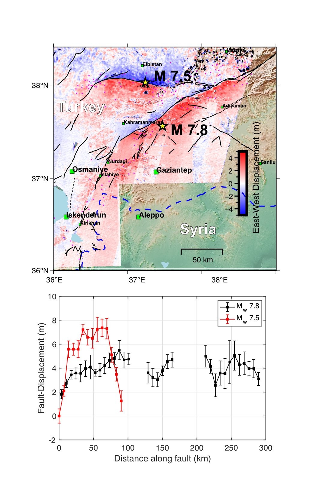
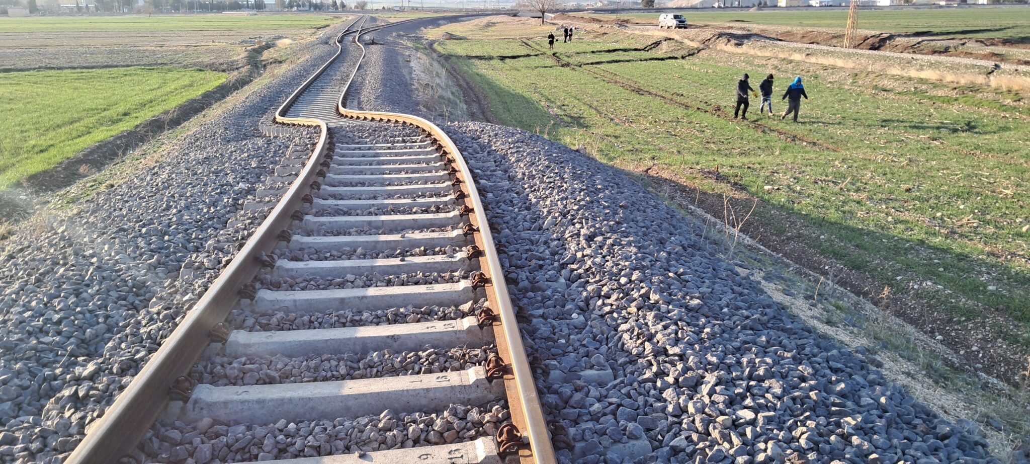
Such ruptures in the earth’s crust usually occur after the most powerful earthquakes, explained Professor Tim Wright, who heads the COMET team. These two cracks are very long, which indicates a huge amount of energy that is released as a result of the earthquake. The movement of the tectonic plates that caused the earthquake was such that the cracks were clearly visible on the surface: they passed through cities, and in some cases even directly through buildings.
Compete picture of the two earthquake ruptures now available from the Sentinel-1 descending pass. @CopernicusEU @COMET_database
Image below is range offsets from pixel tracking. The two ruptures appear not to be connected.
Scale of event is horrific – the image is ~250 km across pic.twitter.com/kc7u3k6z3g— NERC COMET (@NERC_COMET) February 10, 2023
“The stronger the earthquake, the larger and longer the fault is formed. Horizontal displacements of up to 5 m were noticeable in places. This fault is one of the longest in the history of observations on the continents. It’s also very unusual to have two such strong earthquakes several hours apart,” Wright explained.
Scientists shared photos of surface cracks on Twitter, confirming what the satellites observed from space.
Surface rupture at Hassa Town. #earthquake #deprem pic.twitter.com/klsw2zesYj
— OzdemirAlpay (@geodesist_a) February 8, 2023
Seismically dangerous zone in Turkey
The area north of Cyprus, where the disaster occurred, is prone to strong earthquakes, because three tectonic plates converge here — the Anatolian, Arabian and African. However, according to experts, the earthquakes on Monday were distinguished by their extremely destructive consequences.
According to NASA, the epicenter of the shocks was located along the fault line at a depth of 18 km below the surface. Such a shallow depth meant that the shocks spread with furious force for hundreds of kilometers from the epicenter.
“These were very large and powerful earthquakes. This led to extremely strong shocks over a very large area that hit many cities and villages. The length of the rupture and the magnitude of the earthquake with a force of 7.8 points were similar to the event of 1906 that destroyed San Francisco,” said Eric Fielding, a geophysicist at NASA’s Jet Propulsion Laboratory.
In the Turkish cities of Turkoglu, Kahramanmaras and Nurdagi, many buildings were destroyed, which buried their residents and left thousands of people homeless.
Earlier we reported on if earthquakes should be feared in Ukraine.
Follow us on Twitter to get the most interesting space news in time
https://twitter.com/ust_magazine
