NASA has published a couple of satellite images taken with an interval of 49 years. They show a marked decrease in the size of glaciers and icefields in the northwestern part of Greenland.
In 1972, NASA launched the ERTS-1 spacecraft, later renamed Landsat 1. It gave rise to the longest-running program in history to obtain satellite images of the Earth, which continues to this day.
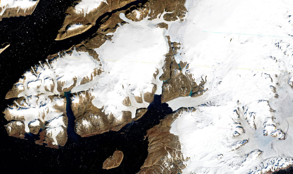
On September 3, 1973, Landsat 1 photographed a peninsula in Greenland, located north of the US Air Force Base, Thule. On August 20, 2022, the Landsat 8 satellite photographed this region again. The pictures are 49 years apart. Few satellite images can boast the same significant time gap.
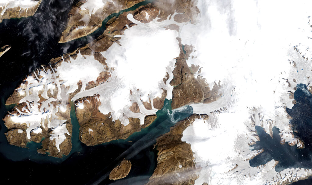
When looking at the Landsat 1 image, it seems that it was taken in natural colors. But in fact they are artificial. If you look closely at the image, you can see a red stripe on the coast, corresponding to the sparse local vegetation. As for the Landsat 8 image, it corresponds to what the human eye would see.
Comparing Landsat images makes it easy to see the changes in Greenland’s ice cover that have occurred over the past 49 years. In some places the glaciers retreated, in some places they decreased, and in some places they separated from the main massif. You can also pay attention to the fact that in the Landsat 8 image, the edges of ice caps and glaciers in general seem much grayer than in 1973. This is due to the fact that in the warm summer of 2022, most of the bright white snow cover melted, exposing darker and dirtier ice.
The comparison of satellite images of the region was made as part of a study aimed at assessing the rate of loss of Greenland’s ice cover. It showed that relatively small peripheral glaciers separated from the main ice sheet (4% of the ice-covered territory of the island) account for 11% of the total ice loss. According to scientists, now the peripheral glaciers in the northwest of Greenland are losing from 3.5 to 7 gigatons of ice per year. This is more than in the south-east and south-west of the island, but significantly less than in the north, where the loss rate is 26 gigatons per year.
According to https://earthobservatory.nasa.gov
Follow us on Twitter to get the most interesting space news in time
https://twitter.com/ust_magazine
