

Between August 11 and 12, NASA’s Lunar Reconnaissance Orbiter (LRO) captured a series of images of a new crater on the Moon. The crater formed on August 5, when the upper stage of a SpaceX Falcon 9 rocket struck the surface after the launch of the Firefly Blue Ghost 1 mission in January 2025.
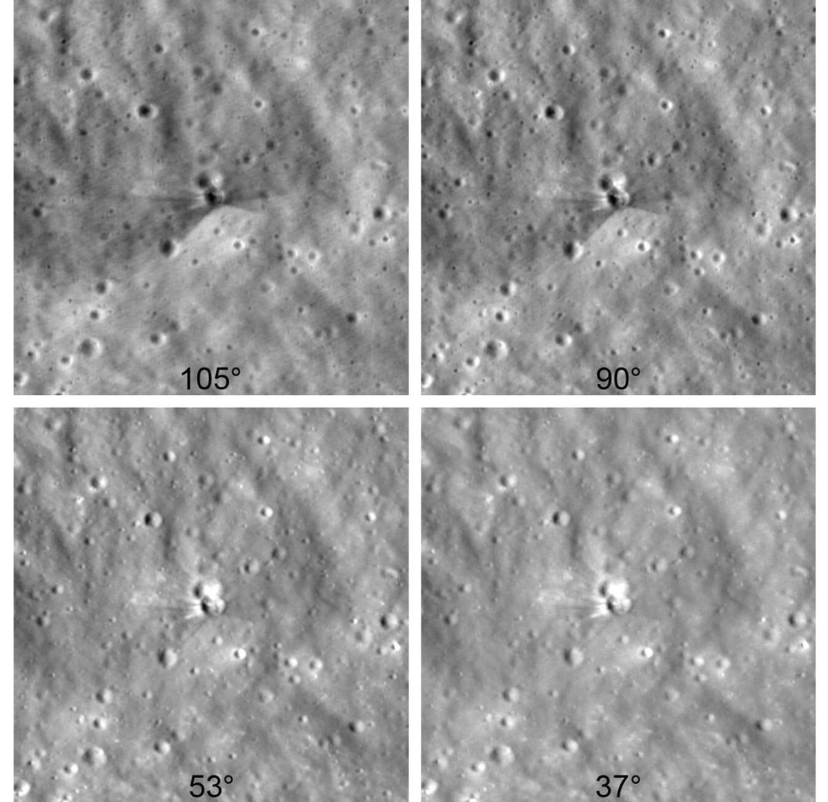
Technique for Obtaining the Images
To capture images of the impact site, engineers tilted the spacecraft so that its cameras would point toward the crater each time LRO passed about 60 miles (97 kilometers) above the Moon, traveling at a speed of 1 mile per second (1.6 kilometers per second). The orbiter circles the Moon from pole to pole every two hours while the Moon slowly rotates beneath it. To photograph a specific location, the spacecraft has to wait until that point comes into view, and in this case it took six days. This was reported by phys.org.
Getting the correct viewing direction was only half the challenge; the timing also had to be precise. If the camera took an image even 10 seconds too early or too late, the target would be 10 miles (16 kilometers) away from the center of the frame.
Details of the Falcon 9 Crater Formation
Thanks to different viewing angles, scientists were able to observe the crater under different lighting conditions, which helped reveal its unique features. In images where the crater rim was clearly visible, scientists measured its width at 60 feet (18 meters). They also determined that the crater is less than 10 feet (3 meters) deep based on the length of its shadow.
To capture these details, LRO used its Narrow Angle Camera, which can distinguish objects as small as 3 feet (1 meter) across.
The images show bright and dark rays extending outward from the crater. The darker streaks consist of surface dust and rocks that have been altered over long periods by the solar wind, galactic cosmic rays, and micrometeorite impacts. This processed material was excavated during the collision from a depth of 1.5 feet (46 centimeters) beneath the lunar surface. The brighter streaks near the crater rim consist of fresh material excavated from deeper underground layers.
International Cooperation to Determine the Crater’s Coordinates
Locating the impact site required global coordination among experts and enthusiasts. Independent astronomers first determined the rocket’s trajectory using publicly available data. NASA’s Center for Near-Earth Object Studies, which tracks natural objects that could pose a threat to Earth as part of the Planetary Defense program, used the opportunity to test and verify impact-prediction tools and methods.
Based at NASA’s Jet Propulsion Laboratory in Southern California, the center gradually refined the trajectory until it identified the impact location, which it then provided to the Republic of Korea for the Korea Pathfinder Lunar Orbiter (Danuri) team. Within several hours, the team used Danuri’s high-quality LUTI camera to photograph the crater and found that the prediction was accurate to within approximately 1 km (0.6 mile).
After obtaining images of the crater, the Danuri mission sent the coordinates to NASA’s LRO team to help refine the next imaging sequence. By comparing the new images of the crater with earlier images taken before the impact, the LRO team updated the coordinates of the crater’s center: 19.4759° N, 266.7138° E, elevation 511 meters (1,677 feet).