The National Oceanic and Atmospheric Administration (NOAA) has shared the first images from the recently deployed GOES-18 weather satellite. The spectacular images were obtained using the Advanced Baseline Imager (ABI) tool from an altitude of about 35 thousand kilometers above the Earth’s surface.
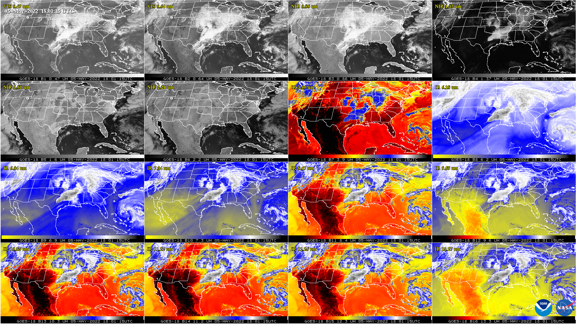
The ABI observes the Earth through 16 different channels. Each of them detects energy at different wavelengths of the electromagnetic spectrum, which allows it to collect data about the Earth’s atmosphere, land and oceans. According to NOAA, data from ABI channels can be combined to create images known as GeoColor that look just as the human eye would see them from space. Data analysis in various ways allows meteorologists to identify and study various features of interest to them.
“Advanced Baseline Imager provides high-resolution images and atmospheric measurements for short-term weather forecasts. ABI data is also used to detect and monitor environmental hazards such as forest fires, dust storms, volcanic eruptions, turbulence and fog,” NOAA explains on its website.
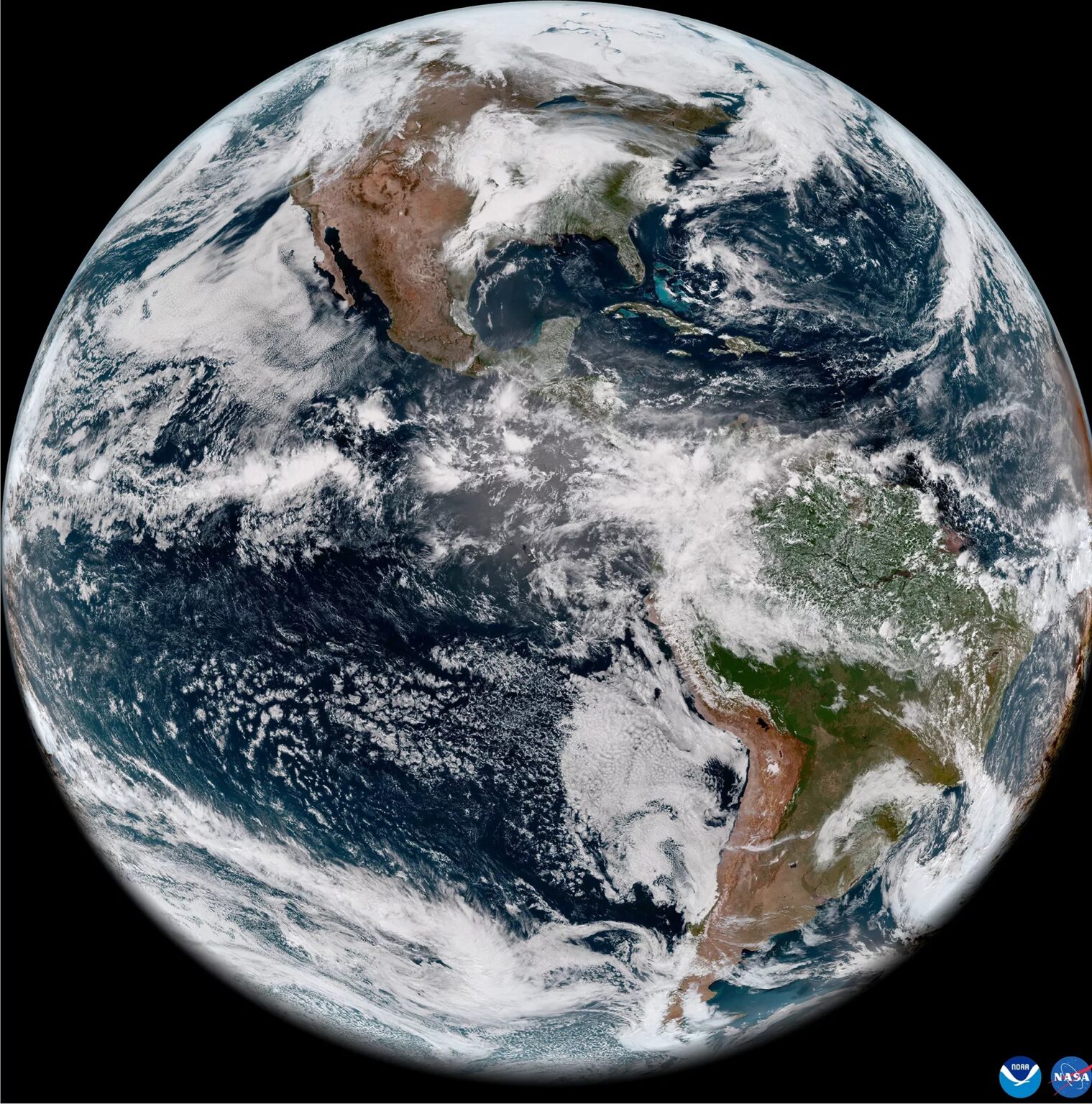
GOES-18 orbits the Earth directly above the equator, moving at the speed of rotation of our planet. This allows the new NOAA weather satellite to constantly monitor the same area of the Earth to track weather conditions and determine the level of danger as they develop.
The third in a series of GOES-R satellites
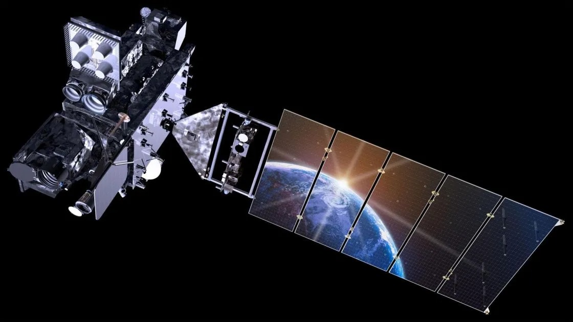
GOES-18, launched from the Kennedy Space Center on March 1, 2022, is the third satellite in NOAA’s new generation GOES-R series and now works alongside GOES-16 and GOES-17, which were deployed in 2016 and 2018, respectively. The new NOAA satellite monitors a vast territory that includes the west coast of the United States, Alaska, Hawaii, Mexico, Central America and the Pacific Ocean.
Continuing to calibrate its systems as part of post-launch test procedures, GOES-18 has already observed storms in east Texas, accompanied by heavy hail, strong wind gusts and tornadoes, as well as wildfires and strong winds that raised dust into the air over New Mexico. Thick fog was also observed in Chile and thunderstorms in Yucatan and Florida.
NOAA said the launch of its new GOES satellites “changed the world of environmental monitoring and hazard detection in the Western Hemisphere forever”.
According to NOAA
Follow us on Twitter to get the most interesting space news in time
https://twitter.com/ust_magazine
