The presented image was taken by one of the ISS crew members. It captures the northwest coast of the Yucatan Peninsula. 65 million years ago, it took the impact of a cosmic body with a diameter of about 10 km. According to the most popular version to date, it was this event that led to the mass extinction of terrestrial species that killed the dinosaurs.
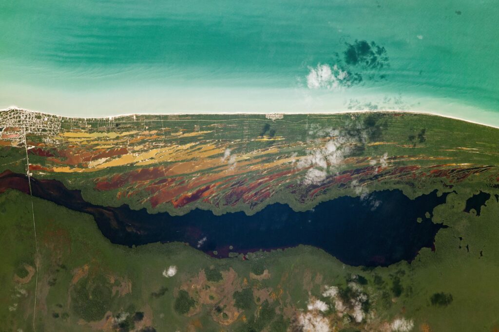
Now there is a national park on this territory. A photograph taken from space shows a very picturesque landscape. We can see dark green mangrove forests surrounding shallow estuaries reaching the Gulf of Mexico. The ebb and flow of ocean currents weigh sedimentary deposits, giving shallow brackish estuaries orange and reddish-brown shades.
At some distance from the coast there are sinkholes called cenotes. This type of relief is formed when carbon dioxide in the groundwater dissolves limestone rocks, which leads to their collapse and the formation of natural sinkholes. Cenotes filter salt from seawater, creating reservoirs that have been used as freshwater resources since the Mayan civilization.
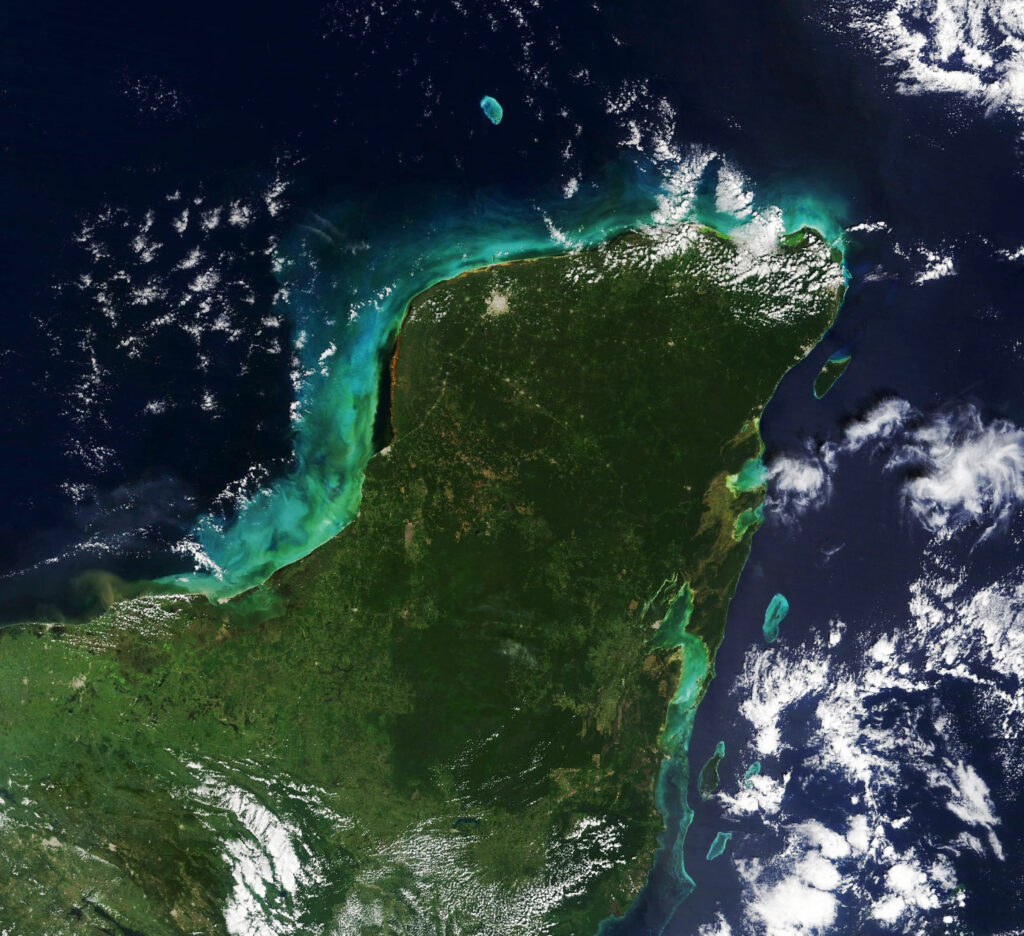
The cenotes of the Yucatan Peninsula are the most visible evidence of the ancient catastrophe that killed the dinosaurs. They outline the boundary of the Chixculub Crater, formed as a result of the fall of a celestial body. It is believed that the original diameter of the funnel was 180 km, and its depth reached 20 km. In 2021, the Terra satellite took a wider view photograph of the Yucatan Peninsula, where you can see a ring of cenotes.
Recall that recently an asteroid the size of two Kyiv TV towers flew past the Earth.
According to https://earthobservatory.nasa.gov
Follow us on Twitter to get the most interesting space news in time
https://twitter.com/ust_magazine
