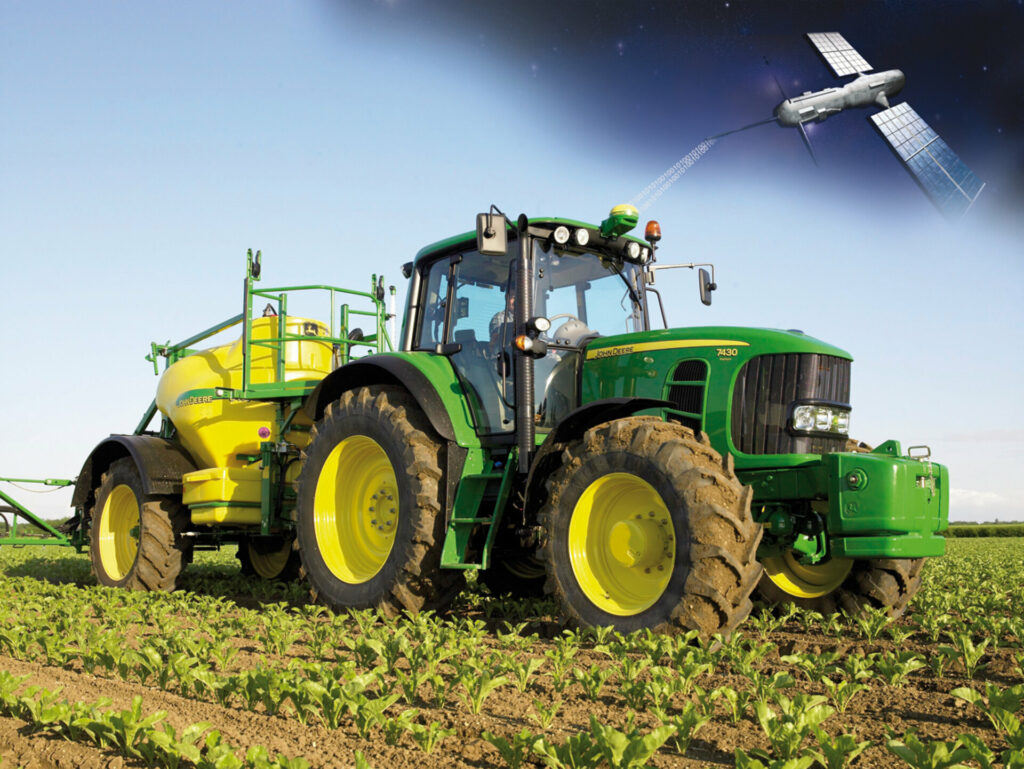
One of the areas where satellite monitoring is actively used is agriculture. Thanks to the latest technologies, such as artificial intelligence and high-precision satellite data, we can observe online today what is happening in the field. The gadget will receive notifications about the state of crops, weather conditions in the region and recommendations on how to improve the harvest.
Space data provide new opportunities not only for agricultural holdings and farmers who work directly in the field. Satellite analytics helps traders make price forecasts, allows lenders and insurance agents to set rates directly from the cabinet, and allows the state to manage land assets.
The latter is especially relevant given the launch of agrarian reform in Ukraine, which should lift the moratorium on the sale of agricultural land.
We tried to understand how space technology can affect the land market in Ukraine.
At the end of 2019, the Minister of Economic Development, Trade and Agriculture Tymofiy Milovanov presented the Open Land project.
Its main purpose is to ensure the transparency of land relations, as well as to provide all citizens with complete information about landowners, the value of purchase and lease agreements, the concentration of land in one hand, and so on.
In 2018, no ensure the transparency, efficiency and reliability of this process, the World Bank, supported by EU, launched a satellite monitoring Land Transparency project for agricultural land in Ukraine.
It is implemented using space technology by the American-Ukrainian company EOS, which won the tender for the maintenance of this component of the program. The company’s products have been successfully sold on the world market both in the public sector and in private business since 2015. In Ukraine, the company has several offices and an R&D center. It cooperates with leading universities and research institutes.
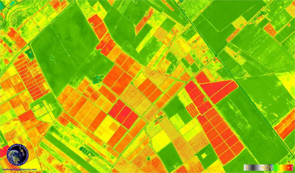
The implementation of the project started in three administrative units — provinces with centers in Kyiv, Mykolaiv and Lviv. And by 2019, EOS specialists have already developed an interactive satellite map of crops throughout Ukraine.
Using satellite data it was possible to determine the actual size of agricultural land in Ukraine, and as a result it was found that the area of agricultural land is larger than indicated in the cadastre. In total, there are almost 4.3 million hectares of fields on unregistered lands.
The map makes it possible to accurately estimate the area under crops and find unregistered lands, identify crop rotation violations, as well as analyze the overall picture of crops by region. This will allow all land market participants, including insurers, state-owned companies and investors, to determine the condition of the fields, obtain historical data on individual plots, their area, and so on.
“You can see that the area under rapeseed in the Kherson province, according to satellites, is 117.8 thousand hectares. This is by a third more than the information in the cadastre. Or, taking Dnipropetrovsk province a example, 136.4 thousand hectares of fields can be seen on lands not registered in the State Cadastre, ”experts say.
To implement the project, EOS used its own developments and methods for processing large amounts of information using machine learning algorithms, as well as data obtained from Sentinel spacecraft, operated by Copernicus project of the European Union.
EOS is convinced that the introduction of monitoring of agricultural land from space will benefit all participants in the agricultural market: public, financial and investment sectors, agricultural holdings and farms, insurance companies, distributors and traders.
“The main goal of the program is to support the transparency of land use by both public authorities and private market participants. This synergy project between a private company, engineering teams, international donors and the Ukrainian authorities is setting a precedent in the market for the applied use of satellite surveillance. The key metric of the work done is transparency. Inconspicuous, and sometimes deliberately closed to society, land distribution processes are quite effectively tracked from space, ” Max Polyakov adds, managing partner of Noosphere Ventures and the owner of EOS.
The use of space monitoring technologies allows estimating the area of crops with high accuracy, to monitor the condition of plants at all stages of growth, to predict the harvest in the early stages, to control agricultural operations, etc.
Access to satellite data from previous years and analysis of huge arrays of information using the latest technologies allows to assess the value of land.
“We can provide information on which crops were grown in a particular field in previous years and propose crop rotation options, identify problem areas and degradation processes over a long period of time, assess the yield of basic regional crops,” — an EOS official commented.
In addition, satellite monitoring should contribute to the development of the agricultural insurance market. The advantages of space monitoring of agricultural lands have been enjoyed by the world’s leading countries for many years. Thus, in the European Union, the work of field controllers has been rendered automatic; and subsidy decisions are made using this technology that. In the United States, satellite data are used to predict yields and analyze pricing around the world.
