The European Space Agency (ESA) has published a new series of images taken by the Mars Express spacecraft. It shot the Tantalus Fossae — part of a huge system of faults stretching across the surface of the planet.
Faults and Volcanoes of Mars
The Tantalus Fossae are depressions that frame Mount Alba on the eastern side — a huge Martian volcano located in the northern part of the Farsida region. With a relatively small height by the standards of other volcanoes of the Red Planet, Mount Alba is the record holder in area. The flows of the erupted rock are traced at a distance of at least 1,350 km from its peak. The total area of the volcano is comparable to the territory of the United States.
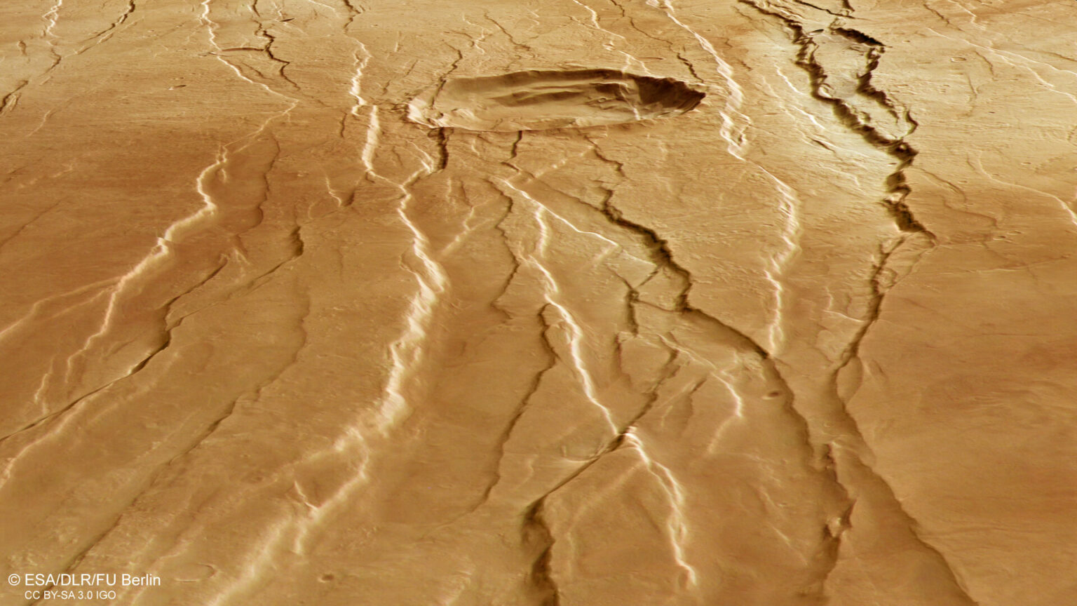
The growth of Alba Mons was accompanied by stretching and curvature of the surrounding surface, which gave rise to the Tantalus Fossae, which are an excellent example of geological structures called grabens. They are formed as a result of rock subsidence between two parallel faults.

A similar fault system is located on the western part of the Alba Mountain. They form an incomplete ring around it. In general, the grabens associated with this volcano have a maximum length of up to 1000 km, a width of up to 10 km and a depth of up to 350 m.
Complex Geological History of Mars
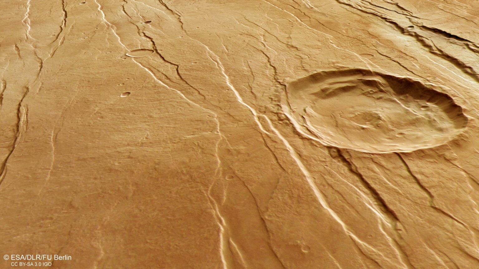
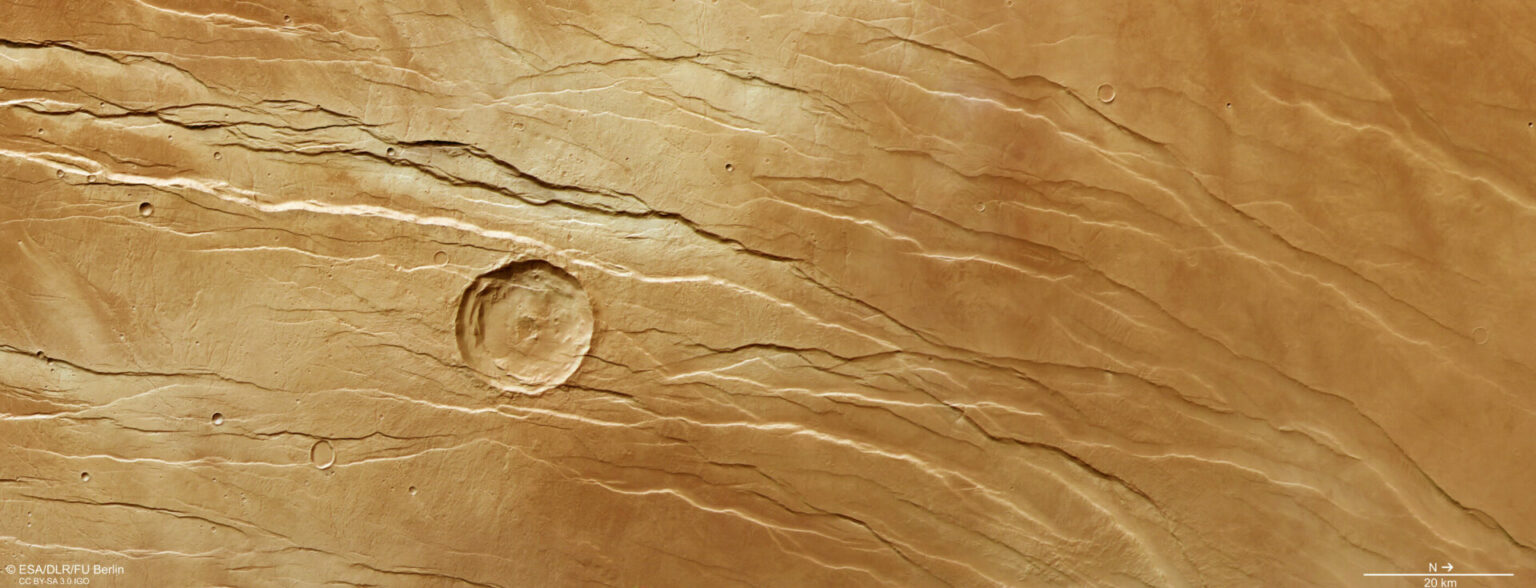
It should be noted that the grabens were not formed simultaneously, but one after another for a considerable period of time. Their study gives scientists the opportunity to look into the past of Mars and compile a geological chronicle of this region. As an example, an impact crater on one of the images of Mars Express can be cited. The grabens crossing it indicate that the impact formation existed even before the appearance of Mount Alba. In turn, a small crater located nearby is located on top of grabens. Which means it’s younger.
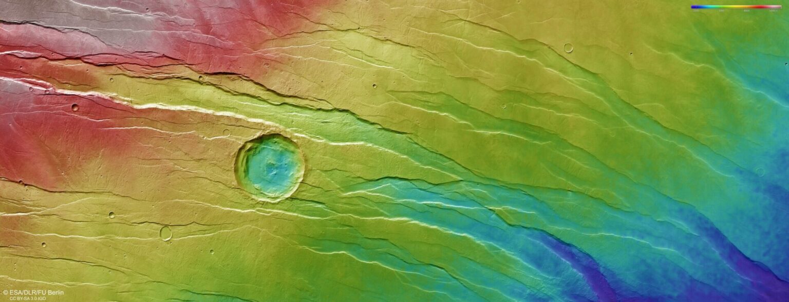
Upon closer examination, many small branched valleys can also be seen in this region. They cut through grabens and are therefore considered more ancient. Since the average height of the northern part of the region is much lower than the southern one (in places the difference reaches three kilometers), one would expect that they would pass along the slopes of Mount Alba and merge in depressions. But satellite images do not confirm this suggestion. Consequently, the valleys appeared even before the formation of the volcano.
According to https://www.esa.int
Follow us on Twitter to get the most interesting space news in time
https://twitter.com/ust_magazine
