
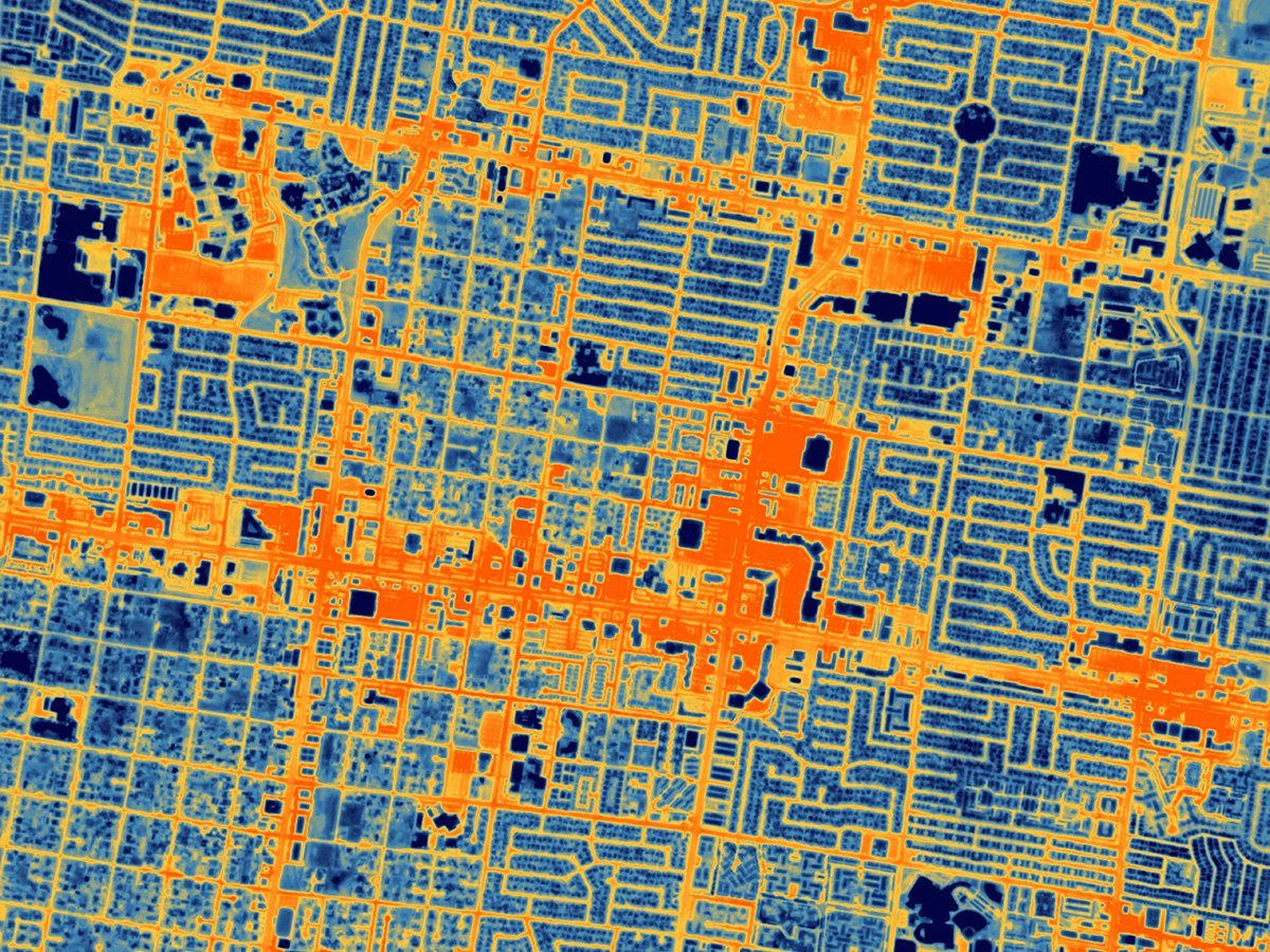
The recently launched HOTSAT-1 satellite has taken thermal imaging from space that shows the temperature of the planet’s surface with unprecedented detail. It can show temperature differences with a resolution of up to 10 meters, according to Space.
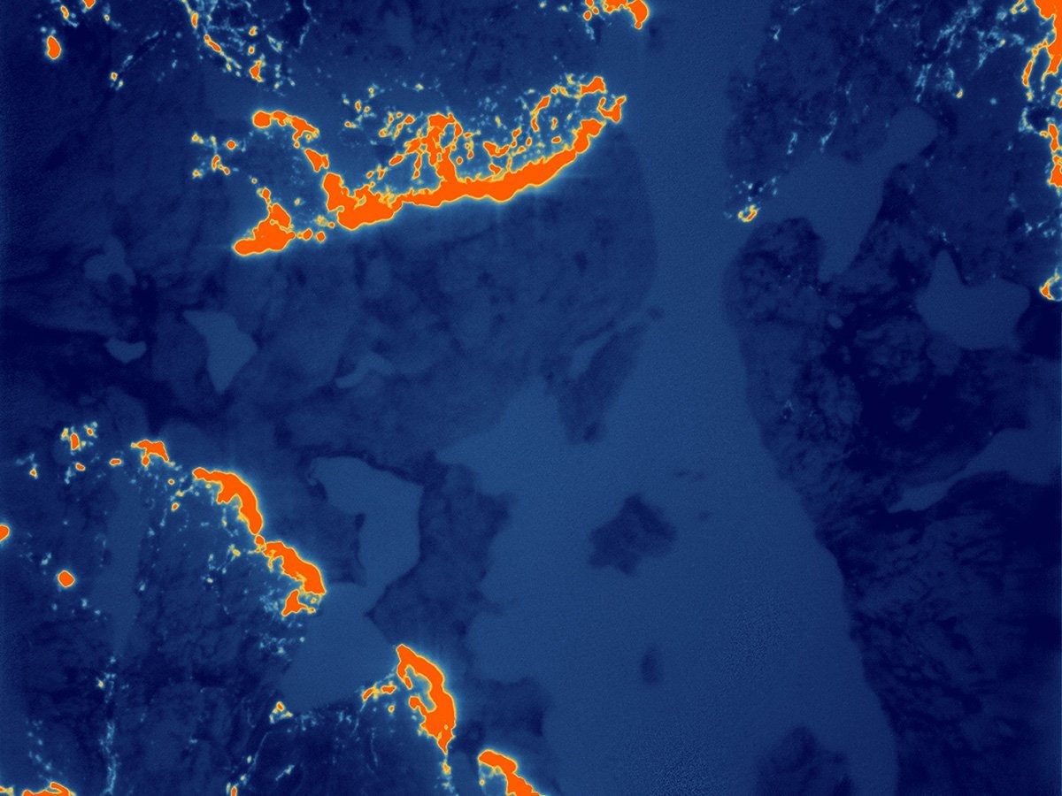
The camera can also film short video sequences. One of them shows the thermal signature of a train passing through Chicago. One of the images taken by HOTSAT-1 shows the thermal footprint of a forest fire that engulfed the Northwest Territories of Canada in June 2023, and it is hoped that this data will help firefighters monitor how the fire is moving across the landscape.
The operator of HOTSAT-1 is the British company SatVu, which plans to launch seven more spacecraft, which will not only increase the amount of data, but also allow faster detection of thermal changes at the scene.
“Thermal imaging has been done for decades by scientific missions like NASA’s Landsat and the European Sentinel satellites. But these satellites are only collecting thermal data at a very coarse resolution — 100 meters, 500 meters or 1,000 meters [330 feet, 1,650 feet or 3,300 feet]. There’s not been a commercial mission that is capturing data under 10 meters [33 feet] in the thermal spectrum,” says Tobias Reinicke, chief technical officer and co–founder of SatVu.
Analysis of the temperature difference on the Earth’s surface in high resolution will help urban planners better understand how heat is radiated from roads, buildings and industrial areas. It is expected that this will lead to the creation of more energy-efficient infrastructure to combat climate change.
Advantages and disadvantages of HOTSAT-1
Most satellites observe the Earth in visible light, that is, in the same wavelengths that a person sees with his own eyes. The HOTSAT-1 satellite detects heat, which is essentially infrared light with a much longer wavelength, but this creates certain difficulties.
“You need a slow shutter. Effectively a longer exposure. But because our satellites travel through space at a speed of 7 kilometers per second [4.4 miles per second], we need to be able to carefully point the satellite; otherwise, the images would be blurry,” says Reinecke in an interview with Space.
#HotSat1, the “thermometer in the sky” ????️????️, is now acquiring high-resolution thermal maps of the built and natural environment. Here, the heat signature of a locomotive ???? is seen moving through the night in #Chicago. “Cool” stuff. @satellitevu https://www.bbc.co.uk/news/science-environment-67010377 pic.twitter.com/EKPX6OB3Xq
— Jonathan Amos (@BBCAmos) October 6, 2023
HOTSAT-1 was launched into space in June 2023 aboard a SpaceX’s Falcon 9 rocket. The spacecraft, in the form of a cube with dimensions of 1x1x1 m, moves in a polar orbit, which allows it to see every point on Earth at about the same time every day. SatVu, which has now raised USD 37.1 million in venture capital, hopes to launch its second satellite in about a year. Finally, the company assumes a group of 8-10 satellites that will allow scientists, urban planners and others to monitor in detail how the temperature on the planet’s surface changes daily.
Earlier we reported on how the summer of 2023 turned out to be the hottest in the history of the Earth.
According to space.com
Follow us on Twitter to get the most interesting space news in time
https://twitter.com/ust_magazine
