Maxar Technologies has presented its new platform called Maxar Geospatial Platform. So far, it is being tested by a limited number of users. But in the future, not only the archive of images will be available, but also the possibility of ordering them, as well as analytics.
New service from Maxar Technologies
On July 10, during the Esri User Conference, which was held in San Diego, representatives of Maxar Technologies presented a new application that would make it much easier for the company’s customers to use its satellite images. It is called Maxar Geospatial Platform (MGP).
This message has greatly interested users around the world. Indeed, in recent years, Maxar Technologies has been the main supplier of important satellite images from around the world. Especially important were their photos with the beginning of Russia’s large-scale invasion of Ukraine, as they helped to reveal the true state of the situation in the information war.
Many independent OSINT investigators began to rely on satellite images from Maxar Technologies in their activities. However, their unavailability put the development of such practices in doubt.
This is exactly the problem that the MGP platform should solve, because its users will have access to the entire archive of the company’s photographs. True, it will not be free, but without making requests or making deals. However, so far, the system is working in test mode, and only a few Maxar Technologies customers have access to it.
What will the service be like?
According to representatives of Maxar Technologies, MGP will be available in three main variants. The first one is intended for possible use by everyone. It’s called MGP Xpress. It is expected that the entire archive of photos with a volume of 125 petabytes of information will be available in it.
All the user will need to do is select the picture that interests him and pay for it with a bank card. Later, the same service will be added to the ability to order pictures of interesting sites in the future.
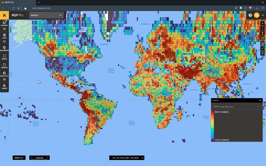
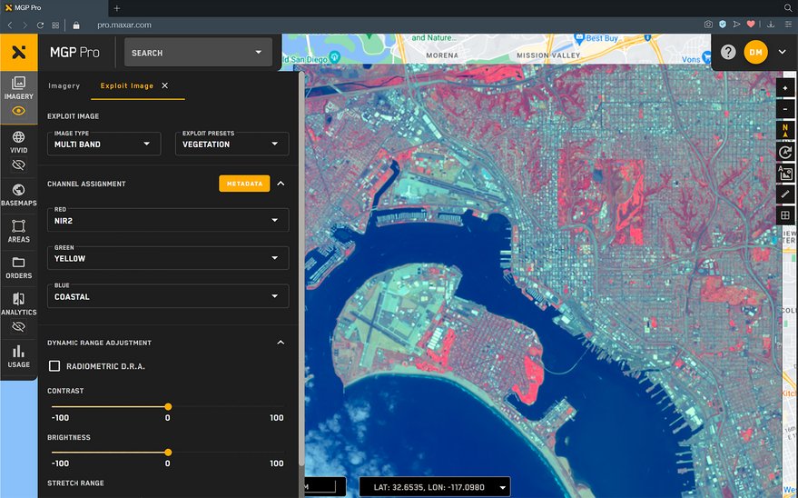
The second kind of this service is called MGP Pro. It will require verification from its users and is aimed primarily at corporate clients and government agencies. Not only archival, but also fresh images of the earth’s surface will be available in it. Therefore, it will be extremely relevant for the needs of defense.
In the future, in the same mode, it will be possible to order from the company the receipt of geospatial information from the specified images according to the parameters specified by the client. It will also be available to receive information from the new generation Legion satellites when they are operational.
As for the third product of the platform, it is called the MGP API. It will provide programmers with a wide range of tools for creating their own software products based on MGP.
According to spacenews.com
Follow us on Twitter to get the most interesting space news in time
https://twitter.com/ust_magazine
