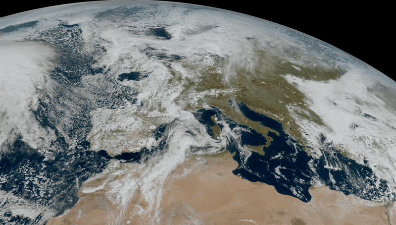
A recently launched meteorological satellite has sent its first image of the Earth from space, showing our planet in incredibly clear detail. The European Meteosat Third Generation Imager-1 was launched last December to monitor weather conditions over Europe and Africa. The latest photo was taken by the most modern satellite from a height of 36 thousand kilometers above the Earth’s surface.
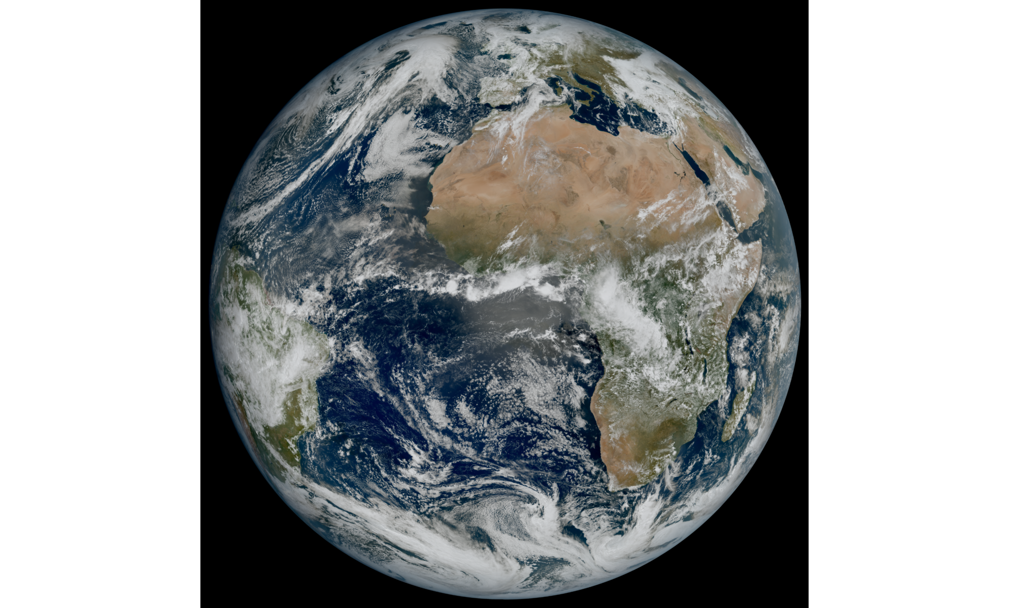
The image was taken using the high-resolution Flexible Combined Imager tool in March 2023. The photo shows areas of cloudy and clear skies that can be seen over the Atlantic Ocean, as well as over European and African landmasses.
The instruments on Meteosat (MTG) have a higher resolution than the previous ones, as this is the first of a new generation of European meteorological satellites. Thanks to the higher resolution, scientists can more accurately track weather features, as well as see in detail how weather systems move in this part of the globe. According to the MTG team, this will help predict the weather and combat extreme weather conditions such as hurricanes.
“This remarkable image gives us great confidence in our expectation that the MTG system will herald a new era in the forecasting of severe weather events,” explained Phil Evans, director general of the European satellite weather monitoring agency Eumetsat.
Third era of satellite meteorology
European Meteosat Third Generation Imager-1 is the first of six satellites that will subsequently create a complete MTG system that will provide important data for short-term and early detection of potential extreme weather events over the next 20 years.
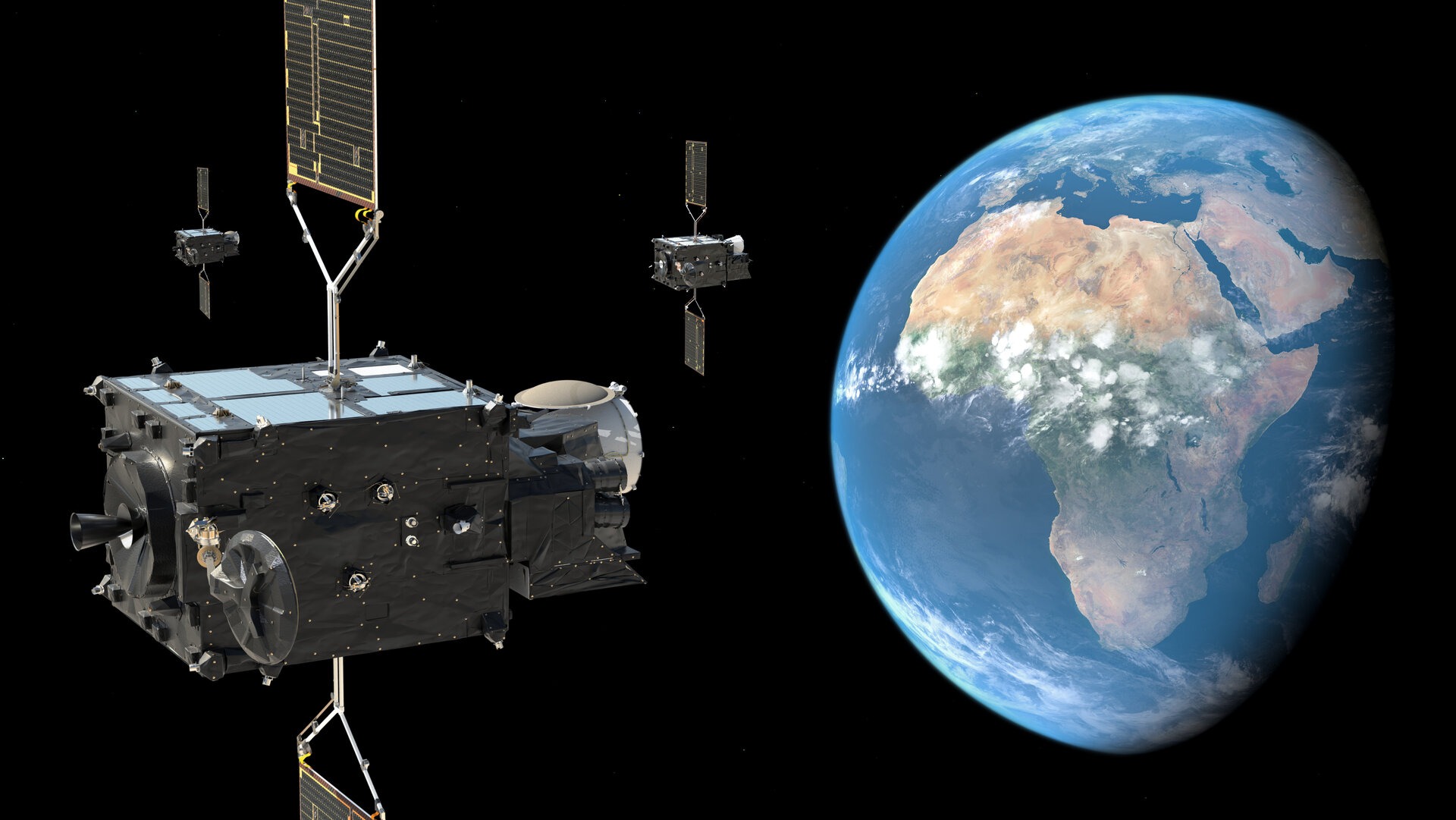
The MTG-S sensing satellites – the first for Meteosat – will have an infrared echo sounder and an ultraviolet visible near-infrared spectrometer. By tracking atmospheric instability in three dimensions, the new generation echo sounder takes a big step forward in early warnings of severe thunderstorms and is expected to provide unique information from geostationary orbit about the state of the ozone layer, carbon monoxide and volcanic ash in the atmosphere.
The satellite data will also help the World Meteorological Organization monitor climate change in the long term.
Earlier we reported how the satellite saw a “message to humanity” in the clouds.
Follow us on Twitter to get the most interesting space news in time
https://twitter.com/ust_magazine
