This year, on April 22 Earth Day is celebrated. First of all, it is dedicated to those who are professionally engaged in its study and systematization of knowledge, allowing making the lives of all people more comfortable and safe, preserving biodiversity and sustainable development.
Man’s interaction with our planet cannot be understood without a deep knowledge of the biosphere itself — one of the Earth’s shells, of which living organisms are integral part. We started researching it with artificial satellites in the early 60’s of last century. Since then, our methods and technology have been continuously improved, and biosphere observations and experiments have become a common element of scientific programs performed by crews of spacecraft and orbital stations.
For the first time in more than ten years, NASA has launched five scientific instruments to monitor Earth as a part of the EARTH SCIENCE program. They provide scientists with new opportunities for remote investigation of our planet.
Three missions are performed by independent specialized satellites, and two instruments are installed on the International Space Station (ISS). As part of the year of active Earth research announced by NASA, air-based laboratory flights to poles and hurricane centers were further developed, new high-sensitivity sensors were further developed, satellite data was expanded to increase preparedness for natural disasters and emerging threats of global climate change, and to mitigate its effects.
Information from satellites and aircraft helps scientists find answers to a number of important questions about climate change, rising sea levels, reducing the availability of fresh water, and extreme weather events.
GPM
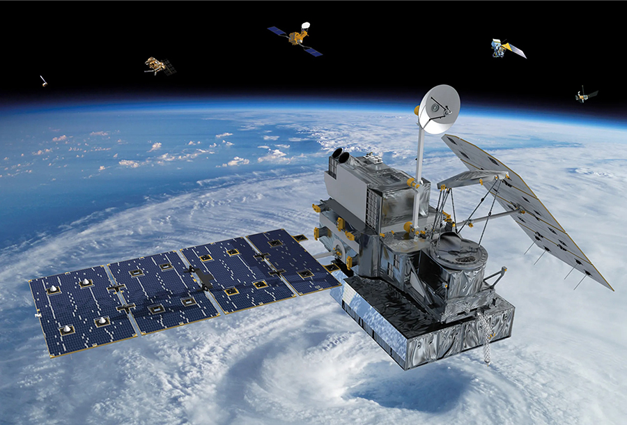
The first mission of EARTH SCIENCE was GPM (Global Precipitation Measurement) — a satellite project implemented jointly with the Japan Aerospace Exploration Agency (JAXA). Аn unprecedented international satellite group was launched, whose main task is to conduct global observations of rain, thunderstorms and snowfall. New information on these phenomena will help answer questions about the functioning of the global water circulation mechanism, as well as improve water management and weather forecasting. The group’s first satellite, the Core Observatory, was successfully launched on February 27, 2014 from Japan’s Tanegashima Space Center with an H-IIA rocket. It was built at the Goddard Space Flight Center, NASA. In total, the full-featured hardware complex, in addition to the main satellite, involves 8 separate ones of the same type, united by a common task.
GPM provides global precipitation measurements with increased accuracy, extended coverage and a large dynamic range. An important result of the mission should be to improve the quality of weather forecasts by taking into account operational information. In addition, its tasks include: accumulation of knowledge about the water cycle in nature and its connection with climate change; obtaining new information on storm structures and large-scale atmospheric processes; improving the understanding of precipitation microphysics; expanding capabilities for monitoring and forecasting hurricanes, as well as other extreme weather events; improving predictions of natural disasters (floods, droughts, landslides), crop yields, monitoring of fresh water resources.
OCO-2
The next step was a mission for in-depth study of the role of carbon dioxide in climate change — OCO-2 (Orbiting Carbon Observatory-2). Observations of this satellite are used to improve understanding of the role of natural and anthropogenic sources of CO₂ and their impact on cyclical changes in the Earth’s oceans, on land and in the atmosphere.
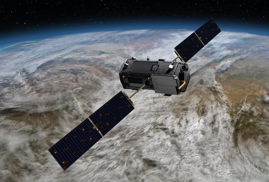
OCO-2 is an improved copy of NASA’s OCO-1 satellite, which failed to be launched into orbit on February 24, 2009. The observatory was launched from Vandenberg Air Force Base (CA) on July 2, 2014. It consists of one tool installed on the original platform. Structurally, the device includes three high-resolution spectrometers to accurately determine the concentration of atmospheric carbon dioxide.
The mission receives data in three different measurement modes. In Nadir mode, the device examines the Earth directly below the device. Glint mode monitors areas of the earth’s surface that reflect sunlight. This mode is used to perform high-precision measurements over the flat areas (especially over the oceans). In Target mode, the satellite scans a given area of the surface each time it passes over it, providing a large number of measurements for comparison with the results of research conducted by ground-based vehicles and other spacecraft. The planned lifetime of the observatory was 2 years, but it is still operating successfully.
SMAP
The letters SMAPstand for (Soil Moisture Active Passive). The satellite with a low-frequency microwave radiometer and radar for measuring soil moisture went into orbit on January 31, 2015. Collected data are used to predict weather, climate change, agricultural productivity and, more broadly, the Earth’s ecosystems, as well as to study the circulation of water, energy and carbon. Global soil moisture maps with high resolution allow taking effective measures to optimize the use of water resources.
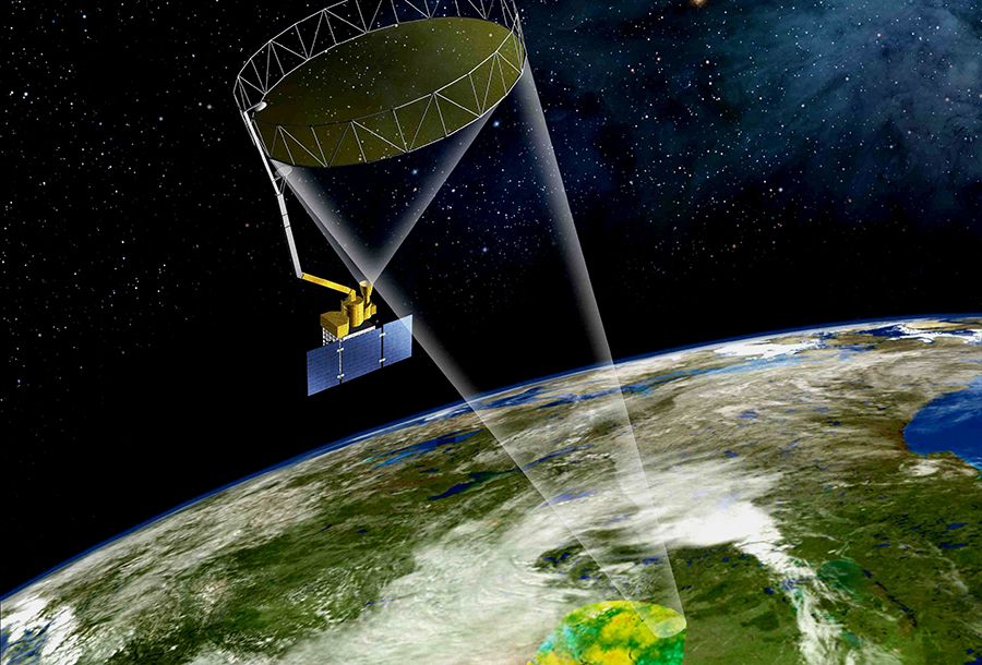
SMAP uses a new technological approach to observations, which combines radar and radiometer operating in the L-band. This allows you to expand the range of operational measurements of the depth of sounding and increase the spatial resolution. The mission was expected to last at least three years, with a discretion of information not exceeding two to three days. However, the satellite has been operating flawlessly for over 7 years.
ISS-RapidScat
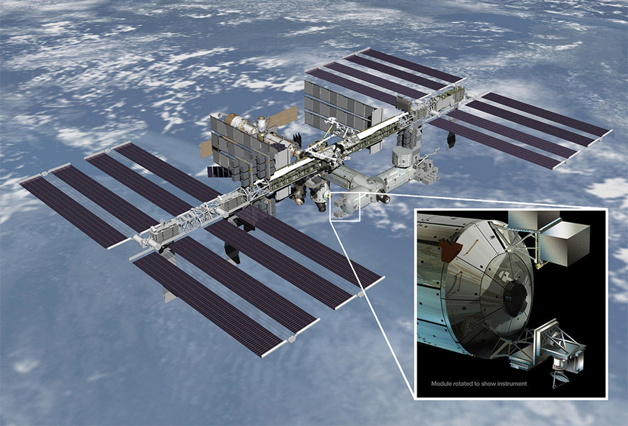
Two other EARTH SCIENCE research missions used the International Space Station as a base platform. The first, ISS-RapidScat, continued monitoring ocean winds around the world, providing key information for climate research and weather forecasting, as well as for tracking storms and hurricanes. The new scientific tool allowed to increase the accuracy of weather forecasts and to study in more detail the interaction in the “ocean-atmosphere” system. It was delivered to the ISS in September 2014 aboard the cargo ship Dragon and lasted until August 2016.
” On our home planet Earth, water is an essential requirement for life and for most human activities. We must understand the details of how water moves within and between the atmosphere, the oceans, and the land if we are to predict changes to our climate and the availability of water resources, — NASA Director of Science Michael Freilich said. — Coupled with data from other ongoing NASA missions that measure sea-surface salinity and that detect changes in underground aquifer levels, with GPM and SMAP we will have unprecedented measurements of our planet’s vital water cycle “.
CATS
A special CATS device (Cloud-Aerosol Transport System), also installed on the ISS in January 2015, not only collects data on small droplets of liquid and dust particles in the Earth’s atmosphere, but also serves as a prototype for a new generation of ACE spacecraft. Meteorological satellite data make a significant contribution to the monitoring of clouds, air temperature, humidity and many other parameters, but it has not been possible to study atmospheric aerosols with them until recently, although they have a significant impact on weather and climate in general. Monitoring is carried out by probing the air with light pulses — using the so-called lidar (laser radar).
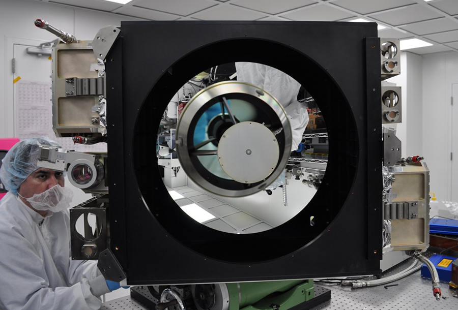
The impact of clouds and aerosols (such as dust and smoke) on the mechanisms of climate change on a global scale has not been fully studied. The resolution of the lidars used in CATS is optimally realized from the height of the ISS orbit, in addition, the station flies over many of the most important ways of transporting aerosols in the atmosphere. Of particular value is the ability to study diurnal variations — conventional scientific satellites may not always be able to provide such data due to the specifics of their orbits.
CATS has four radar devices designed specifically for the study of atmospheric aerosols. They have demonstrated excellent performance in earlier missions, such as ICESat, which conducted similar studies for two months in 2003, and CALIPSO (Cloud-Aerosol Lidar and Infrared Pathfinder Satellite Observations), which has been in orbit since 2006. It is planned that CATS will take the baton from CALIPSO and will work until 2023, when the f the device ACE (Aerosol-Cloud-Ecosystems) will be launched.
Specialists and believe that CATS data will allow conclusions to be drawn about the nature of aerosols in the upper atmosphere. That is, scientists will be able to say unequivocally whether they are represented by ice particles and water droplets or dust, which consists of less volatile substances. These data are also extremely important for understanding the processes of energy transfer in the atmosphere. Microparticles can absorb different amounts of sunlight and heat from the surrounding air and release this energy elsewhere.
Aeronautical research
The sending of EARTH SCIENCE instruments to the ISS marked the beginning of its use as a platform for continuous round-the-clock observations of the Earth. Throughout its existence, the orbital complex is a unique base for the development of scientific research and technological innovation. Its orbit allows observations of almost 85% of the earth’s surface. NASA has already installed five tools for this.
Together with devices operating outside the atmosphere, the research involved a Global Hawk drone and a fleet of aircraft equipped with the most sophisticated modern equipment. In 2014, 12 NASA departments conducted research programs around the world — from Antarctica to the Arctic (including all regions of the United States, Central and South America): studied polar glaciers, urban air pollution, natural disasters and more.
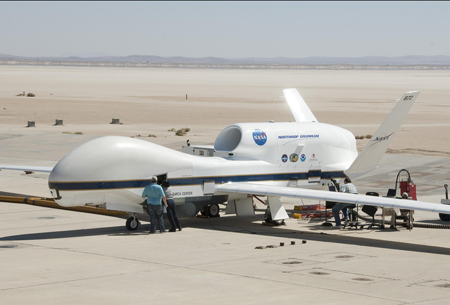
Another task of the EARTH SCIENCE research program is to provide operational data to regional governments around the world. In particular, in 2014, the focus was on the conservation of ecosystems in the Gulf of Mexico, water shortages in the southwestern United States, and floods in the Mekong Delta. New sensors have been tested to more accurately measure water levels in lakes and reservoirs, carbon dioxide concentrations, terrestrial ecosystem characteristics, and to monitor natural disasters such as earthquakes and tsunamis.
NASA not only monitors vital parameters of the Earth by various means and carries out their subsequent computer analysis to track long-term and short-term climate change. The agency also generously shares this unique data with the rest of the world — to work together and find new ways to preserve the ecosystems and biodiversity of our home planet.
Follow us on Twitter to get the most interesting space news in time:
https://twitter.com/ust_magazine

