
Astrophotographer Andrew McCarthy has published a photo captured during the photographing of the Orion nebula. It demonstrates “traffic” in geostationary orbit. The numerous discontinuous lines in the photo mostly correspond to geostationary satellites.
What is a geostationary orbit?
Geostationary is a circular orbit located at an altitude of about 36 thousand kilometers above the earth’s equator. An artificial satellite located on it orbits the planet with an angular velocity equal to the angular velocity of the Earth’s rotation around its axis. Thus, it will “hang” in the sky motionless.
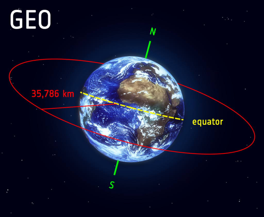
Due to this, the geostationary orbit is one of the most in demand. It is actively used to put communication spacecraft, repeaters and weather satellites.
“Traffic” in geostationary orbit
McCarthy’s target was the Orion Nebula. It is placed near the celestial equator, where the positions of the geostationary satellites are located.
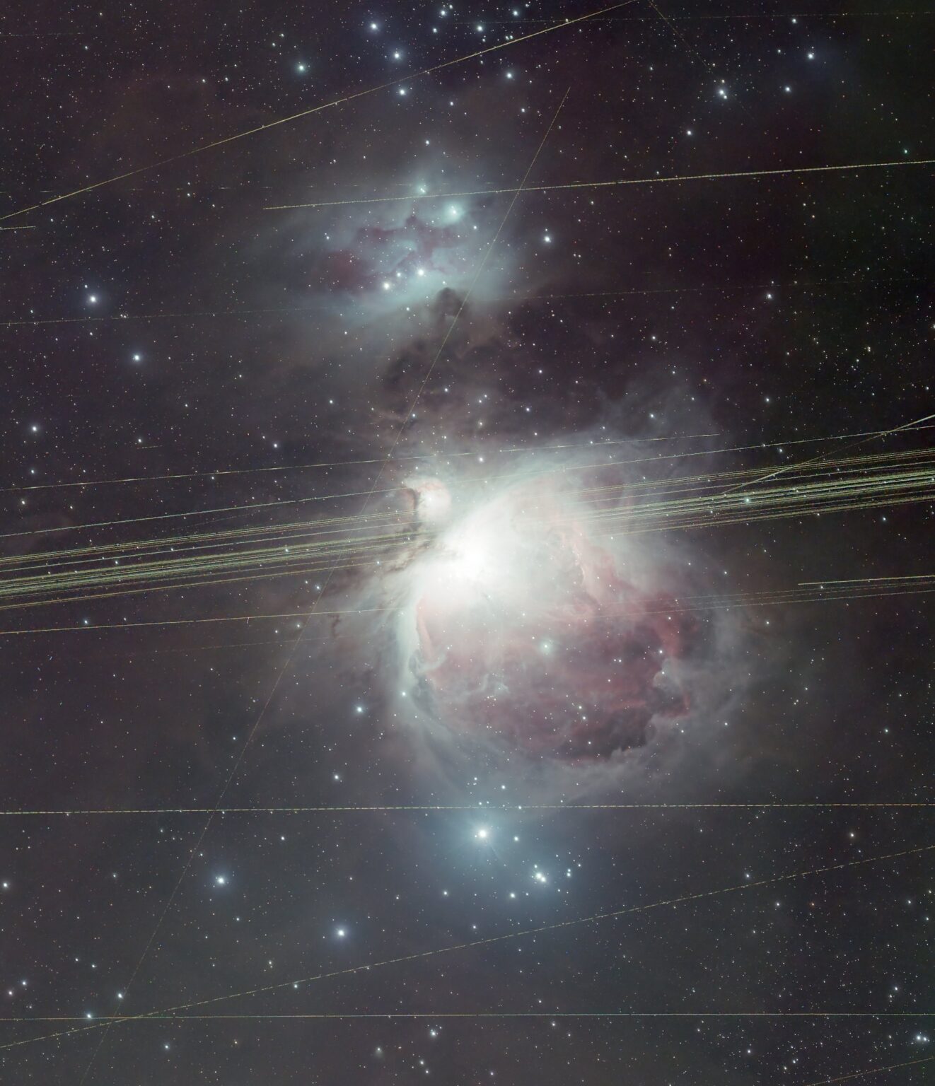
According to an Earth observer, as such spacecraft hang motionless in the sky, it may seem that in the photo we should see dots, not lines. But the fact is that although the satellites hang “motionless”, the celestial bodies shift during the night. And since the target of the photo shooting was the Orion nebula, the telescope through which the photo shooting was conducted (it lasted five hours) moved after it. As a result, the dots from the satellites turned into lines.
According to McCarthy, such lines are quite easy to remove during post-processing. But he posted a picture with them to demonstrate the “traffic” of the geostationary orbit.
Follow us on Twitter to get the most interesting space news in time
https://twitter.com/ust_magazine
