
The Fraunhofer Institute for High Frequency Physics and Radar Techniques FHR in Germany has published images obtained using the TIRA radar. They demonstrate the last days of the ERS-2 satellite.
ERS-2 was launched by ESA in 1995 with the aim of exploring the Earth. It collected data on surface and ocean temperatures, sea level rise and melting glaciers. The satellite was decommissioned in 2011, after which the altitude of its orbit gradually decreased. On the evening of February 21, it entered the dense layers of the atmosphere and burned up over the Pacific Ocean.
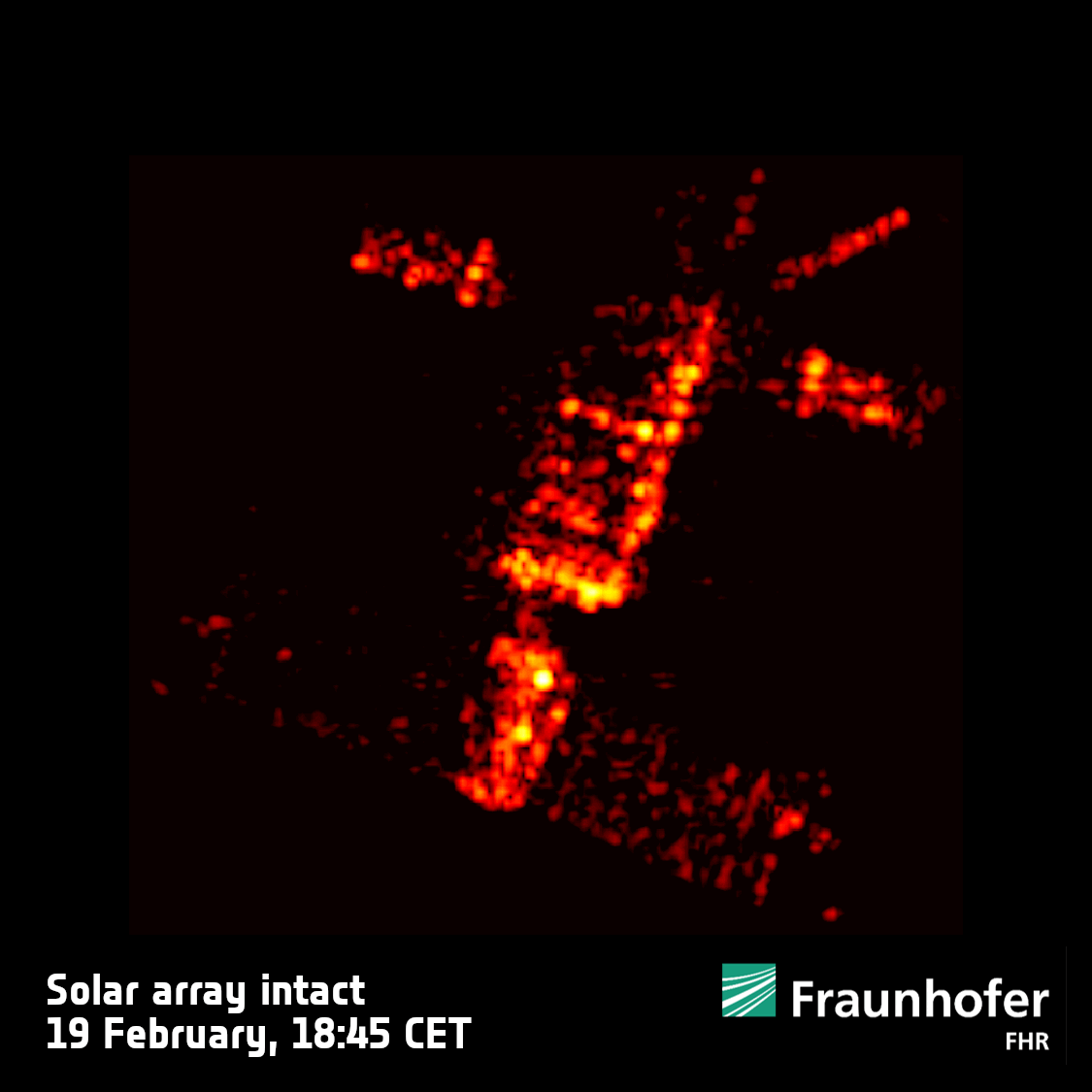
Given the rather large dimensions and weight of the spacecraft (2.5 tons), experts closely monitored the process of its descent. On February 19, 20, and 21, the doomed ERS-2 was in the range of view of the 34-meter antenna of the TIRA radar. The last observation session took place 10 orbits before entering the atmosphere.
The images obtained by TIRA demonstrate that already a day before entering the atmosphere, the ERS-2’s solar battery had already weakened and ceased to be firmly attached to the rest of the satellite. This data is very important. The fact is that when calculating the trajectory of a satellite’s entry into the atmosphere, experts usually consider it as a single solid object almost to the very end. One of the examples of ERS-2 shows that this is not always the case. Experts hope that the TIRA data will allow them to improve the models used in making forecasts of the place and time of the de-orbiting of satellites and fragments of space debris.
Earlier, we talked about how a satellite photographed a used stage of a Japanese rocket.
According to https://www.esa.int
Follow us on Twitter to get the most interesting space news in time
https://twitter.comne/ust_magazine
