Throughout Russia’s large-scale invasion of Ukraine, the media publish satellite images of enemy equipment. They help not only the military, but also civilians to better understand what is really happening to it. How do the satellites manage to see all this? Let’s find out together!
1. How do satellites manage to see everything from such a height?
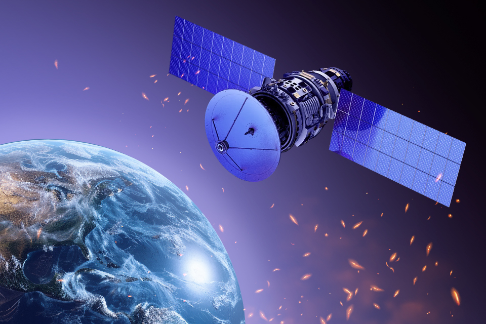
The orbits of Earth observation satellites, including reconnaissance satellites (they are also called “Earth remote sensing” — ERS), lie at altitudes from 300 to 900 km above the Earth’s surface. It seems that this is an incredible height, and it is impossible to see anything from it. However, we can see the International Space Station, which flies at an altitude of up to 400 km, with the naked eye, and with a small telescope you can even see it in detail.
This is how conventional ERS satellites, such as Planet Labs, Maxar or Sentinel, work. They are equipped with optical systems that have characteristics similar to amateur telescopes, and powerful CCD arrays that allow obtaining high-resolution digital images.
2. Can satellites see at night?
Conventional satellites operating in the optical range cannot see what is happening on earth at night or when the sky is overcast. However, in the dark, in clear weather conditions, it is quite possible to catch heat from heated objects. This is the principle of operation of spacecraft receiving images in the infrared spectrum.
Even more sensitive are the spacecraft on which synthetic aperture radars (abbreviated SAR) are installed. They work by emitting and capturing reflected radio waves. Therefore, for them, either night or cloud cover, fog, smoke, and a number of other obstacles are not a problem.
3. Can satellites observe the Earth in real time?
Satellites in low orbits cannot be over the same area of the surface all the time. They move along their trajectories, making a complete orbit in about an hour and a half and examining the entire Earth in a few days.
This means that it is impossible to get a picture of an arbitrary part of the earth at an arbitrary time from a single satellite. But if there are many satellites and each of them moves in its orbit, then one of them will fly over a given point much more often. However, even then, the delay between the need to photograph this point and obtaining a satellite image can be several hours.
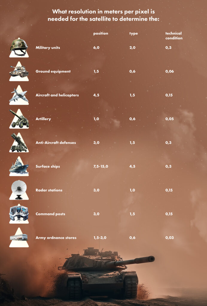
4. What resolution is needed to see enemy equipment?
Just getting an image of an object on the surface of the Earth is not enough to recognize it as an enemy cannon or aircraft. For this, it is necessary to have a sufficiently high resolution, which will allow you to see it in detail. This characteristic is measured in meters per pixel.
In modern optical and infrared systems, the resolution has long reached tenths of a meter per pixel. SAR satellites have only recently approached this indicator. In addition, it needs to be taken into account that it should be different for various tasks.
5. How do satellites distinguish equipment on the ground?
When a satellite receives an image of the surface, it “covers” an area of several tens of square kilometers. Therefore, even if the image resolution is 0.3-0.5 m/pixel, it is very difficult to find enemy equipment on it, because there are millions of pixels there.
Getting important information about enemy equipment from the “raw” satellite image is the most difficult part of the task. It is usually carried out by entire analytical departments, whose employees know what to look for and “manually” find tanks and aircraft. However, recently, artificial intelligence, “trained” to recognize certain images, has been actively involved in this.
Follow us on Twitter to get the most interesting space news in time
https://twitter.com/ust_magazine
