NASA scientists studying the ocean from orbit have developed a program that translates the color of seawater into notes. With its help, they created several music videos. You can try to do it yourself on their website.
Ocean Color Music
18 months ago, brothers Ryan and John Vandermulen, who work at the Goddard Space Center, thought about how to show people the ocean as it is seen by satellites from orbit. And they decided that the music was better suited for this than the image.
Ryan Vandermulen’s research concerns biological processes in the world’s oceans. He knows better than anyone that the color of water can be very different from blue because of algae, plankton or sand deposits. Ryan asked his brother John, a programmer and electronic musician, to translate colors into notes.
So there is a video showing how the ocean looks and sounds near the estuary of the South American river Rio de la Plata, where there are a lot of sand deposits. However, the brothers did not stop and created a video for the Indian Ocean, the Bering and Coral Seas.
Currently, everyone can try to create their own music video with the color of water. For this, you need to have the appropriate data from satellites and go to the Vandermulen brothers’ website www.spektune.com/. There you can choose a way to process the image and a palette of notes.
What the colors of the ocean told scientists
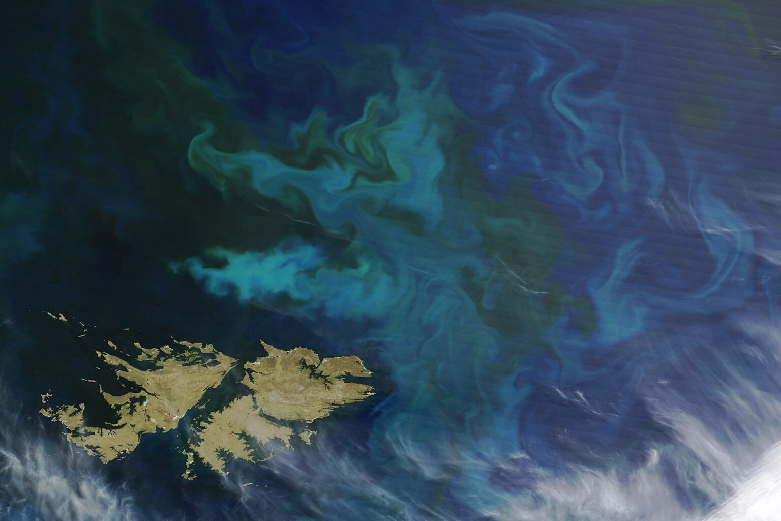
NASA scientists are seriously studying the colors of the ocean. This information about sediments allows understanding not only how the landscape of the seabed is changing, but also how rivers work. Because the solid particles in them are at the same time soil erosion and an element of the carbon cycle. Therefore, based on these data, it is possible to determine how comfortable life on Earth will be in the future.
Even more important are the green and purple colors in the ocean. They indicate the presence in some places of plankton and algae, which are the basis of the food pyramid in the sea; and problems with them can be the beginning of the destruction of the world ecosystem.
Also, data on the distribution of plankton can be used as a water temperature and oxygen content indicator. And this allows us to ensure that our planet does not overheat. It is not surprising that many satellites are studying these processes.
According to www.nasa.gov
Follow us on Twitter to get the most interesting space news in time
https://twitter.com/ust_magazine
