At the launch of the SpaceX Falcon 9, the video camera on the second stage of the rocket was capable of capturing impressive footage of the Earth. In the video, our planet looks like a beautiful blue marble with complex bands of white clouds illuminated by the rays of the Sun against the background of the cold darkness of space.
View from the second stage following last week’s launch of SES-18 and SES-19 to a geosynchronous transfer orbit pic.twitter.com/GbSbq6ob2m
— SpaceX (@SpaceX) March 20, 2023
The video was shot when the rocket was launching a payload with two telecommunications satellites for the Luxembourg company SES into a geotransfer orbit. This means that the footage posted on Twitter by SpaceX probably shows the Earth from an altitude of about 35.7 thousand km.
Falcon 9 with two satellites, known as SES-18 and SES-19, lifted off from the launch complex at the Cape Canaveral Space Force Station on March 17. Two SES satellites built by Northrop Grumman will provide data transmission services in the C band and a TV signal for the needs of the United States.
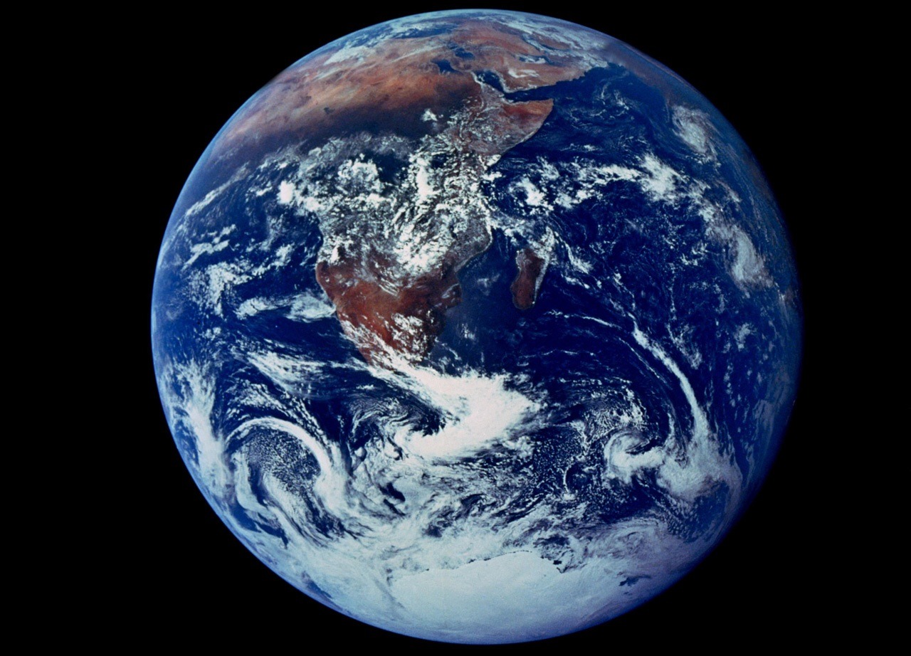
Blue Marble photo in the history of space exploration
The new SpaceX video combines many stunning images and shots of the Earth taken from space. The most famous image is the original photo of Blue Marble, taken in December 1972. This photo was captured by astronauts aboard the Apollo 17 spacecraft during a trip to the Moon and was taken at an altitude of about 45 thousand km.
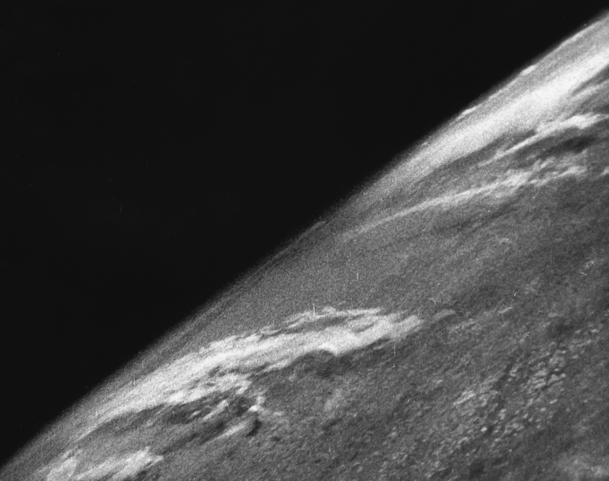
However, Blue Marble was not the first image of the Earth from space. In 1946, immediately after the end of World War II, grainy black-and-white photographs of our planet from space were taken with a 35mm movie camera mounted on a V-2 rocket, which was launched from a missile range in New Mexico. The movie camera took pictures every one and a half seconds, recording the entire flight for several minutes. But the soft landing system had not yet been invented at that time, because after a suborbital flight, the rocket fell to the ground at a speed of 550 km/h and completely burned down. However, the film survived because it was in a steel cassette.
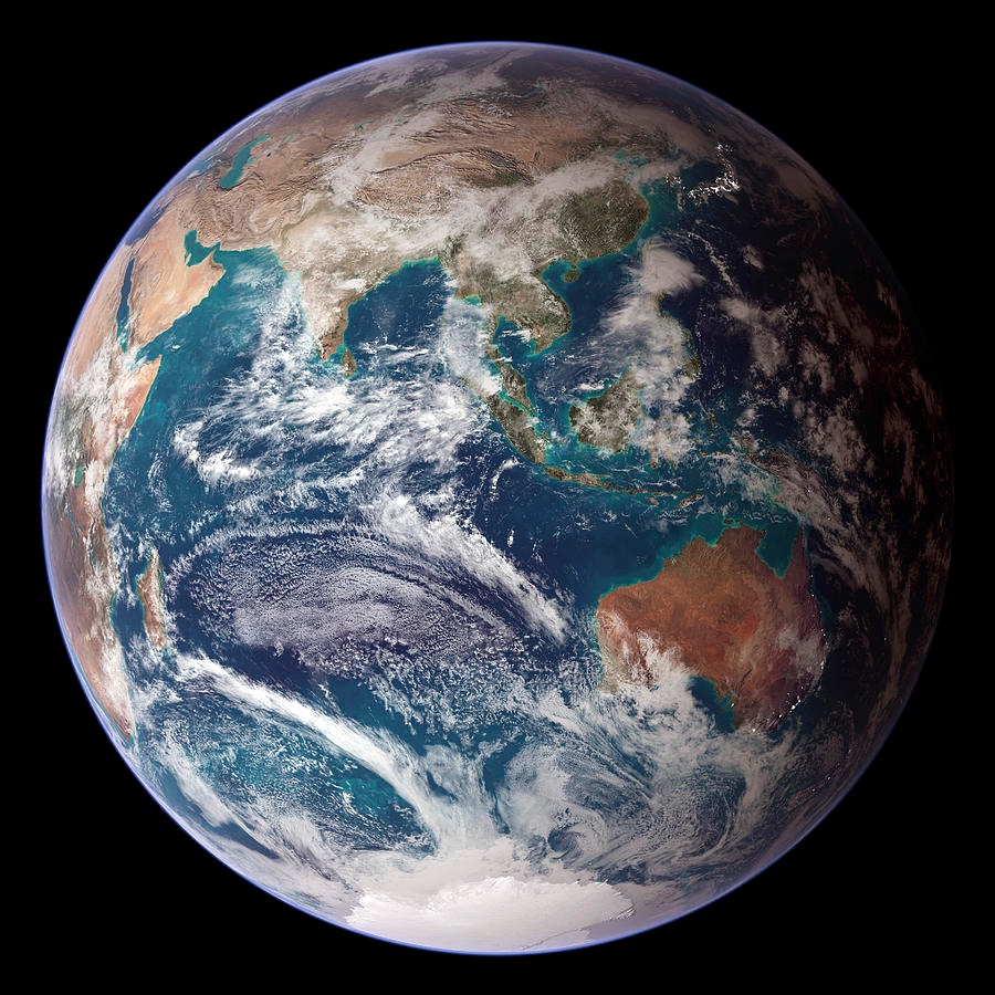
A new version of this image called Blue Marble: Next Generation was published by NASA in 2005 and became the most detailed image of the Earth from space. Today, such photographs are produced in a wide range of light waves by both public and private spacecraft. These images are used for a variety of purposes, including monitoring weather conditions, measuring greenhouse gas emissions, and tracking forest fires.
Earlier we reported how Lucy impressed with a stunning view of the Earth from a distance of 620 thousand km.
Follow us on Twitter to get the most interesting space news in time
https://twitter.com/ust_magazine
