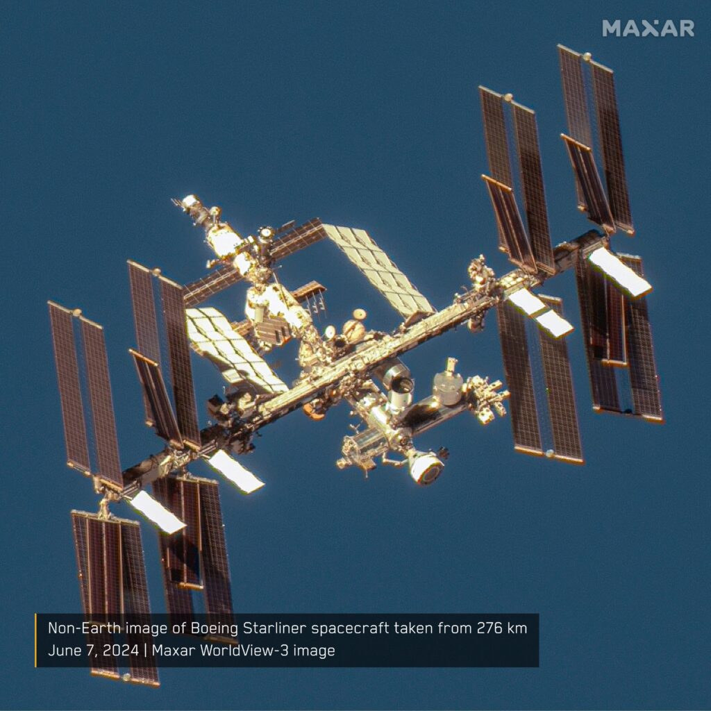
Maxar has published an image taken by one of its satellites. The image shows the ISS and the CST-100 Starliner spacecraft docked to it.

Maxar is primarily known for its high-quality satellite images of the earth’s surface. They are used for monitoring, disaster and warfare assessment. Maxar satellites regularly photograph the front line, the results of strikes on facilities in the Russian rear and traces of war crimes in the occupied territories.
However, Maxar is not limited to just Earth. In 2021, the company received permission from the U.S. National Oceanic and Atmospheric Administration to photograph satellites in low Earth orbit in the altitude range of 200 to 1,000 kilometers. Since then, the company has launched the NEI (non-Earth imaging) initiative, which offers both public and private customers spacecraft imaging.
This photo is a demonstration of Maxar’s capabilities. It was taken on June 7, 2024, by a satellite at a distance of 276 km from the ISS. In the image, you can see the structure of the orbital complex in full detail, including the main modules, solar panel arrays and radiator panels. Also clearly visible is the CST-100 Starliner spacecraft docked to the ISS.
According to Maxar’s statement, its instruments can receive images of satellites in the declared range of altitudes with a resolution of up to 15 centimeters per pixel, as well as track their movements. As part of the NEI initiative, it offers the following services to its clients:
- Assist in the identification and characterization of space objects and in assessing the operational environment for new space launches.
- On-orbit collision risk assessment, maneuver planning, end-of-life inspections of spacecraft, and orbital descent control.
- Assist satellite operators in providing safe navigation, assess the condition of their assets and monitor inoperable satellites.
- Missions for the national security purposes of the U.S. and its allies.


