The EOS SAT-1 satellite developed in Ukraine, launched into space in January, sent a photo from orbit. It captured itself against the background of the Earth with the help of an outside camera. The first images of the Earth’s surface intended for analysis are next in line.
Ukrainian satellite sends a selfie
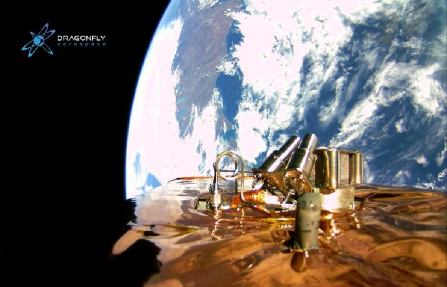
Dragonfly Aerospace announced on its Facebook page that the EOS SAT-1 satellite built by it sent an image from space and published it. The photo is a kind of selfie taken with the help of an outside camera on the body.
It shows the spacecraft itself against the background of the Earth. On this occasion, the post quoted “That’s here. That’s home. That’s us.” — the words that American astronomer Carl Sagan said when commenting on a photo of the Voyager spacecraft from the vicinity of the Solar System, on which the Earth was visible as a tiny blue dot.
EOS SAT-1 is much closer to the Earth, so the earth’s disk looks huge in the photo. And on it you can even see the eastern coast of Argentina, viewed through thick layers of clouds.
Why does EOS SAT-1 need
EOS SAT-1 is a satellite that Dragonfly Aerospace designed and built in Ukraine by order of EOS Data Analytics, specializing in processing images from orbit and obtaining geospatial information from them. Both of them are part of the Noosphere group, founded by businessman Max Polyakov.
The main purpose of the satellite launch is to obtain images and information about the state of agricultural and forest lands. It is part of the world’s first constellation specially created for the analysis of the agricultural sector.
That is why the camera from which the selfie has been taken is auxiliary, and the main ones are a pair of Dragon Eye devices developed by the same Dragonfly Aerospace. They are capable of receiving information in both the visible and near infrared ranges.
The company informs that the work on putting the satellite into operation continues. GPS and altitude control systems are working properly, and soon we will be able to get amazing images of the surface obtained by a pair of main cameras.
According to www.facebook.com
Follow us on Twitter to get the most interesting space news in time
https://twitter.com/ust_magazine
