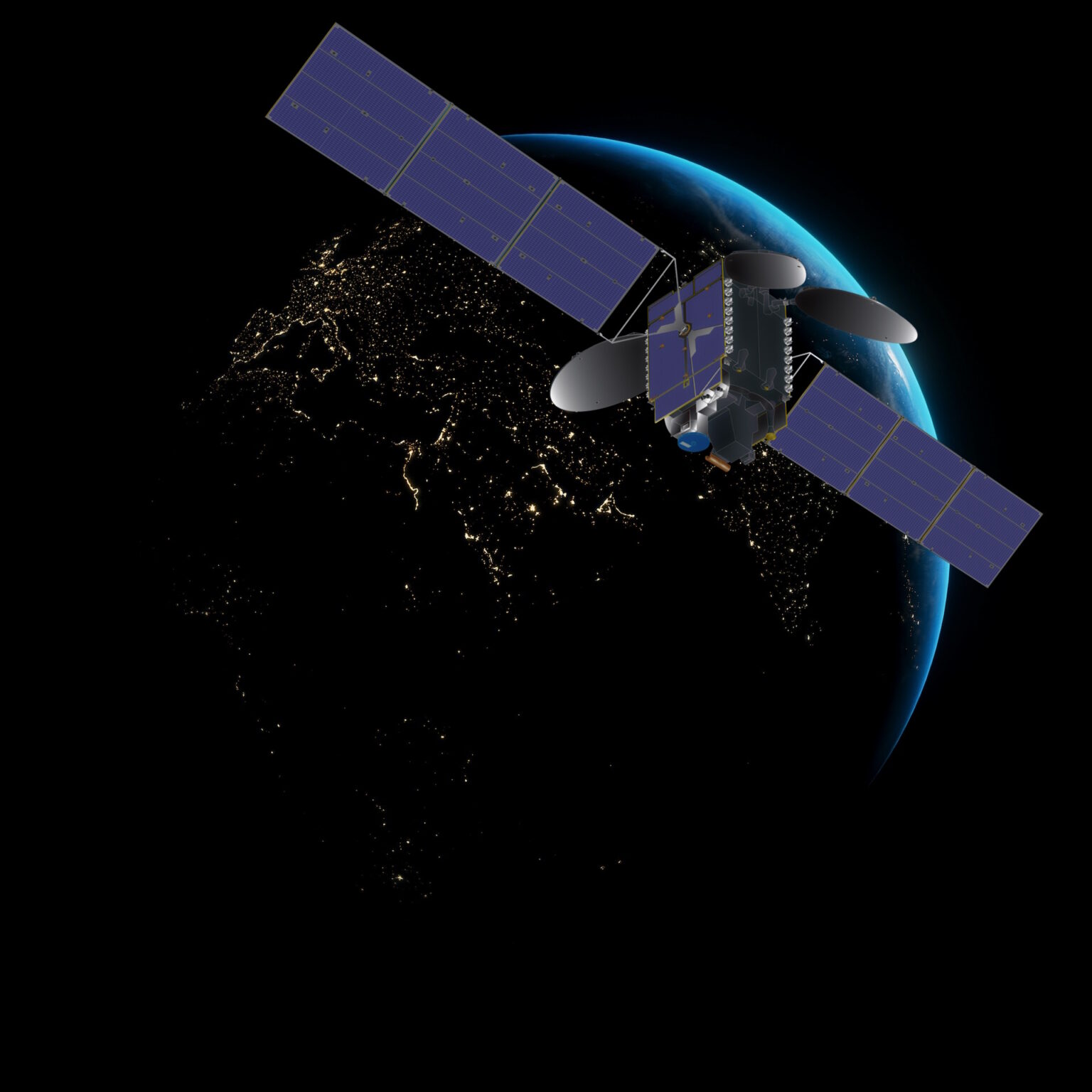
The new NASA satellite designed for Earth pollution monitoring has shared its first images. The photos showcase the satellite’s capabilities to track air quality across North America. The TEMPO instrument (Tropospheric Emissions: Monitoring of Pollution) was launched at the beginning of April this year and is observing from a near-Earth orbit at an altitude of 35,000 km above the equator.
TEMPO can measure air pollution with high spatial resolution, down to a few square kilometers, and can capture rapid changes occurring over short periods. This ability allows it to gather data on pollution-driving factors, such as traffic during rush hours or smoke from forest fires.
https://universemagazine.com/wp-content/uploads/2023/08/1-tempo-no2-1080p60.mp4?_=1
“Neighborhoods and communities across the country will benefit from TEMPO’s game-changing data for decades to come. This summer, millions of Americans felt firsthand the effect of smoke from forest fires on our health. NASA and the Biden-Harris Administration are committed to making it easier for everyday Americans and decision makers to access and use TEMPO data to monitor and improve the quality of the air we breathe, benefitting life here on Earth,” NASA Administrator Bill Nelson announced.
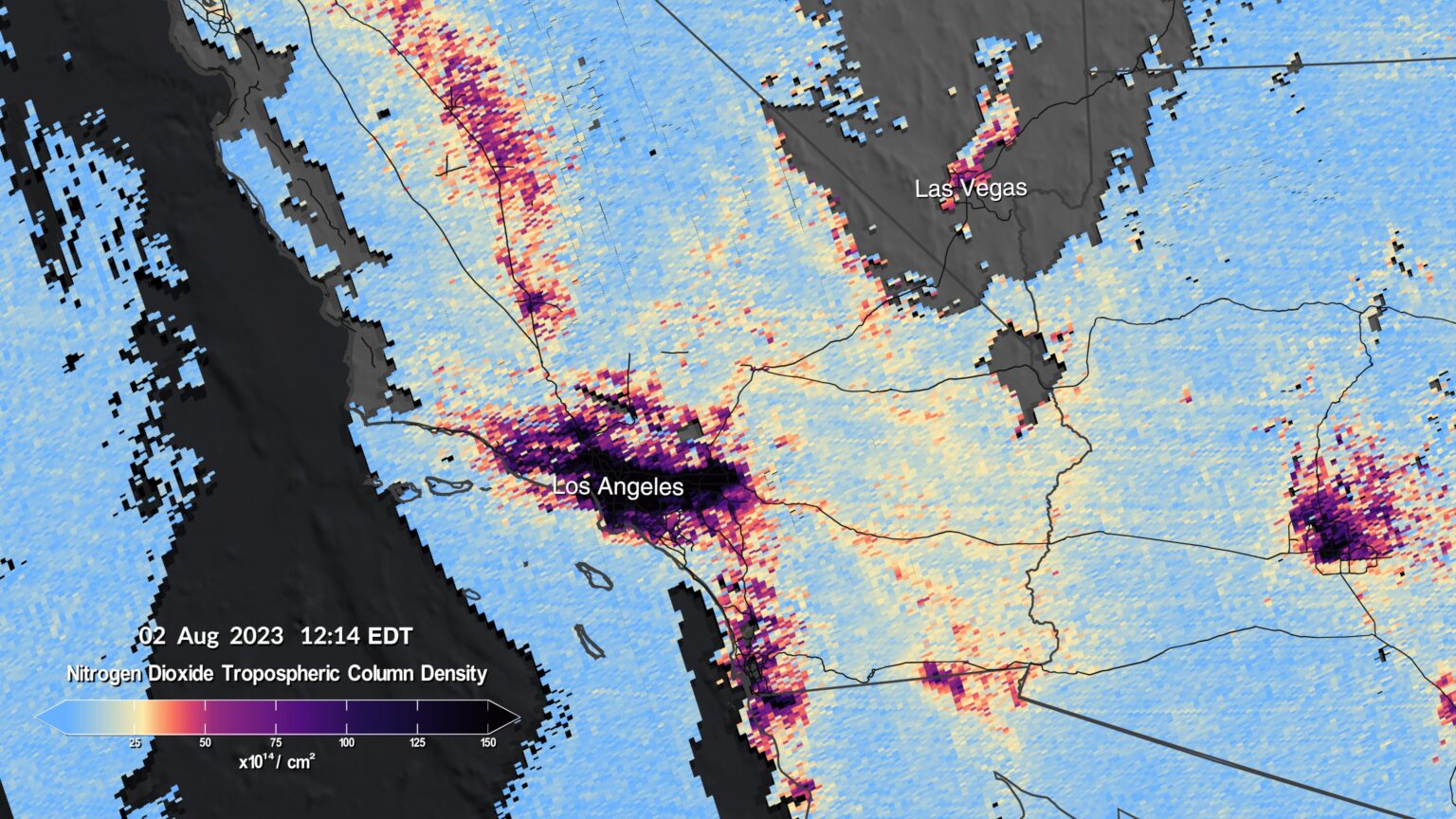
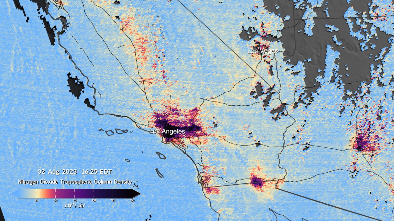
The initial TEMPO images are available in a series of visualizations, including two pollution maps showing the region around Los Angeles between noon and 4:00 p.m. on the same day. The maps below display nitrogen dioxide levels in the air on August 2. Darker colors correspond to higher concentrations. Other visualizations illustrate pollution around major cities such as New York and Washington, or Houston and New Orleans.
“TEMPO is starting to register hourly daytime air pollution over a large part of North America. It measures ozone, nitrogen dioxide, formaldehyde, aerosols, water vapor, and some trace elements. Nearly 50 scientific studies have already been planned based on this new data collection method,” stated TEMPO’s principal investigator, Kelly Chance.
These initial data were collected as part of the calibration process of the satellite’s primary instrument, a spectrometer that measures pollution by determining which wavelengths of light are absorbed by atmospheric gases. In full operation, TEMPO will conduct hourly scans during daylight hours, covering territory from central Canada through the U.S. and down to Mexico.
Earlier, we reported on how debris from a downed aircraft carrying Wagner Group leader Prigozhin was spotted from space.
Based on NASA materials.
