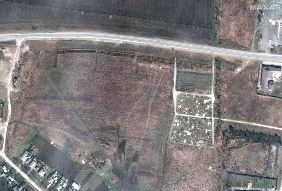
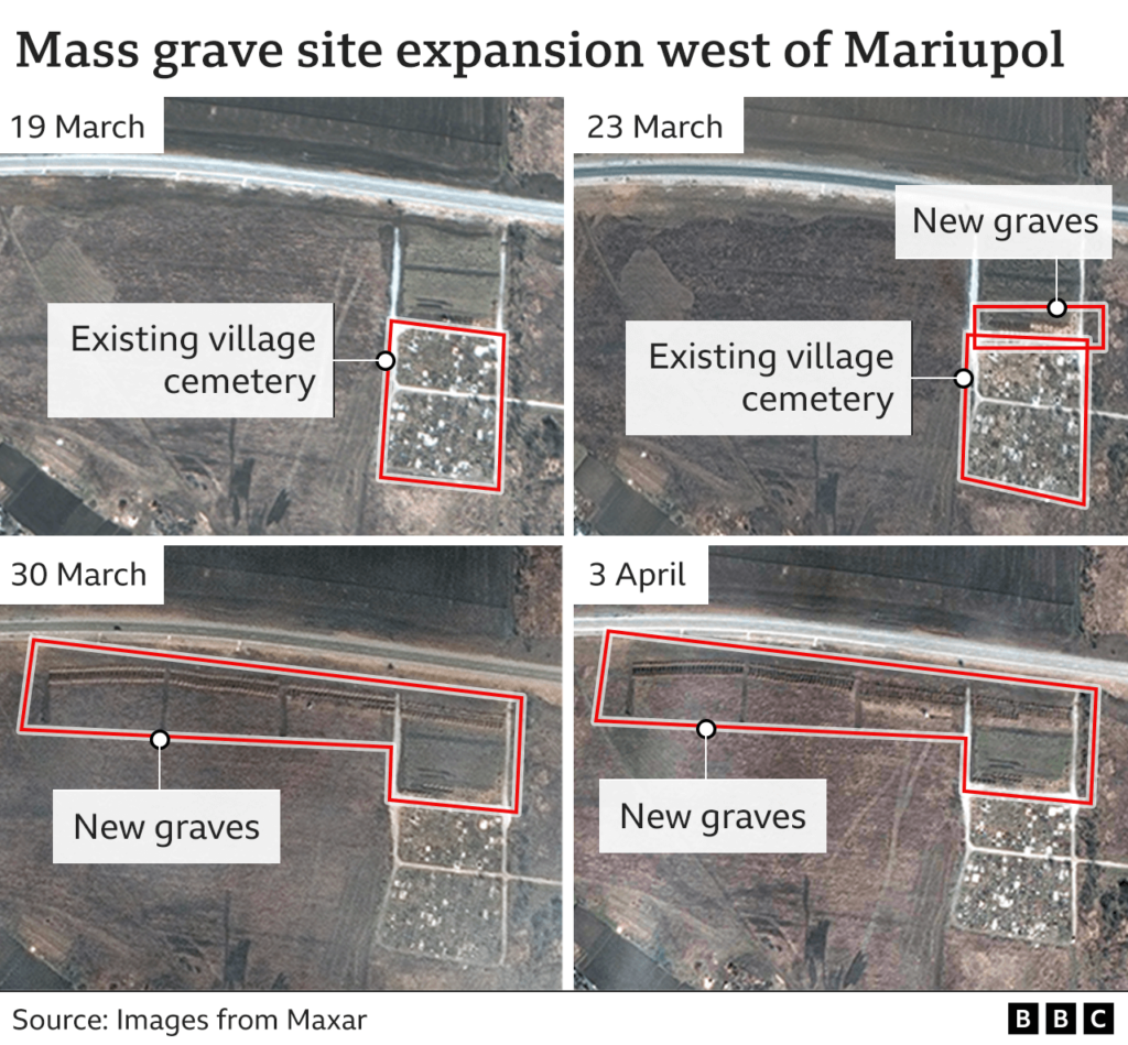
Satellite images of Maxar Technologies showed a new mass grave near Mariupol. It appeared in the images in late March, when Russian troops captured part of the city.
Maxar shot the mass grave
The GeoEye-1 satellite, which belongs to Maxar Technologies, once again showed the world the consequences of the war in Ukraine. This time it shot new graves in the village of Manhush near Mariupol. The photos showing numerous new graves are dated April 3.
Manhush is located 20 kilometers west of the city. Satellites shot this area during March-April. Therefore, the images can be traced in detail as the number of graves increases.
If the images from March 19, when the UAF still fully controlled Mariupol, show only the old grave, then on March 23 a new row of graves appears in the photos. And a week later, the new grave area is approaching the entire old cemetery and continues to grow in the first days of April. In total, the number of civilian casualties may exceed 10 thousand people.
What Maxar shot before
Earlier, the satellites of the American company have already helped to establish the truth about the killings of civilians in Ukraine by the Russian military. So, a series of pictures of the city of Bucha in the Kyiv region helped to find out that the bodies were lying on the streets before the Ukrainian troops liberated the city. And the mass grave near the local church was generally shot in the process of its creation.
And it’s not the first time that Mariupol has attracted the attention of their satellites. Besides documenting the destruction in this city, satellite cameras captured the food queue in this city. Thanks to them, we can estimate how many people stayed there that day. In the future, this may be useful in connection with the possible removal of people to Russia.
According to www.bbc.com
