The Ukrainian-Russian war has increased the demand for high-resolution satellite images. The military wants to receive them more and more often. It is expected that by 2028 the number of corresponding satellites will grow by 9 times.
New Satellite Reality of War
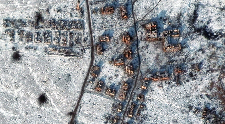
The main consequence of Russia’s large-scale invasion of Ukraine for the satellite services market was a sharp increase in demand for high-resolution satellite images. This is stated in the report of the consulting company Quilty Analytics, published on January 16.
Satellite images of military equipment, destruction and just people on the streets have made this war documented in history. In fact, it is the first in which both sides use spacecraft in orbit to adjust the actions of their troops on a daily basis.
But soon several more may join this conflict. First of all, this concerns the situation with China and Taiwan. And in all these cases, the military wants to have a high-resolution image quickly and in large quantities. They are willing to pay a lot of money for this.
How to obtain high-resolution images?
Quilty Analytics notes that the military is very demanding on the quality of photos. High-resolution images, in their opinion, mean a pixel size of 50 cm. Now there are quite a few such devices.
However, experts are confident that in the near future, both by improving the software and launching new satellites, the operator companies will expand their capabilities. It is expected that by 2028 the number of satellites of this class in orbit will increase by 9 times, reaching hundreds.
The main players in this area are four companies named Airbus, Imagesat International, Maxar Technologies and SI Imaging Services. Although now they are increasingly competing with BlackSky, Planet and Satellogic. And this is not counting the operators that are just about to enter the market: Albedo, Earth Observant and Skeyeon.
One of the main techniques expected from companies to get clearer images is lowering the orbit. Now many satellites receiving high-resolution images are above 400 km. It is expected that the location of the satellites below will allow for a resolution of 10 to 35 cm. However, it will have to do something about the impact of the atmosphere.
According to spacenews.com
Follow us on Twitter to get the most interesting space news in time
https://twitter.com/ust_magazine
