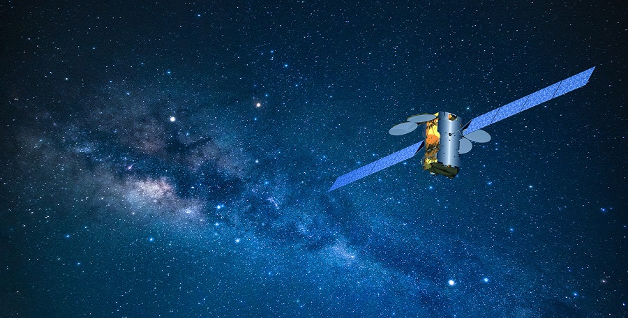
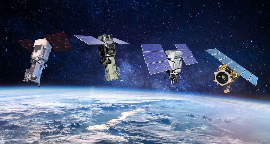
Intelligence, communication and mobility allow even a not very powerful army to win battles. All this is impossible today without satellites. It is difficult to imagine receiving information about enemy equipment without pictures from space; moving through unfamiliar terrain without a navigator; and good coordination between units without communication. To meet these needs, the army uses three types of spacecraft: surveillance, communication and navigation.
Hackers against satellites
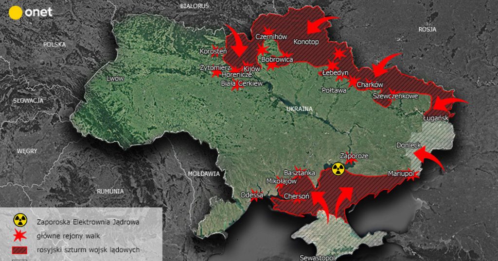
Russia’s full-scale war against our country has revealed a potential weakness of space infrastructure. On the eve of the invasion, Moscow carried out a massive cyber attack on satellite networks. Hackers tried to interfere with the work of spacecraft that transmit commands to Ukrainian military drones.
The attack in cyberspace was carried out not only against our country. The same day, Elon Musk reported an attempt by Russia to block Starlink signals near the Russian-Ukrainian border, and experts registered an increase in GPS interference in our region. Malefactors hacked and shut down the KA-SAT satellite Internet network of the American company Viasat, which provided services to many Ukrainian government agencies and government agencies in neighboring countries.
As a result, the United States began to completely restructure its security system in space in three areas: increasing resilience against software cracking, integrating commercial operators to these efforts, and creating Ally Space Force.
“Fog of War”
To succeed, the army must have reliable information about the enemy and coordinate well the actions of its own units. At the same time, both warring parties will do their best to hide their actions: to disguise themselves, to carry out deceptive maneuvers, simply to hide in the middle of the field. The military has a special term for this: “fog of war.”
Under such conditions, it is difficult to quickly and efficiently verify information. This is where reconnaissance satellites come to the fore. They let us to get reliable information about the location of the enemy and its movement. An enemy platoon can be shot, a drone or a plane can be shot down, but it is difficult to destroy an object in orbit. Anti-satellite weapons are still only in the experimental stage, and their use is a double-edged sword. After the shot, the amount of debris in orbit will increase dramatically, and the wreckage of the destroyed satellite will pose a threat to the attacker’s own space infrastructure.
This was clearly demonstrated by Russia, which used anti-satellite weapons last year. After hitting the old Soviet spacecraft, the amount of debris in orbit increased sharply, posing a serious threat to the International Space Station.
Optical range satellites
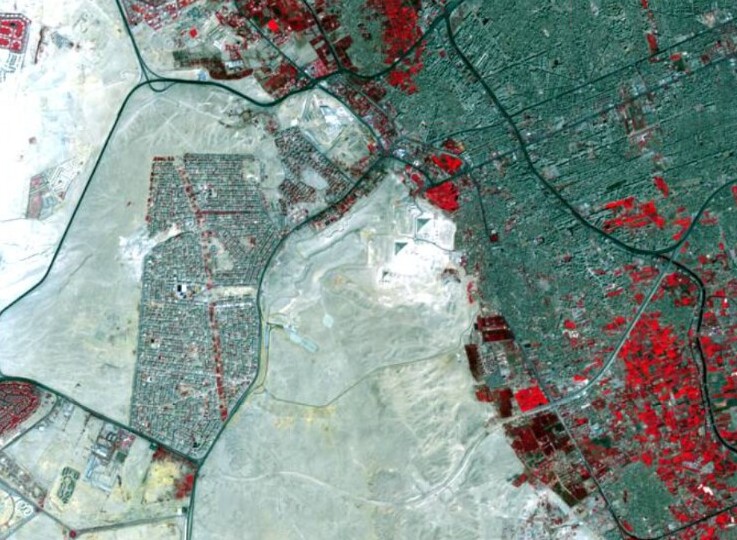
Reconnaissance satellites come in several types depending on the range in which they operate. The simplest option is the optical range. This is what we would see with our own eyes if we were sitting on a spaceship with a telescope.
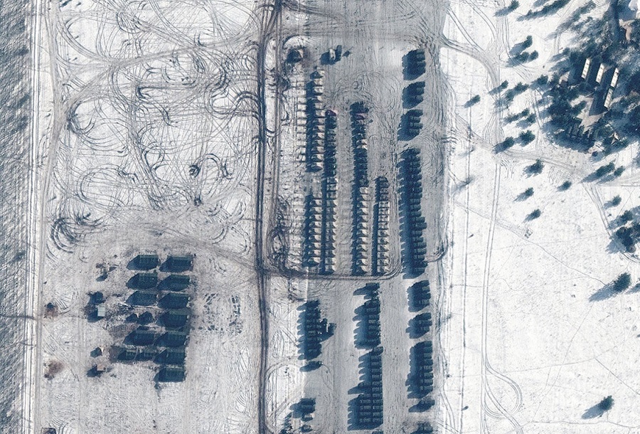
The resolution of images of satellites in the optical range is now several tens of centimeters. This is enough to distinguish tanks from trucks and count their number. Due to this, the headquarters is aware of the accumulation of enemy equipment and troops. From the orbit you can even see the bodies of killed people, which made it possible to record and prove the crimes of the Russian army in Bucha, Irpen and other Ukrainian cities and villages.
Maxar satellites are of this type. They consistently supply sensational photographs throughout the Ukrainian-Russian war. Previously, only army had access to such devices, as exemplified by the KH-11 (Keyhole), which was launched by the United States during the Cold War. Now pictures of this kind are available to everyone.
Orbital night vision devices
However, the optical range has its drawbacks. It allows you to see something on Earth only during the day and in the absence of clouds or smoke. This problem is partially solved by infrared imaging. You can see all the heated bodies in such pictures, which means that such satellites allow you to see warm objects even at night.
The radiation of the human body is at the limit of sensitivity of “orbital night vision devices”. The situation is completely different with the engines of tanks and other armored combat vehicles. They are clearly visible, and this makes any blackout when moving the columns at night meaningless.
Even better in the infrared range you can see airplanes, helicopters and cruise missiles. Their engines heat up to hundreds and thousands of degrees Celsius, so they can sometimes be seen even through light clouds. In particular, this is how Russian Iskanders and Kalibers can be tracked. No one “catches” them on approach. Instead, the satellite scans a strip of surface hundreds of kilometers wide and “sees” them at launch.
Radar satellites
Clouds effectively absorb radiation in many ranges, so they are a real obstacle for satellites. But this is not a problem for directional radiation. Such are the basics of radar satellites operation.
Such systems are much more complex than optical and infrared cameras. First, you need to create radio waves using a transmitter and a directional system. The beam then flies to Earth, passes through a layer of clouds, bounces off the surface, then comes back and is received by the antenna.
The disadvantage of radars is much lower sensitivity than optical systems. Previously, it was impossible to get a clear image of the surface with the help of reflected radio waves. The most one could see were the directions from where the intense echo came or some blurs.
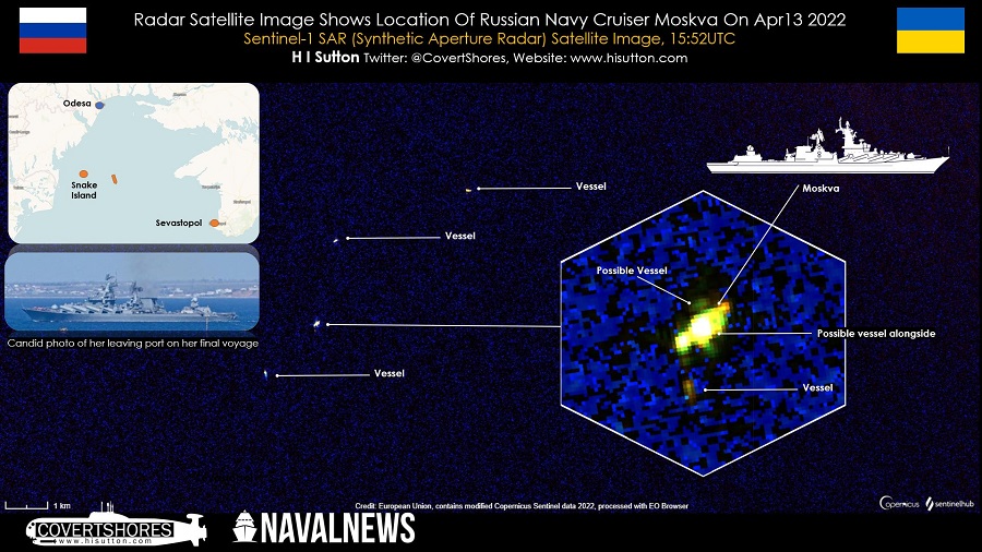
Today, such devices as Sentinel use synthesized aperture radars. As they move in orbit, they “remember” the imprint of the signal every second, and then put them together, creating a three-dimensional picture from which you can learn even the material of certain objects. But such images also have a resolution measured in meters, which is very far from the quality of optical images.
Is it possible to hide from orbital observation?
There are other, somewhat more exotic observation satellites. For example, HawkEye 360 monitors attempts to jam global positioning system signals. These data greatly helped the Ukrainian military to identify Russian electronic warfare.
Space surveillance tools are not omnipotent. Despite common myths, satellites are unable to recognize the faces of enemy soldiers or read secret documents. But usually this is not necessary. Anyway, the movement of people and technology is tracked better now than in any of the past wars.
