The presented image was taken by NASA’s Landsat 9 satellite. The image shows the volcano of Bagan. It is located on Bougainville Island, part of the Solomon Islands.
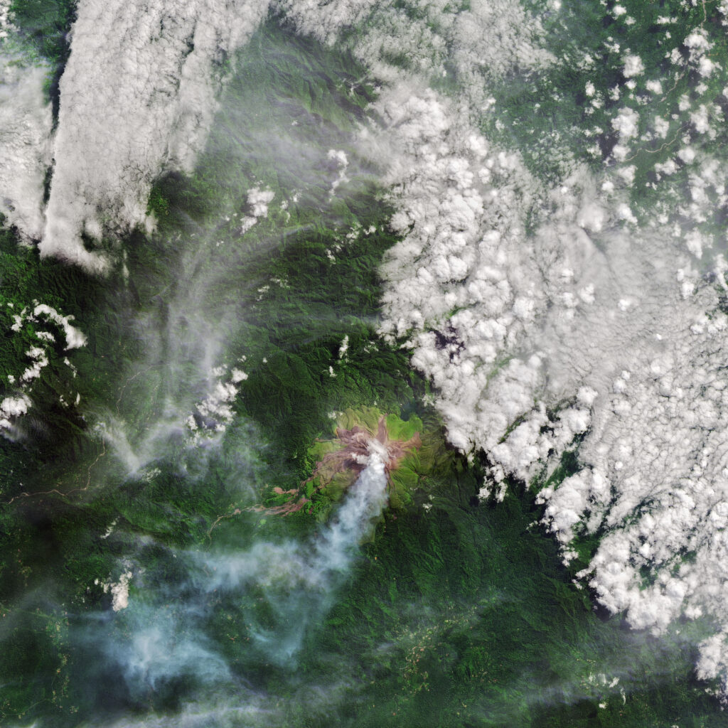
The volcano of Bagan rises to 1855 meters above sea level. When the first European explorers reached it in the 1840s, it was erupting. Over the next 180 years, the situation has not changed. All this time, the volcano has been erupting almost continuously. According to geologists, its cone was formed in the period from 300 to 500 years ago. Thus, Bagan is one of the youngest active volcanoes in the South Pacific Ocean.
The Landsat-8 image shows a lot of brown stripes stretching from the top of Bagan. Darker areas correspond to fresh lava flows, lighter areas correspond to places that have lost vegetation cover as a result of volcanic gases and ash deposition. The old lava flows are covered with light green vegetation, while the surrounding forests are dark green.
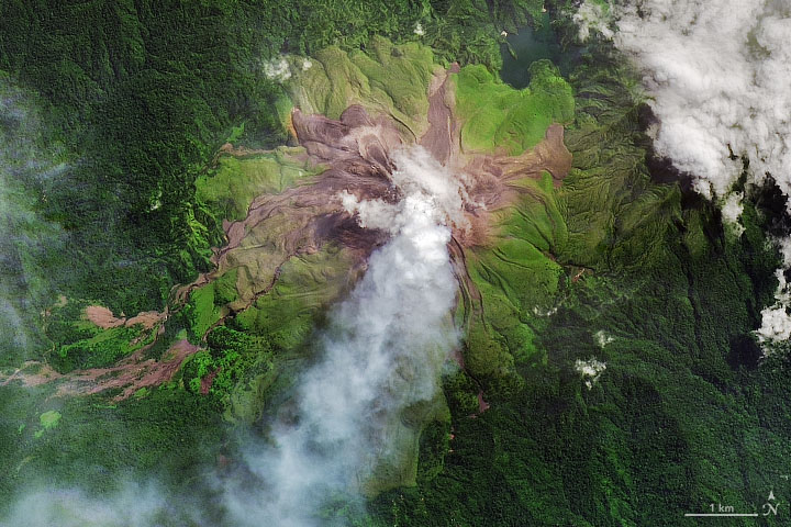
In the photo, you can also see a white plume stretching from the top of the mountain. According to a recent study, Bagan erupts several thousand tons of sulfur dioxide into the air every day. This is more than any other volcano in the world that does not have a lava lake.
The source of all this activity is the collision of the Australian and Pacific plates, occurring at a speed of about 11 cm per year. The Pacific plate “dives” under the Australian plate in a process called subduction. As a result, a deep-water trench forms on the leading edge of the “sinking” plate, and volcanoes form on the overlying plate.
According to https://earthobservatory.nasa.gov/
Follow us on Twitter to get the most interesting space news in time
https://twitter.com/ust_magazine
