The Mars Express spacecraft photographed Mawrth Vallis: an ancient outflow canal covered with a large amount of sedimentary deposits. It is considered one of the most promising places to search for traces of life on Mars.
Ancient Martian Canal
Mawrth Vallis is located in the Northern Hemisphere of Mars. Its length is 600 km, the maximum depth reaches 2 km. It was formed billions of years ago, in an era when Mars was experiencing a series of grandiose floods. The powerful streams of water flowing over the surface of the Red Planet left behind a network of characteristic valleys, also called outflow canals.
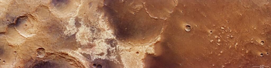
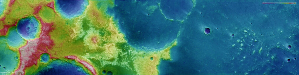
The Mars Express photo demonstrates a number of interesting features of this region. Mawrth Vallis is a clear example of the Martian dichotomy. The fact is that the hemispheres of the Red Planet differ significantly from each other in topography. The Southern Hemisphere is a cratered upland, while the Northern Hemisphere is 3-6 km lower and is characterized by a flat relief and a much smaller number of craters.
This difference is clearly visible in the images of Mars Express. The surface on the left in the main image has a much higher relief than on the right, which is clearly visible on the corresponding topographic map. It is older and eroded, and it is dominated by a large impact crater 25 km wide with a partially collapsed wall and a smaller crater at the central point. This may indicate the presence of buried ice that evaporated during the impact, causing the surface to collapse.
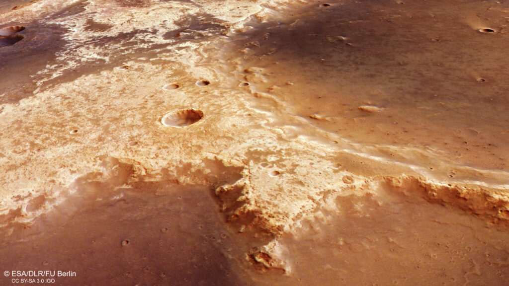
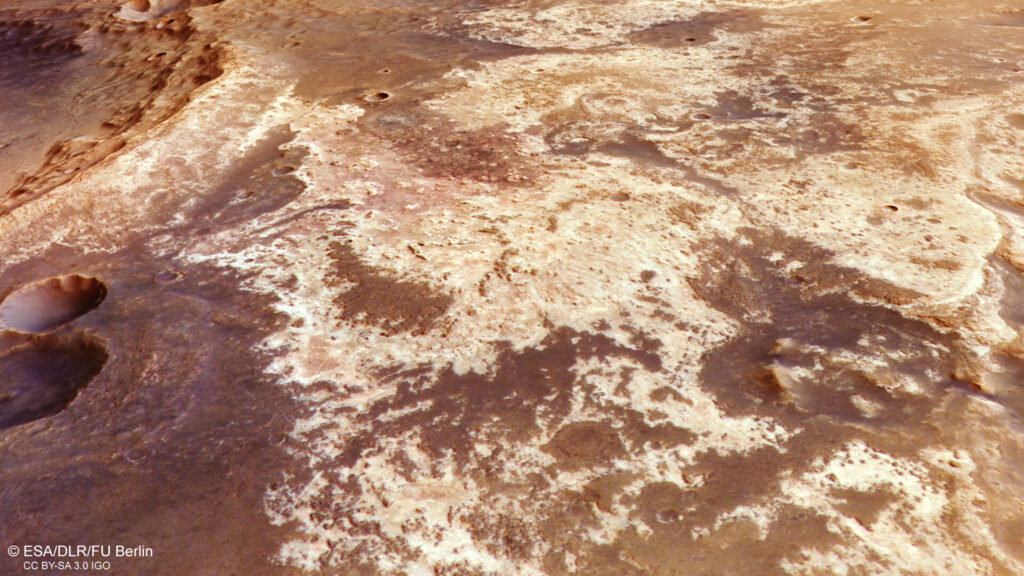
In the center of the image, to the right of the crater, there are characteristic bright spots. They correspond to clay. Clays interspersed with dark volcanic deposits are also visible in the walls of some craters.
As you look to the right (northern) part of the image, you can see how the terrain is leveled and the height of the relief decreases. This is the beginning of the Martian lowlands, more precisely Chryse Planitia. Two large, interconnected, and heavily eroded craters are located on this border: the larger one is about 75 km across, and the smaller one is about 35 km.
The “company” of these craters is a number of ‘mesas’ and knobs (small hills) with a diameter of about 3 km. And finally, in the upper right part of the frame, you can see the consequences of another powerful impact of a space guest. As a result, a mixture of water, rocks and debris spread like mud and flooded the entire surface.
Promising place to search for Martian life
The ancient clay deposits that can be seen in the Mars Express image are the main reason why Mawrth Vallis is considered one of the most promising places to search for traces of life on Mars. They formed in the presence of water and could retain traces of ancient microorganisms.
All this makes Mawrth Vallis a very attractive target for scientists. At one time, it was considered as a possible landing site for the Curiosity and ExoMars missions. Probably, in the future, a mission will land on its territory, which will study local sedimentary rocks to search for traces of Martian life.
According to https://www.esa.int
Follow us on Twitter to get the most interesting space news in time
https://twitter.com/ust_magazine
