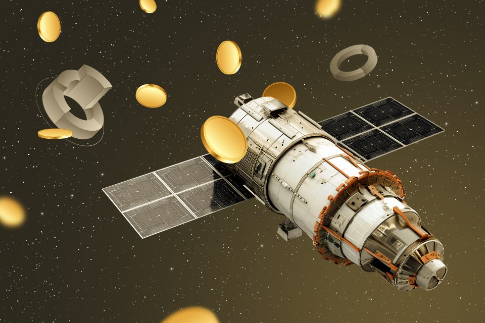
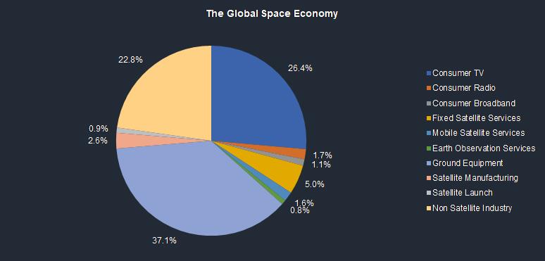
Space is not only about scientific research and military projects. For many years, it has been bringing considerable profit to public and private companies. Telecommunications and Earth observation are the things that have provided space businesses with profits in recent decades and will continue to do so in the future.
Are space industries unprofitable?
Space travelling is an extremely expensive pleasure. People realized this at the very beginning of the space age. According to the Tsiolkovsky equation every kilogram of cargo launched into orbit requires a much larger mass of fuel to be spent for. In addition, the devices themselves that consume this fuel are among the most complex systems created by humans.
And every little thing can potentially lead to a catastrophe, as a result of which both the cargo and the launch system itself will be lost. And even if everything is done properly, in most cases, the main result of the flight will be scientific data, which is of interest mainly to scientists.
The lack of results that can bring money right here and now is one of the main obstacles to the development of the space industry. So businessmen and ordinary citizens simply do not understand why they should invest so much efforts and money in some projects that will not create many goods and services in a short time.
However, as early as 1970s, meticulous analysts calculated that huge investments in the space sector had somehow brought huge profits or at least paid off. And since the beginning of the 21st century, there has been a real boom in the creation of space companies. This indicates that there is still money to be made outside the Earth.
Space communications and television
The first thing that traditionally earns money in space is the transmission of information. Due to the curvature of the Earth, radio waves have an extremely limited range over most of their bands, no matter how powerful the transmitter is. If a transponder is placed in a geostationary orbit, it can transmit a signal to almost half of the globe, and several such devices will cover the entire world, except for small circumpolar regions.
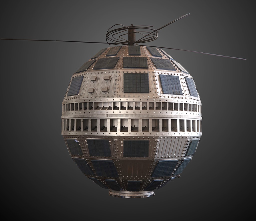
Television companies were the first to take an interest in this opportunity. A satellite called Telstar began broadcasting European TV channels to the United States and vice versa in 1962. And in 1984 alone, more than 500 thousand satellite systems worth $2000 each were sold in the United States. Television from space was in incredible demand.
At the same time, the idea arose that not only TV channel signals but also phone calls could be transmitted via satellite. The first commercial company to sell satellite telephone services to customers was called Inmarsat, founded in 1979. Since then, orbiters connecting people on different continents have become an expensive but extremely profitable investment.
Satellites and the Internet of the future
At the turn of the twentieth and twenty-first centuries, both telephone calls and television were digitized. In essence, they became part of a much more powerful telecommunications system — the Internet. After all, what difference does it make whether you transmit a conversation between relatives or a popular TV program in binary code, if both are available in online services?
That’s why when people talk about communication satellites as an extremely profitable component of the space industry; they mean vehicles capable of transmitting a huge amount of digital information regardless of its actual content. Moreover, this service should be available even in the absence of ground infrastructure.
This is how the race between SpaceX and OneWeb began. The question was who would be the first to create a low-orbit constellation that could provide Internet anywhere — you just need to acquire an antenna and use it without restrictions, just as people used to install satellite TV dishes in the 1980s.
SpaceX is currently winning this race. However, while the big companies were arguing for leadership at this stage, life has moved on. More and more people are using their cell phones instead of laptops or desktops to connect to the Internet. Therefore, all those who provide online services are mainly focused on such consumers.
Therefore, in 2021-23, numerous telecommunications corporations and satellite operators are forming alliances to reach the next stage. A low-orbit system must be created that can provide such a broad and stable data channel that all people on Earth will be able to use the Internet from their mobile phones without restriction, regardless of whether there is a relay tower or satellite terminal nearby or not.
But even after this goal is achieved, the growth of the telecommunications market will not stop. After all, stable communication at this level is still available mainly in developed countries. Africa and parts of Asia are still very poorly provided with satellite infrastructure, and the growing standard of living there makes it more and more necessary.
And even after the entire Earth is provided with high-quality satellite Internet, this market will have room to grow for a long time to come, as other bodies in the solar system will begin to be explored. And the people who settle there will also need digital communications and other services.
Satellites monitoring the Earth
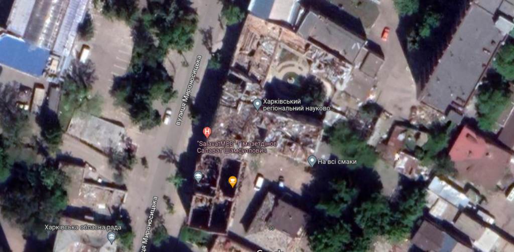
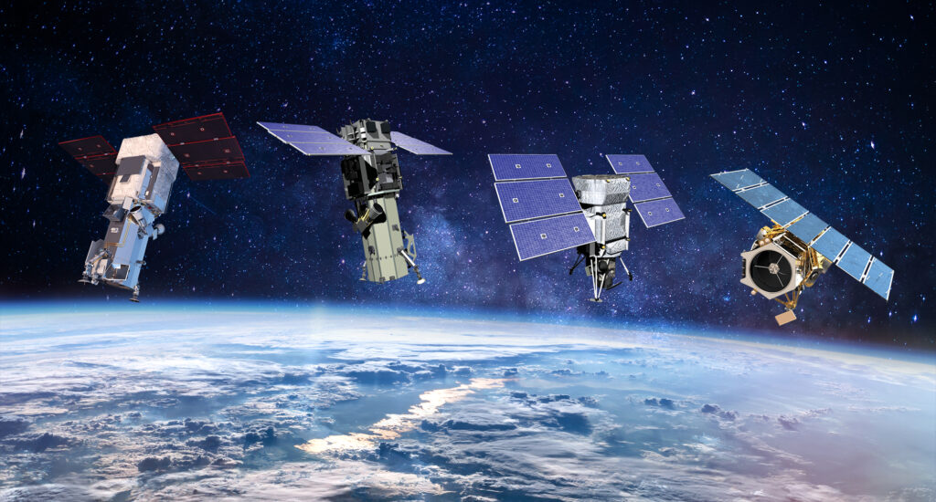
Another branch of the space business that is gradually becoming traditional is Earth observation. Initially, it was entirely owned by the military and security services of different countries. Gradually, private companies began to engage in it, launching their own satellites that monitor our planet in optical, infrared, and radio bands.
Governments and government organizations of different countries are still the main customers of private satellite operators. A constellation of satellites in low Earth orbit can provide a volume of information comparable to all other types of intelligence combined. Of course, there are those willing to pay millions and tens of millions of dollars for it.
So if a company is able to enter into an agreement with a government for the long-term supply of earth’s surface imagery, it is a great business idea. However, recently, not only government agencies have been interested in such information. Corporate executives who are interested in the state of affairs of competitors and partners and the prospects of certain markets are also monitoring land from space.
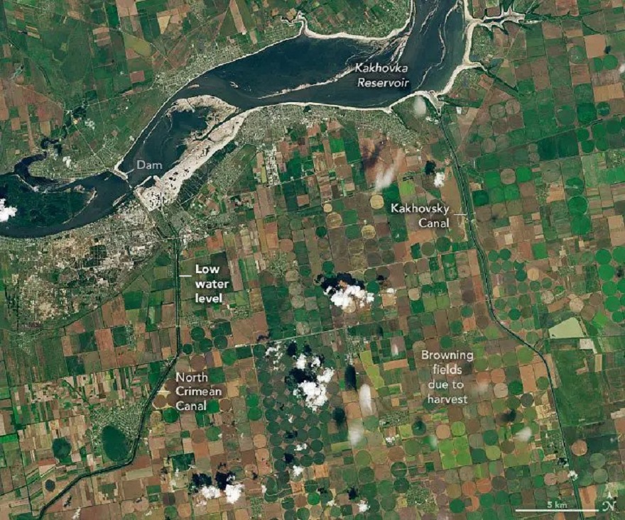
However, in this case, simple images are usually not enough, because the customers still need some more information. It is called geospatial data. It can contain not only the position of an object or group of objects in a certain place at a certain time, but also what surrounds these objects, their condition, and how all this changes depending on various factors.
Therefore, it requires data analysis, which can cost even more than the images themselves. Some companies are now exclusively engaged in extracting geospatial data from satellite images that do not belong to them, according to the client’s wishes. Others offer a service for processing their own photos and radar images. In other words, the space business is closely related to IT.
But lately, this is not enough. After all, there are so many satellite photos that it is extremely difficult to find what you need in a pile of similar images. Therefore, companies are already working on even deeper integration with Internet technologies. For example, Maxar Technologies recently introduced an application for working with its data. It allows not only to conveniently search for existing photos but also to order new ones.
Agricultural monitoring and control of biological resources
One of the industries where satellite monitoring and geospatial data can become a particularly valuable commodity is agribusiness. The world’s population is growing, and people’s need for food — especially in developing countries — is increasing even faster. At the same time, the Earth’s climate is changing in a direction that is less favorable for agriculture.
So, “just sowing as our grandfathers did” will no longer work. Agriculture is becoming a high-tech industry, where they are trying to make the harvest independent of natural factors, and look for customers as early as the stage of cultivation.
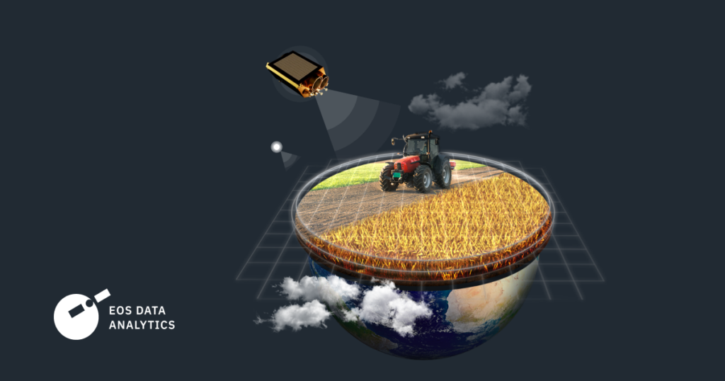
In such conditions, a satellite that regularly inspects all fields in the region and receives geospatial data about them can help farmers greatly, as it allows them to respond to changes in the situation quickly. Such services can be an extremely profitable business. An example of this is EOS Data Analytics. For many years, it has been processing data on the state of agricultural land received from various satellite operators.
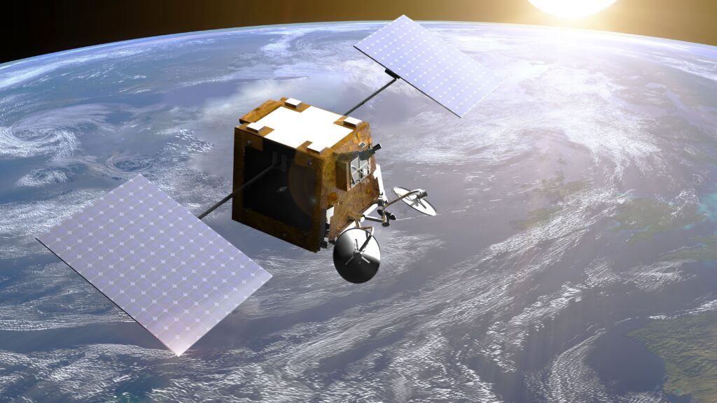
A few years ago, this company decided to become the owner of an orbital grouping itself. Its first satellite is called EOS SAT-1. It was launched on January 3, 2023, and on April 24, the first images taken by it were published. The satellite’s cameras operate not only in the visible but also in the near-infrared range, so the images obtained allow us to assess the degree of moisture in the fields and their health.
And this is just the beginning. Agriculture is increasingly linked to the use of natural habitats. Forestry and orchards are already not much different from them, and in the future, both agricultural land and natural biological resources may become a single system whose condition will be assessed by satellites.
