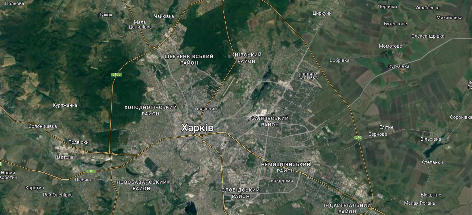
The Google Maps service has partially updated satellite images of the city of Kharkiv. It was one of the first targets of the Russian army during the invasion; and it is still constantly being subjected to missile strikes. The information about the destruction of the city completely does not correspond to reality. Although there are a lot of disasters in the photos.
Kharkiv in Google Maps photos
The Google Maps service continues to update satellite images that show how the large-scale invasion of Russia has changed Ukraine. Earlier, photos of Mariupol, which was severely damaged during the siege in the spring of 2022, had already been posted. Now it is the turn of Kharkiv, which has been one of the main goals of the Russians since the first hours of February 24, 2022.
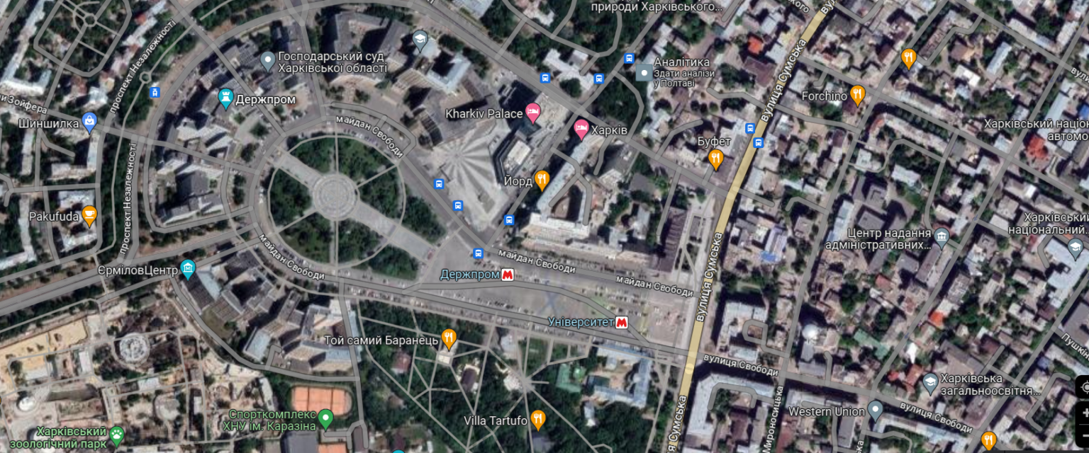
Kharkiv has been repeatedly subjected to shelling and air raids. In the early spring of 2022, fighting took place not only directly next to the city, but also within its borders. Because of this, the news of the whole world was full of pictures of destroyed buildings. Many people then thought that it was dilapidated. However, satellite images posted on Google Maps show that this is far from the case. At least the city center with Freedom Square, which has a bizarre shape and is the largest square in Ukraine, looks intact at first glance.
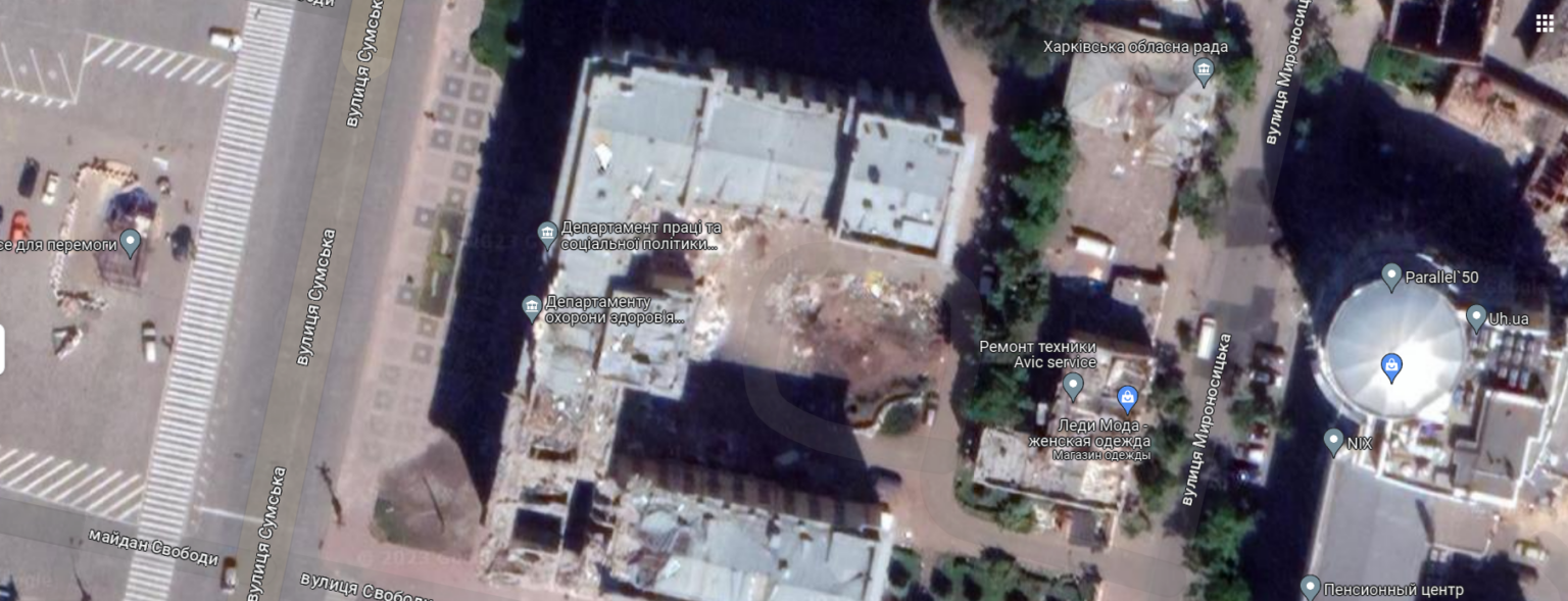
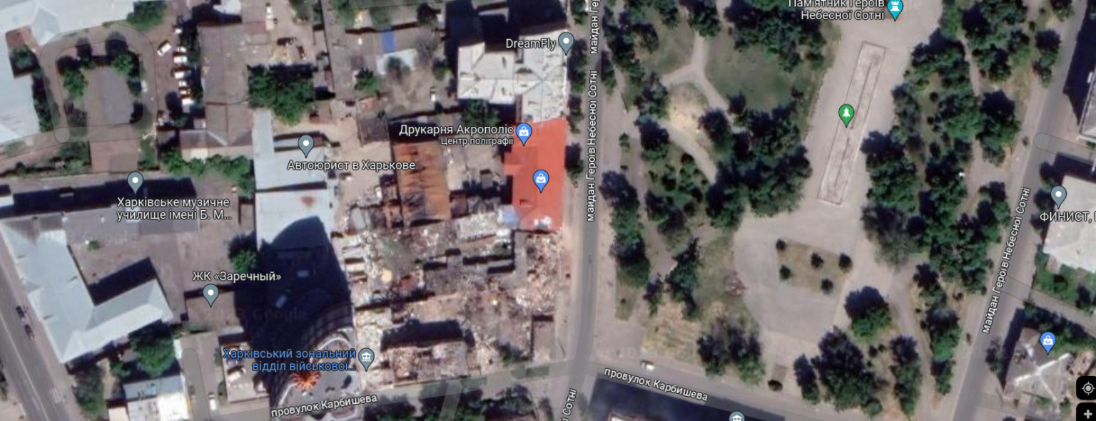
However, when zooming in, the consequences of the missile strike inflicted by Russia on the morning of March 2 are clearly visible. Then several dozen people died as a result of it. The building of the Kharkiv Regional State Administration is located at the end of the rectangular part of Freedom Square.
The satellite image shows that the roof has partially collapsed in it, and in the left part there is a huge gap that goes all the way to the bottom. The surrounding buildings were also severely damaged, especially the tower with a round roof, located in the picture to the right of the Kharkiv Regional State Administration.
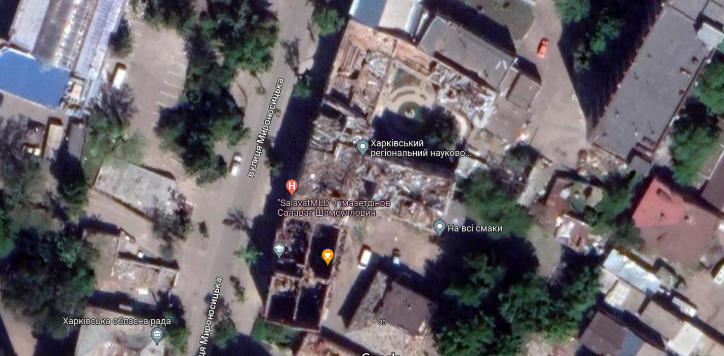
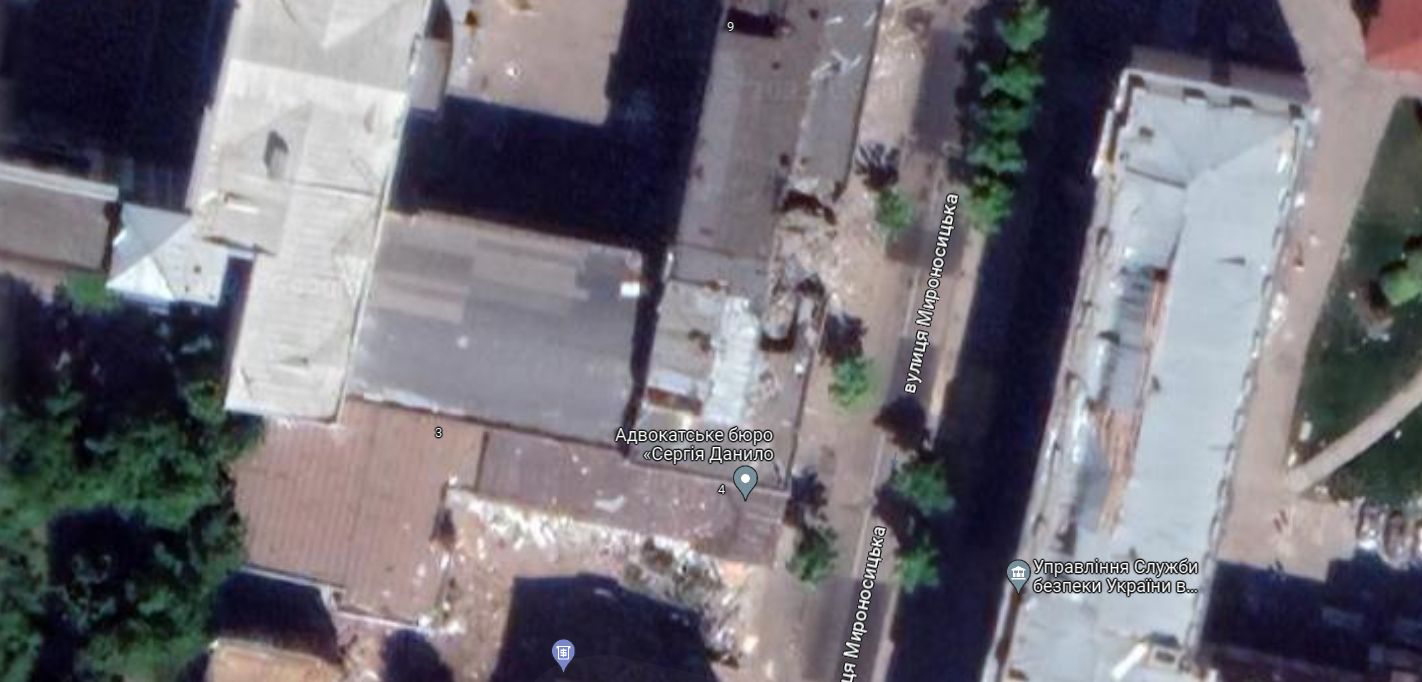
Not far from this place, also in the very center of Kharkiv, in the images you can see the destruction caused to residential buildings 32 and 34 on Mironositska Street. They represent a significant historical value, and their residents are now fighting for the houses to be restored, not dismantled.

Another important object on satellite images is the building of the Main Police Department in the Kharkiv region, which is also located in the city center. On the morning of February 27, 2022, several groups of invaders on light vehicles broke into the city and headed to its center. One of their main goals was this convenient building for defense.
When the Russians drove up to this place in armored cars, they found that there were Ukrainian military inside, who were actively shooting back, and they got away. However, a few days later, as a sign of revenge, they launched a rocket attack on the building.
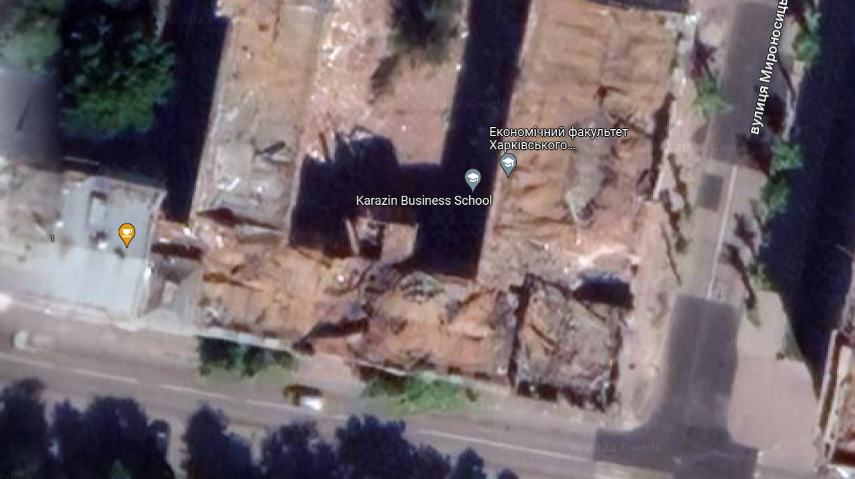
Simultaneously with the Main Police Department, the building of the Faculty of Economics of V. N. Karazin Kharkiv National University, located literally across the street from it, was severely damaged by the blow. A burning building, from which a large piece of the roof falls, is exactly that. The pictures of these events also flew around the world.
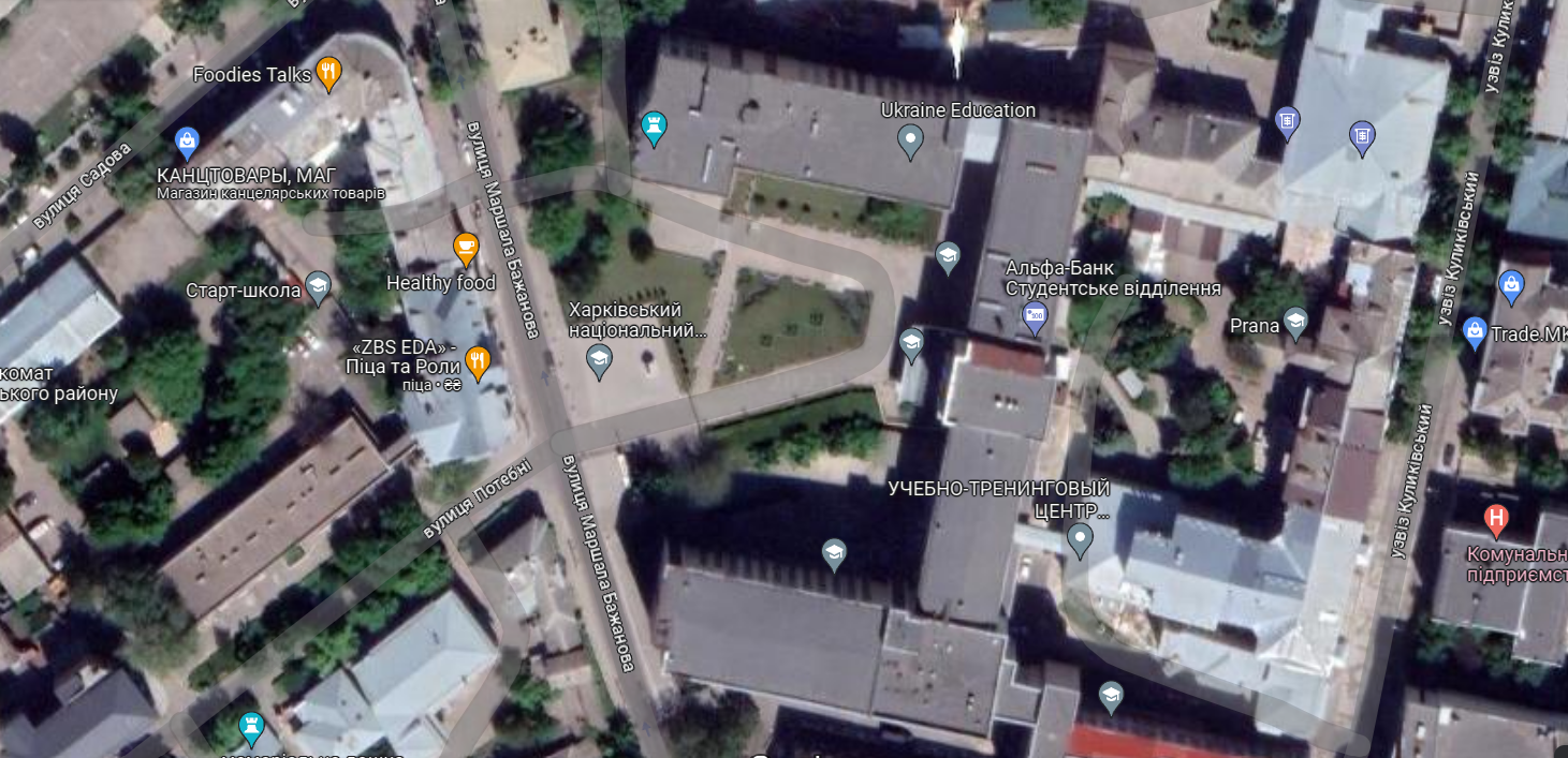
At the same time, the building of the Kharkiv National University of Civil Engineering and Architecture suffered significantly, although not so much. It was unlucky for the university to be across the street from the regional directorate of the Security Service of Ukraine.
Upon a detailed study of satellite images of Kharkiv, it became clear that they were taken last summer; and much of the destruction on them is simply not visible. For example, the building of the Beketov National University of Urban Economy in Kharkiv is still intact in the pictures. In the winter of 2023, it was severely damaged by another rocket attack.
Kharkiv: Other areas
Satellite images showed that not only the center of Kharkiv was affected, but also other areas. In particular, they show what remains of the school building No. 134. On February 27, 2022, on the very day when Russian saboteurs tried to seize the police department, they occupied this educational institution.
Then the Ukrainian military had to storm, as a result of which the school burned down. The pictures clearly show that it has not undergone such destruction at all as those objects on which the Russians launched missile strikes.
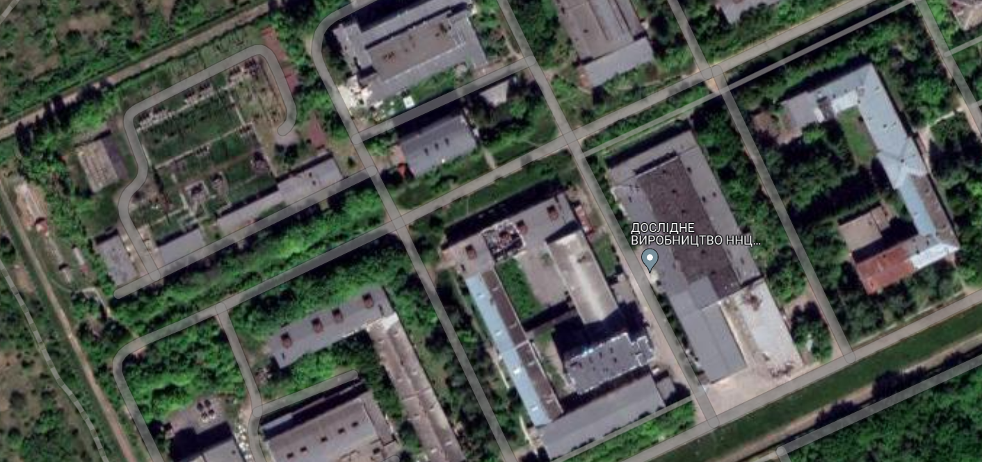
Piatykhatky became one of the districts of Kharkiv, near which there were fighting. It is located in the very north of the city, and it is here that the Kharkiv Institute of Physics and Technology, one of the main centers of nuclear research in Ukraine, was built. It is known that as a result of Russian shelling, the building where the particle accelerator was located was damaged.
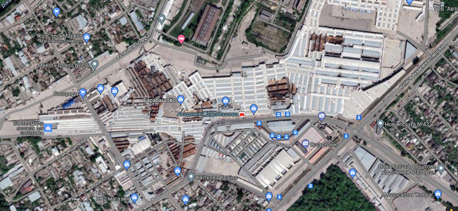
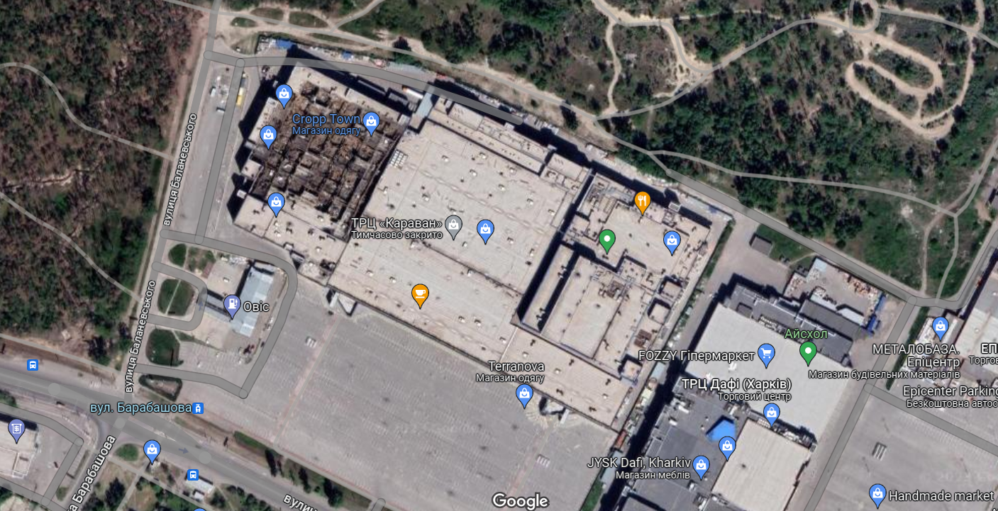
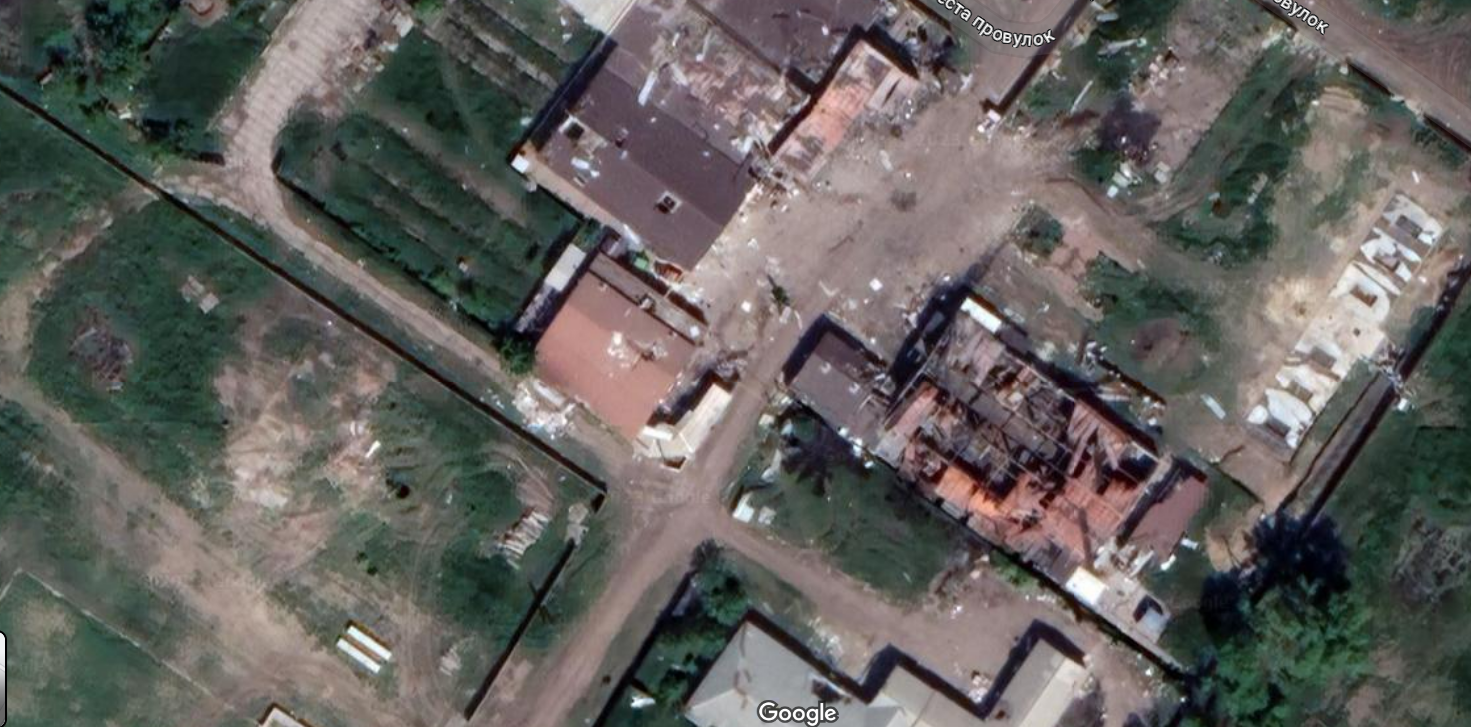
Barabashovo is known as one of the largest markets in Ukraine. In fact, it gets its name from the Akademika Barabashova station, around which it is located. And that, in turn, is named after an outstanding Kharkiv astronomer. Satellite images clearly show the scale of the destruction of this giant shopping complex.
Another commercial facility that was damaged as a result of Russian attacks was the Karavan hypermarket; it is part of another large market. The photos clearly show that part of it is completely burned out as a result of a missile or heavy artillery hit.
Northern Saltivka
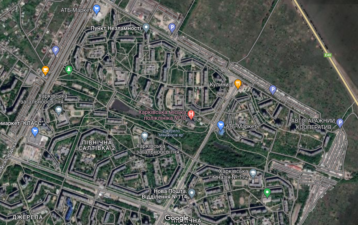
Another area of Kharkiv that has become famous due to the destruction caused by Russian troops is Northern Saltivka. It is often confused with just Saltivka, which is the largest “bedroom community” of Ukraine.
In fact, Saltivka was not much affected by the shelling. And satellite images of Northern Saltivka also look normal. However, if you zoom in, it immediately becomes clear how severely this area has been affected.
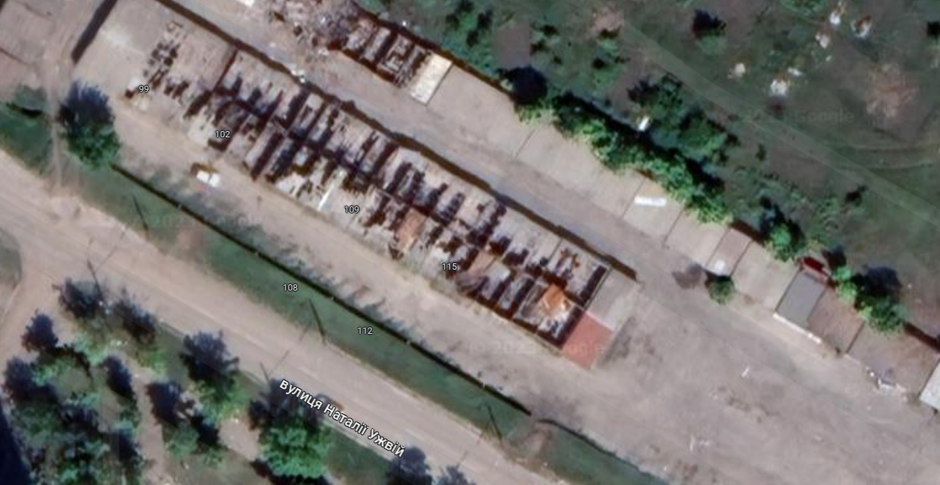
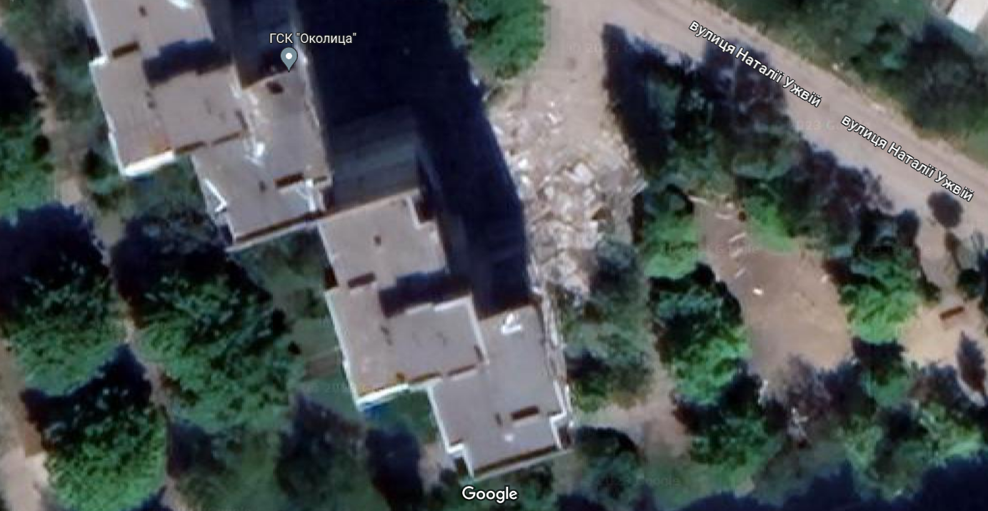
An example is a 16-storey building on Natalia Uzhviy Street. This image is often used to illustrate the destruction of the Northern Saltivka. Satellite images clearly showed that part of one of the two identical blocks simply collapsed to the very bottom.
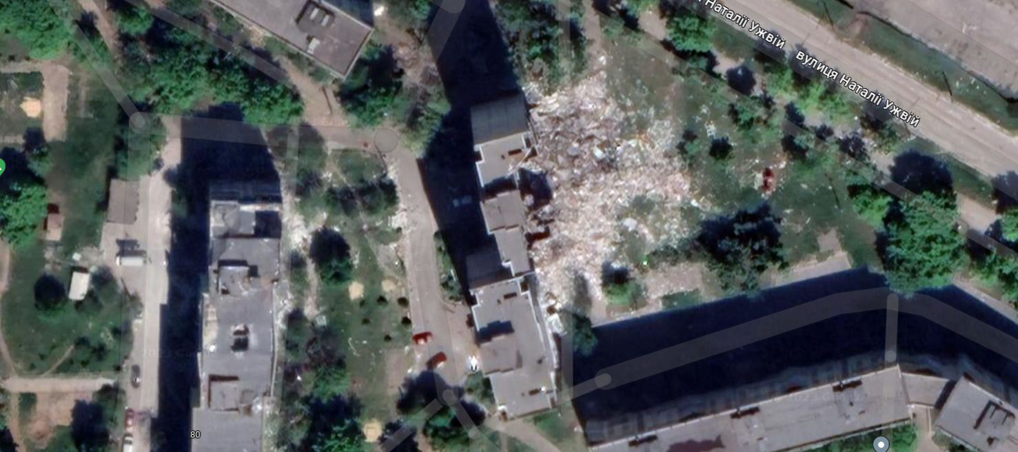
Natalia Uzhviy Street is notable for the fact that it is the last in the multi-storey development of Northern Saltivka, and further from it there is only an exit from the city in the direction of Russia. Images of destroyed garages can serve as evidence of the proximity of the battles here.
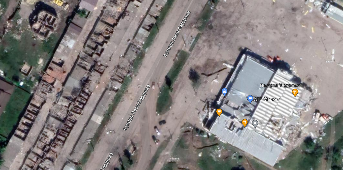
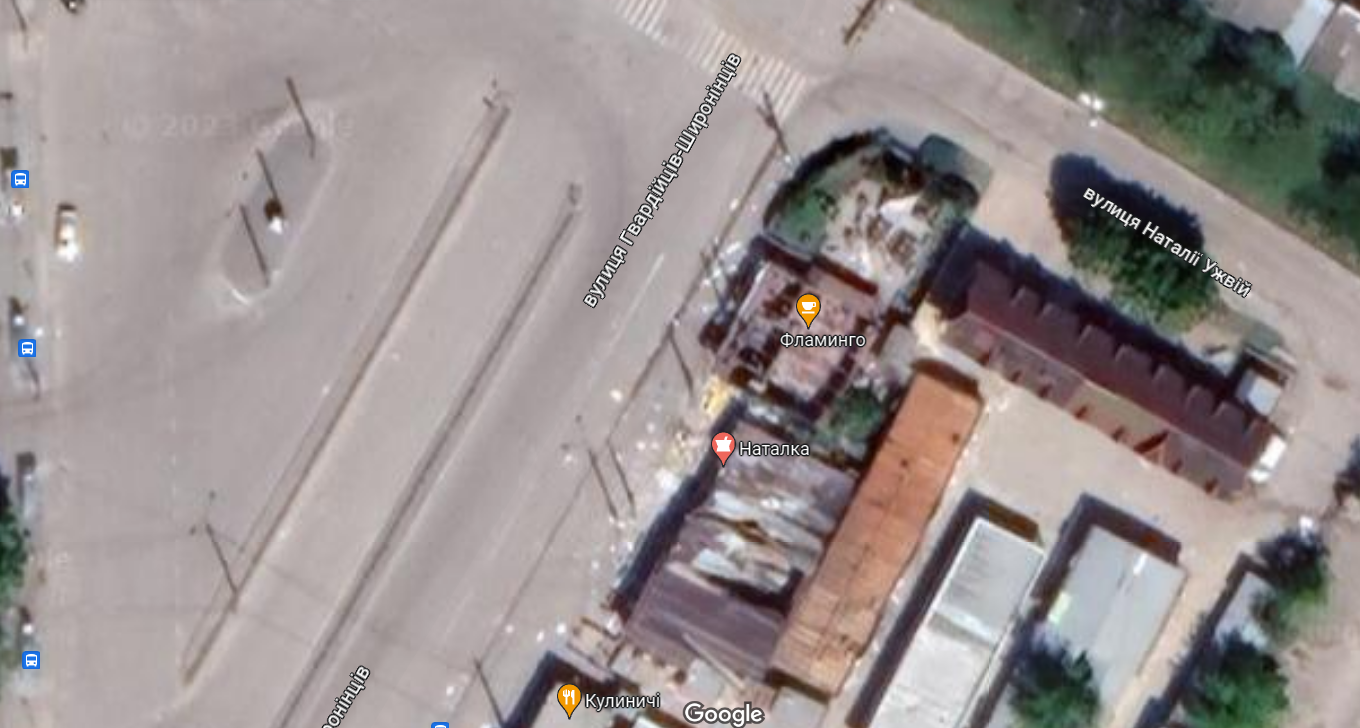
Other high-rise buildings of the district, at first glance, do not look so damaged. But this is mainly due to the angle of the image. Piles of debris nearby reveal their true condition. No less eloquent is the destruction of shopping facilities located on the Northern Saltivka: supermarkets, cafes and small shops near the trolleybus circle.
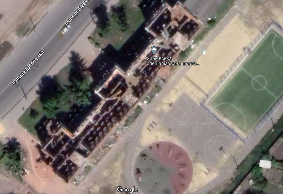
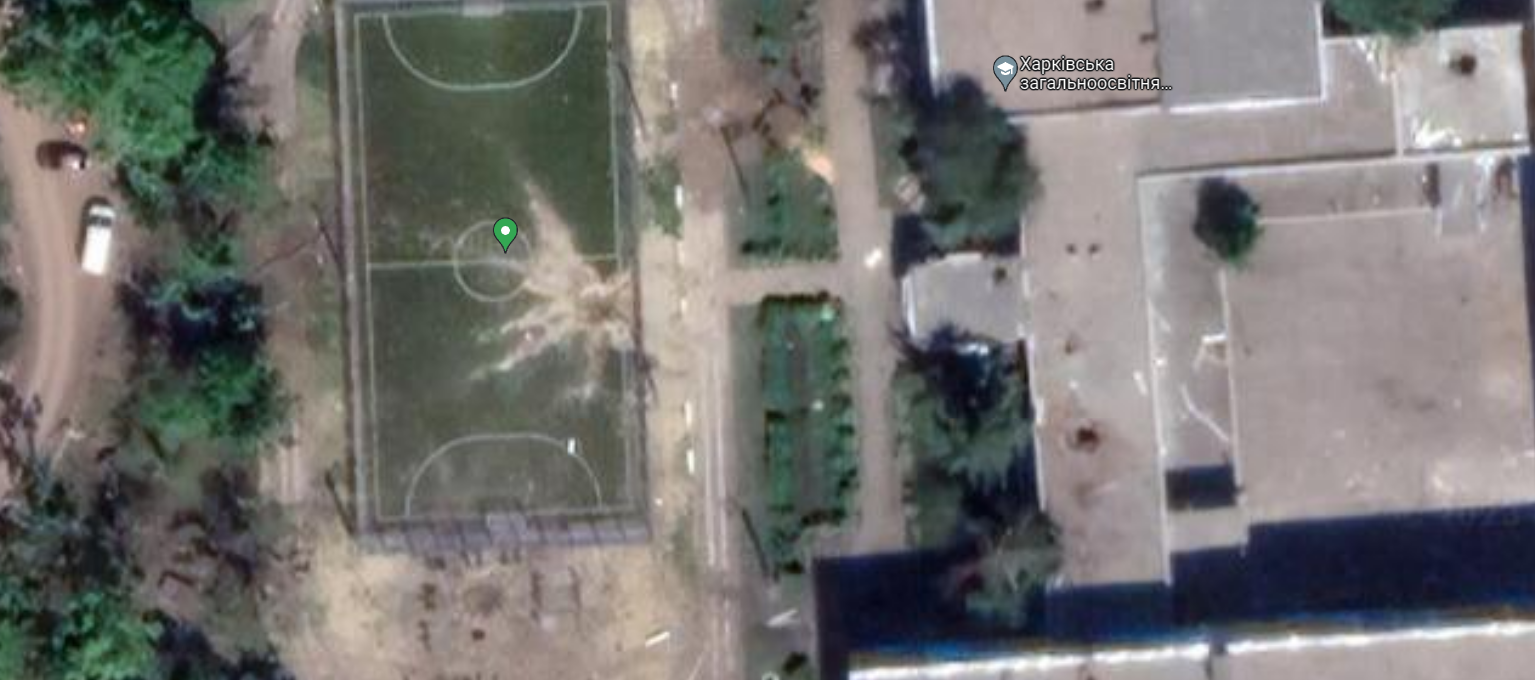
Separately, it is necessary to pay attention to the image located below. The Russians claimed that they did not open fire on the schools of the city. However, the satellite image does not agree with them. It shows something that looks very much like a lunar crater, located right on the football field next to the educational institution. One can only hope that this image will someday become part of the evidence of guilt voiced in court.
North of Kharkiv
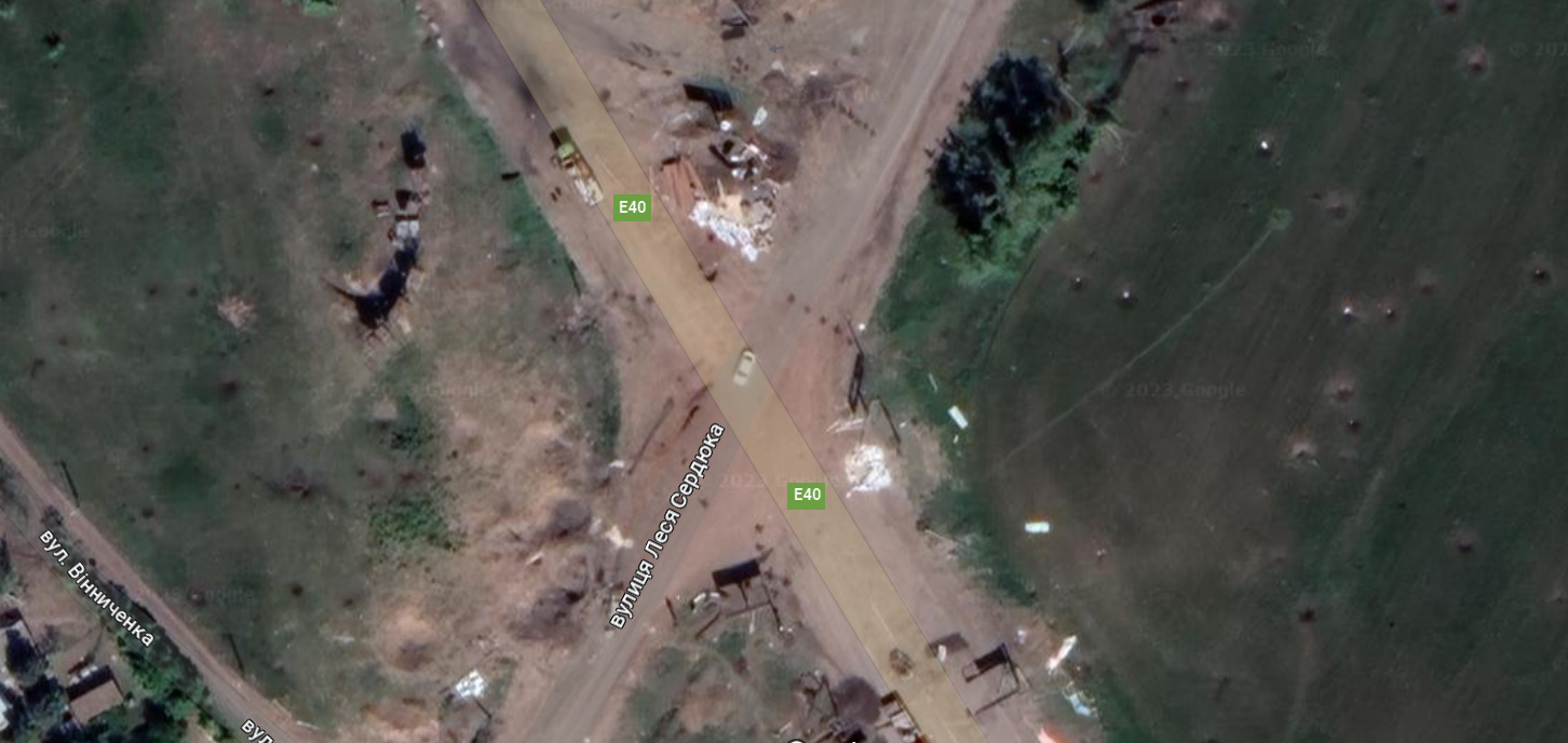
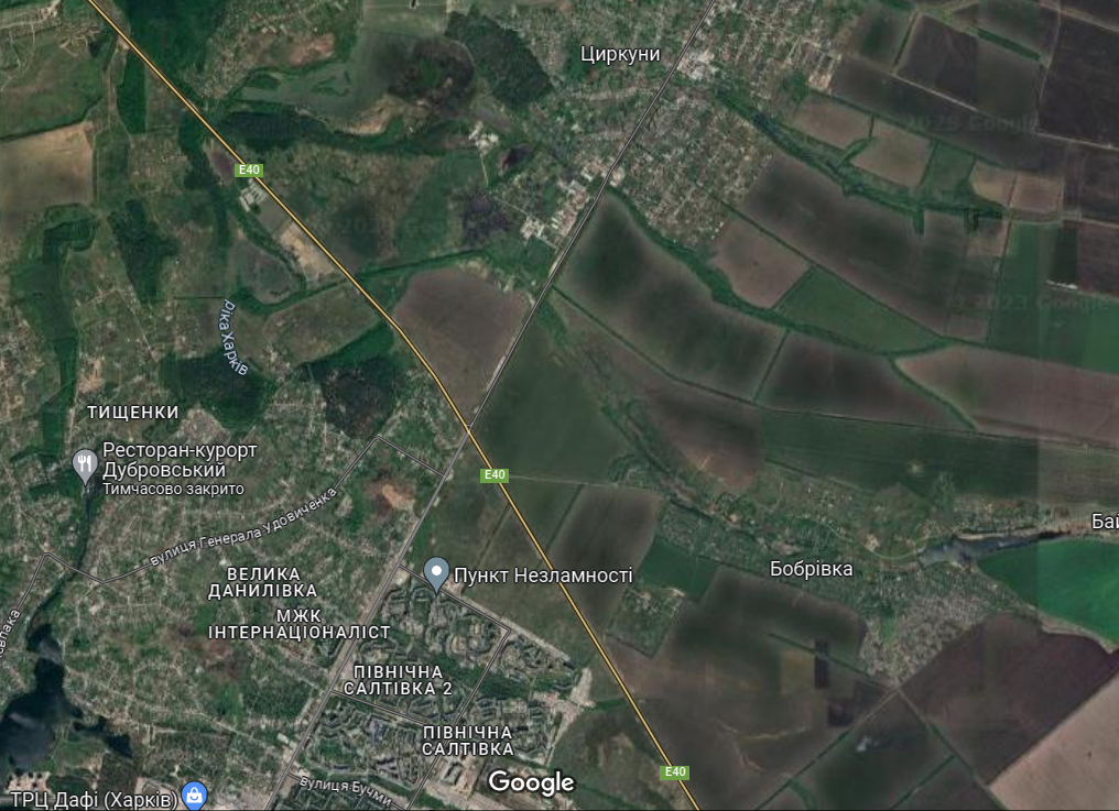
Satellite photos clearly show not only Kharkiv, but also the surroundings of the city. Here, first of all, the cluttered intersection with the Ring Road attracts attention. A group of objects located to the left of it are the remains of the inscription “Kharkiv”, which greeted the guests of the city when they entered it from the north with good intentions.
It was here, on the morning of February 24, that one of the first battles of a large-scale invasion took place. An advanced group of Russians broke through here from the north and stopped in front of the intersection. Here they were found by the Ukrainian military. For the representatives of the aggressor country, it ended with burnt armored vehicles and a retreat to the neighboring Tsyrkuny village.
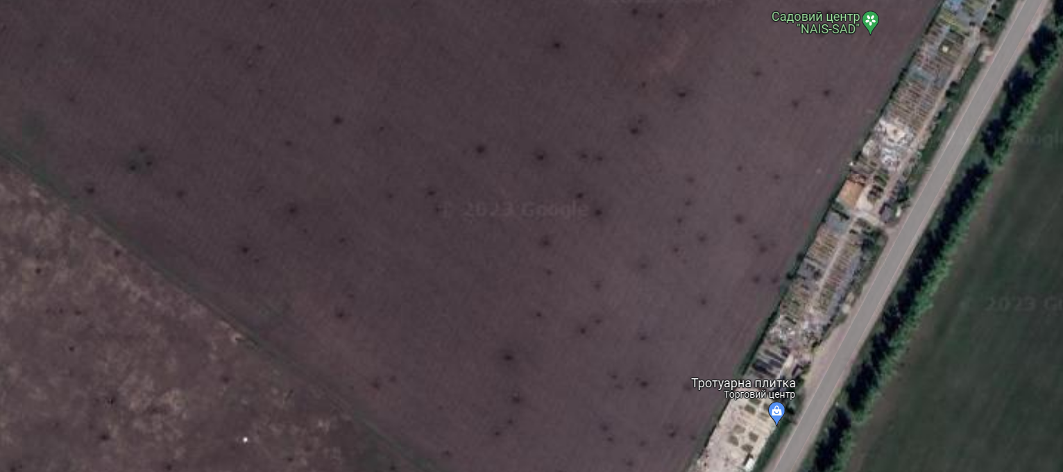
However, they could not be knocked out of the Tsyrkuny until May 2022. This is evidenced by the numerous craters in the fields directly next to the Kharkiv Ring Road, as well as the destruction of buildings in the village.
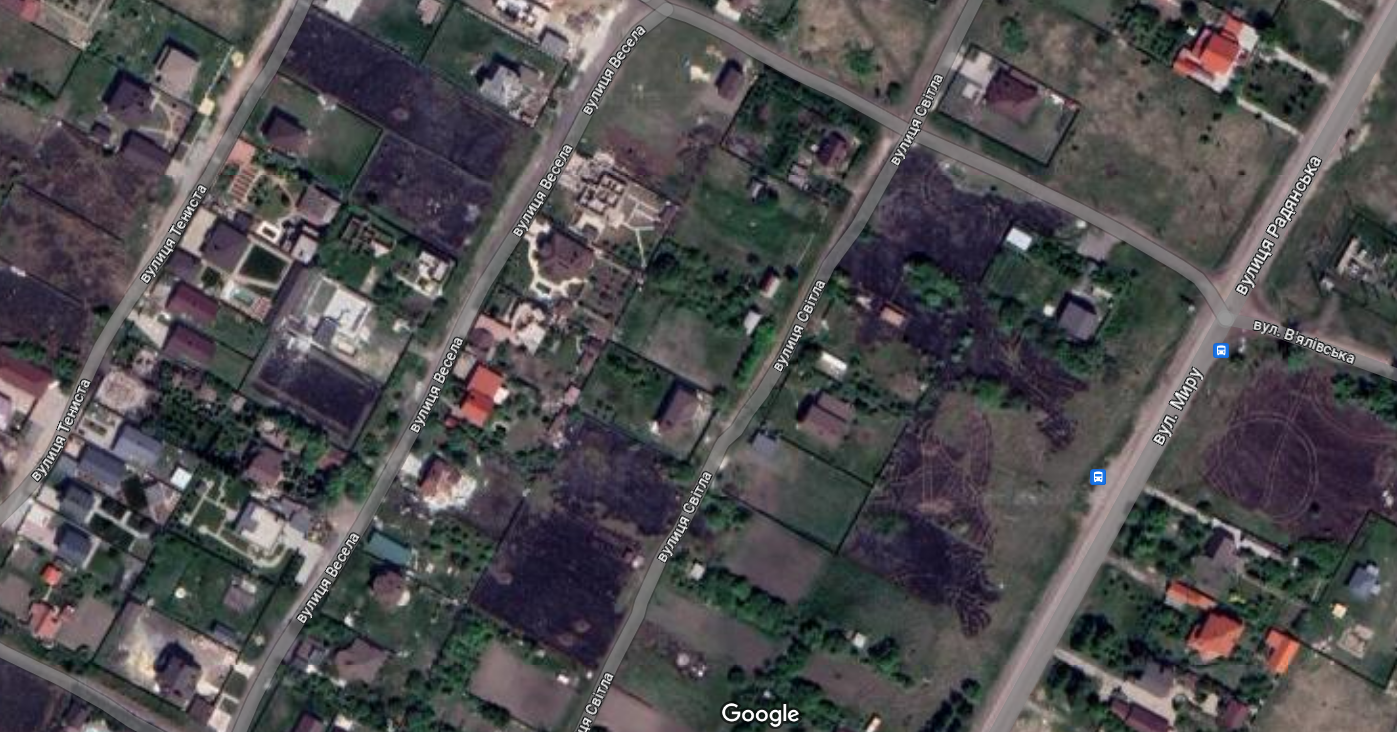
Especially noteworthy are the four parallel streets in Tsyrkuny, which have wonderful names: Tenysta (Shady), Vesela (Cheerful), Svitla (Bright) and Myru (Peaceful). Between them, the satellite images show ashes with traces of the occupiers’ armored vehicles.
Satellite images also perfectly demonstrate why Northern Saltivka has suffered so much from shelling. The yellow line in the photo below shows the Kharkiv Ring Road. In the first month of the war, the advanced defense positions of the Ukrainian troops passed through it. The invaders fired at them from the Tsyrkuny.
And the picture below clearly shows how close Kharkiv is to the border with Russia. In the picture, the border is marked with a white line. Grayvoron in the upper left part of the image is the town where the Russian volunteer corps went. In Shebekino on the right, something incomprehensible is happening all the time, but very interesting.
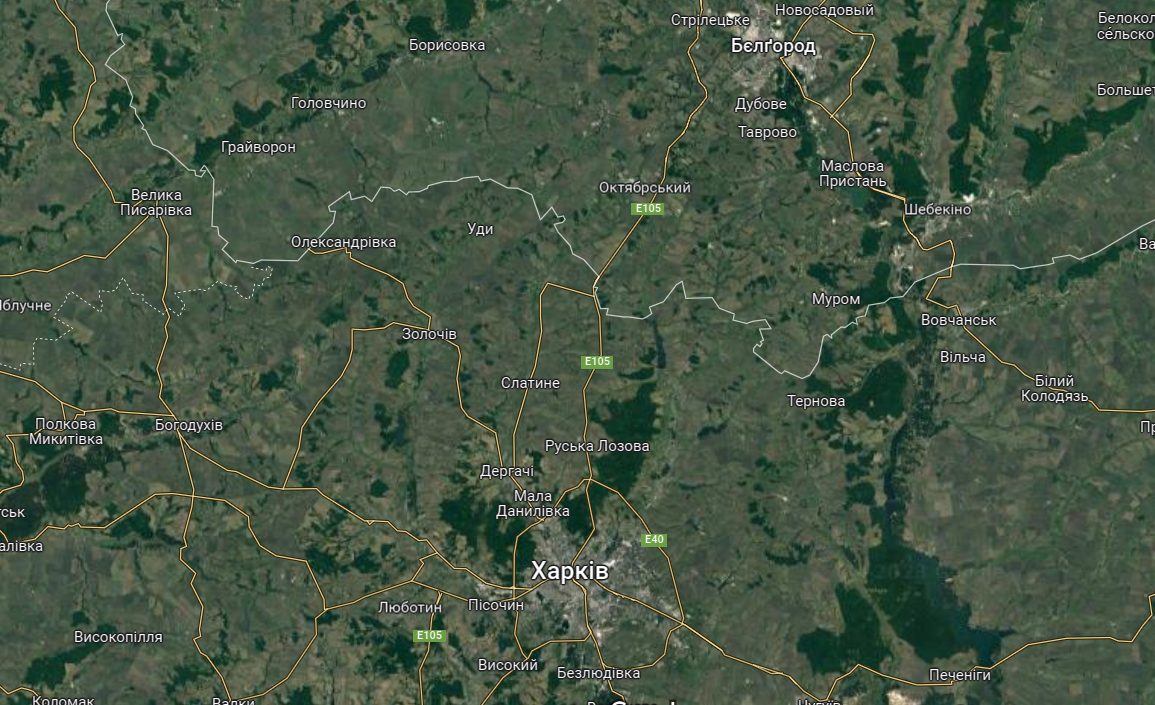
And the city of Belgorod is also visible in the picture. The distance to it from Kharkiv in a straight line is 72 km. It is there that the S-300 missile systems are located, the missiles from which still go to Kharkiv. Their speed is 1300 m/s, and anyone can calculate how long it takes them to overcome the path to the goal. We can only hope that there will be no new facilities to study the consequences of their hits on satellite images.
Follow us on Twitter to get the most interesting space news in time
https://twitter.com/ust_magazine
