Over the past week, Google has updated online maps of Mariupol, using images taken during the battles for it and during the Russian occupation. They show numerous destructions, empty beaches and the heroic Azovstal metal plant.
Destroyed Mariupol
Last week, Google updated its maps of the city of Mariupol. The city is now under occupation by the Russian Federation. At first, this happened in the Pro version, and on April 26, the images became available for the regular online version.
At the same time, images were used that were taken by satellites during the battles for the city in the spring of last year, throughout last year and more recently. Therefore, you can see on them both completely destroyed neighborhoods and traces of the former peaceful life, when the blue-yellow flag was still flying over the city.
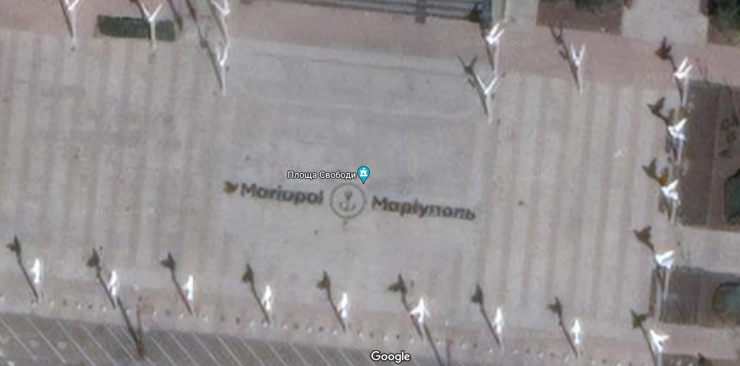
An example of the latter can be Freedom Square, which was almost not damaged during the fighting. It was reconstructed just a few years before the invasion; at maximum zoom, the name of the city, which is laid out on it in Ukrainian and English, is clearly visible. Now the occupiers have renamed it in honor of Lenin.
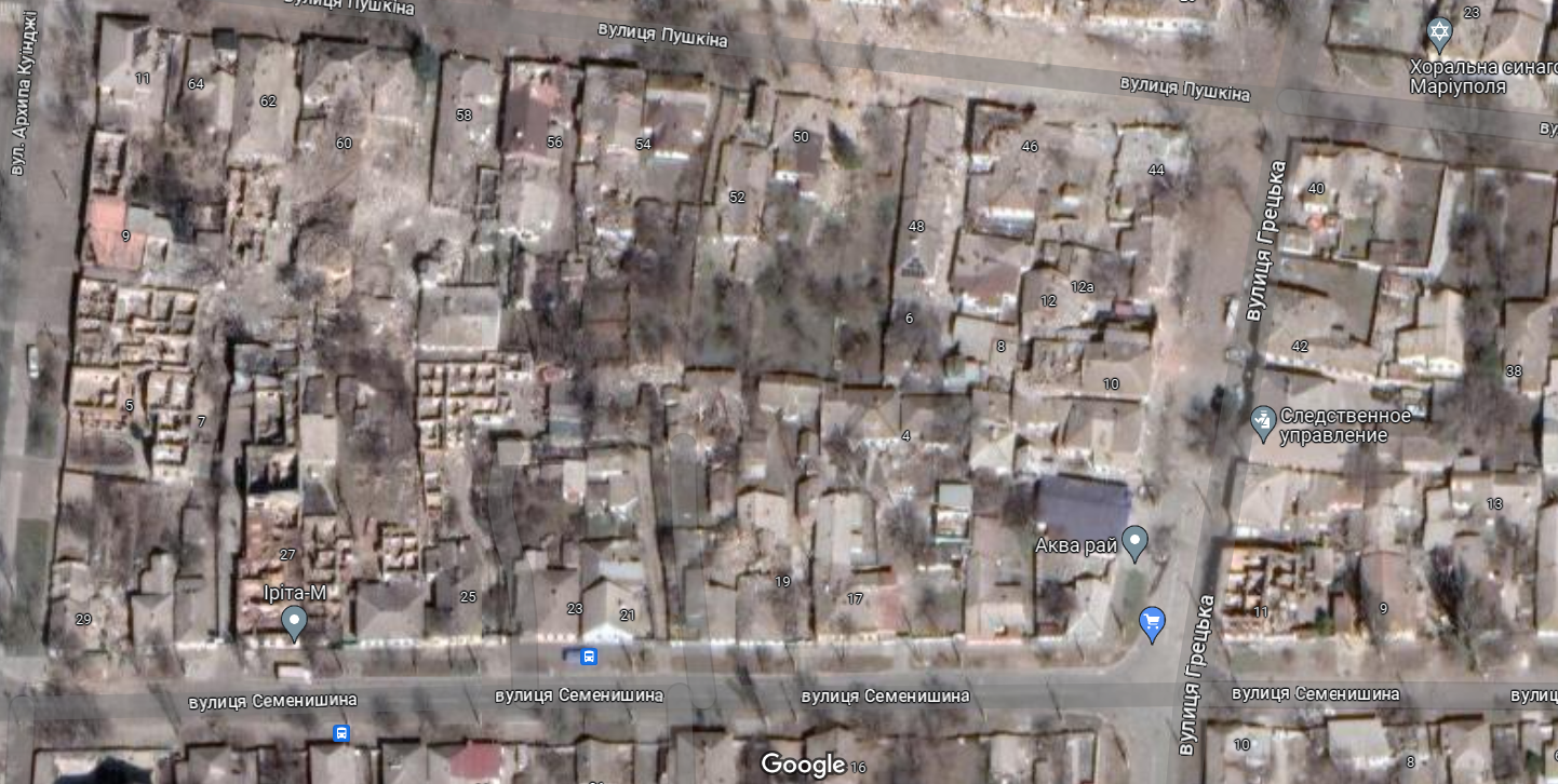
It cannot be said that Mariupol on the map is a continuous zone of destruction. But areas where only walls remain of houses can be found without problems. They clearly show that these are civilian houses that the occupiers have destroyed and are in no hurry to restore.
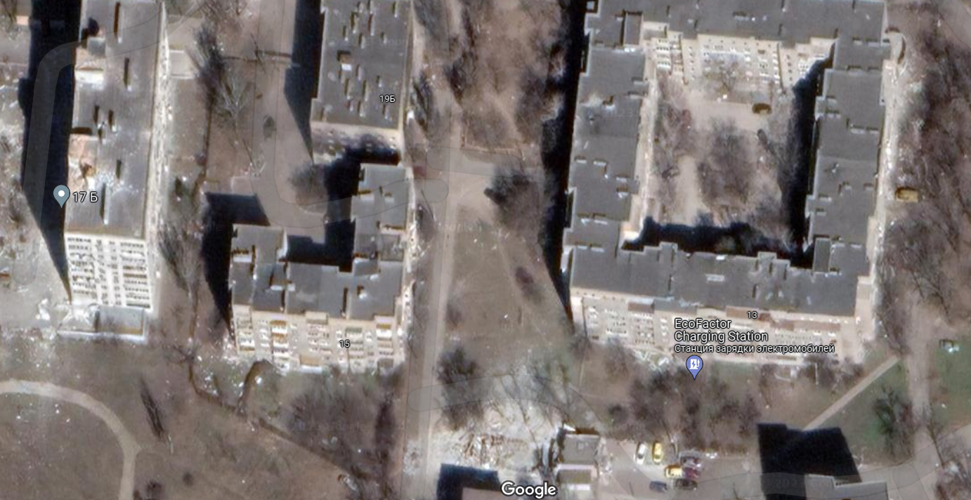
Some of the multi-storey buildings look completely intact from the outside. However, if you zoom in as much as possible, it becomes clear that in fact they are surrounded by numerous debris. And the cars in the yards look abandoned.
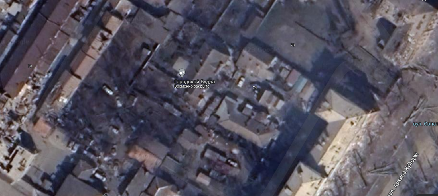
The placemarks on the map work and some of them would look funny if not for the circumstances. It is difficult to say what kind of organization is designated as the “Urban Buddha”, but it does not work. And the reason is clearly visible on Google Maps. The area around it is badly destroyed and completely burned out.
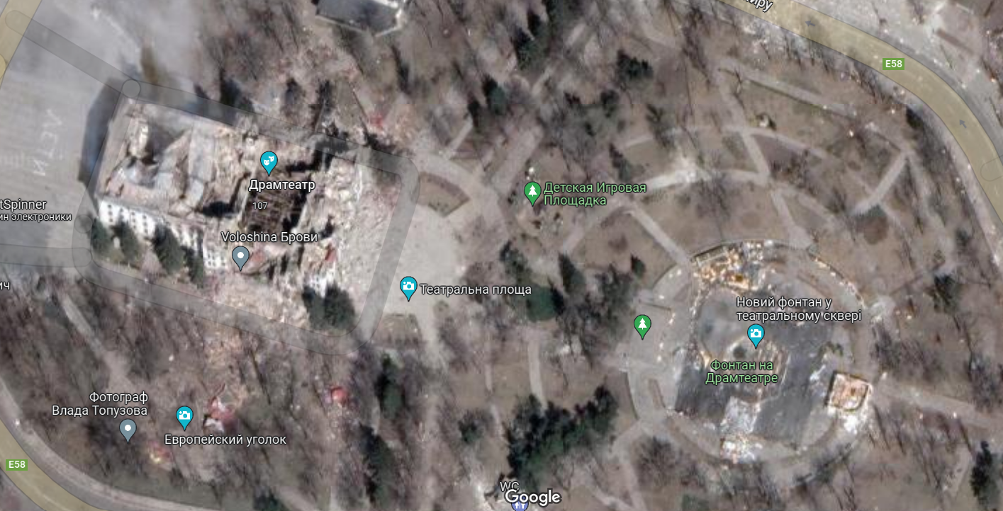
The Drama Theater in Mariupol in the pictures looks the way the world remembers it. The inscription “ДЕТИ” (CHILDREN) is clearly visible. It did not prevent the Russians from dropping a bomb on it, the consequences of which are also clearly visible on satellite images. Now the occupiers have surrounded the ruins with a screen and are quickly trying to hide the traces of their crimes.
The square next to the theater looks no less eloquent. Relatively recently, it underwent reconstruction and a fountain was built in it. In the photo in Google Maps, it is littered with some debris and looks like a landfill.
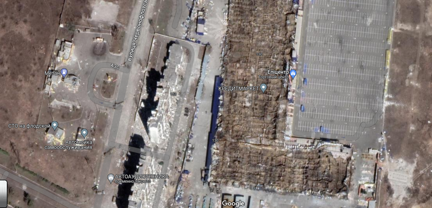
Closer to the western outskirts of the city near the residential area there was a giant supermarket “Epicentr”. The pictures clearly show that it burned down to the ground, and its roof collapsed. The multi-storey buildings next to it look noticeably damaged.
Mariupol is the sea
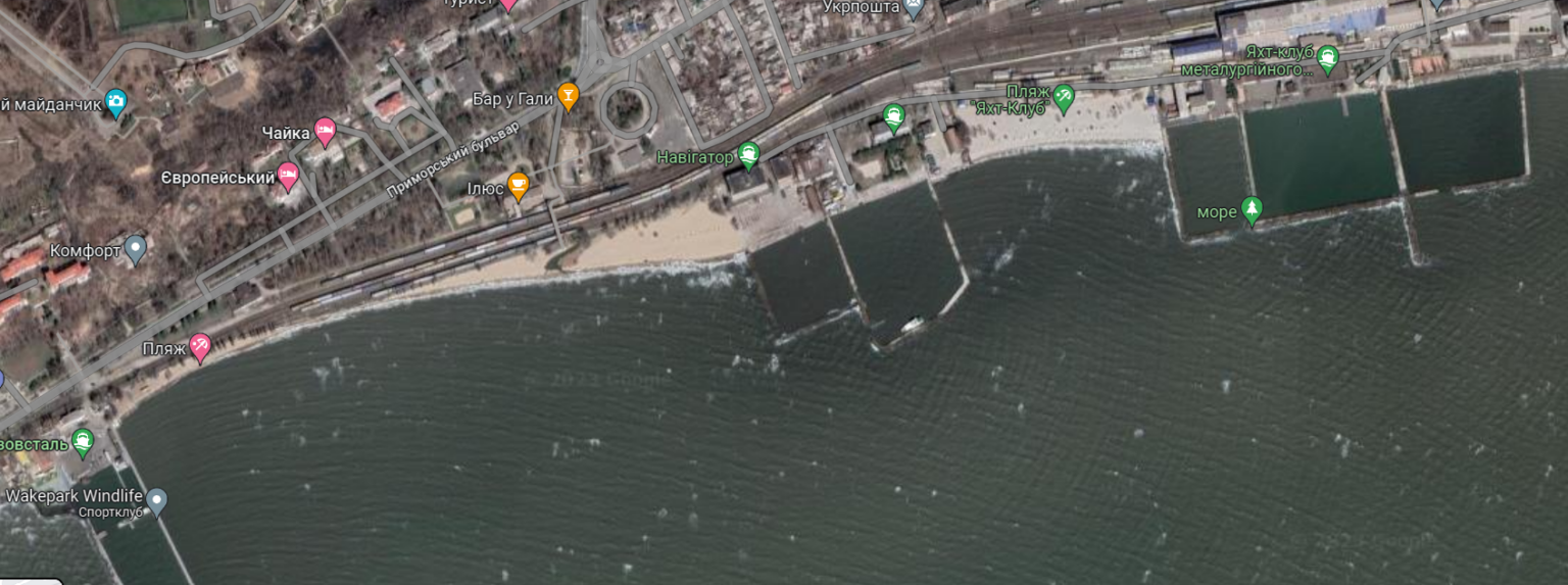
Do not forget that Mariupol is the largest Ukrainian city on the coast of the Sea of Azov. And before the large-scale invasion, it was famous as a resort, a yachting center and a seaport. However, satellite photos show that now it has nothing to brag about in this regard.
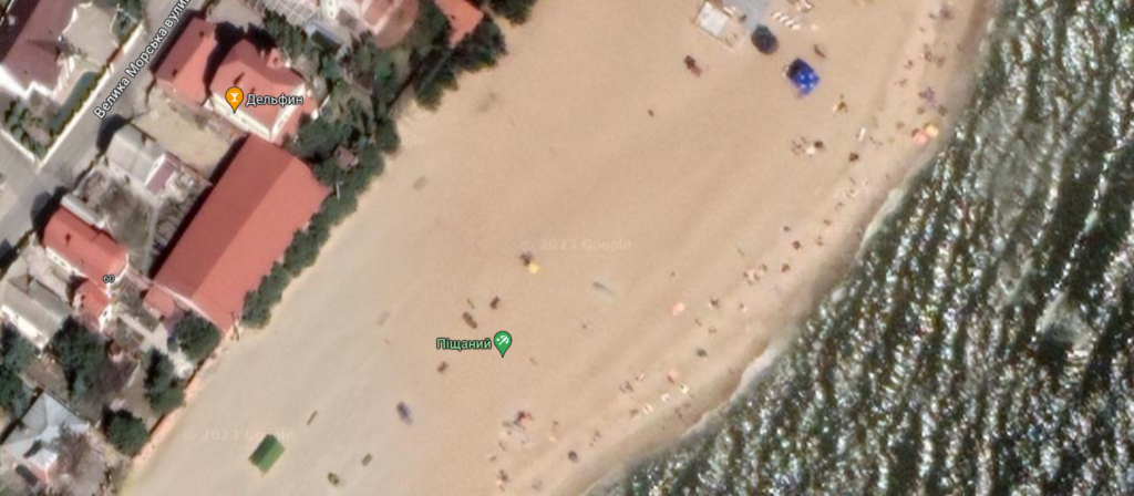
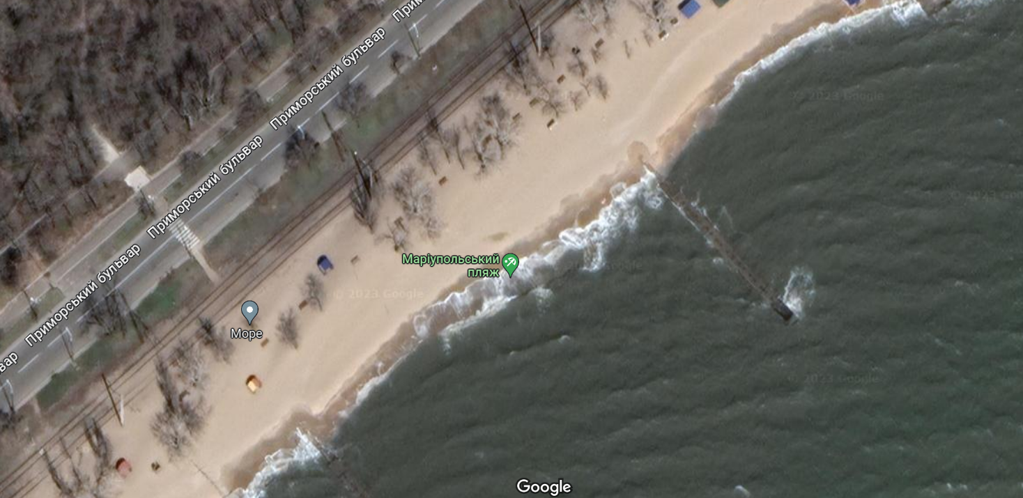
For example, urban beaches and the infrastructure around them do not look war-torn. However, there are either extremely few people on them, or they are not visible at all. Of course, we can say that they are made when it is too cold, but green trees make us doubt this.
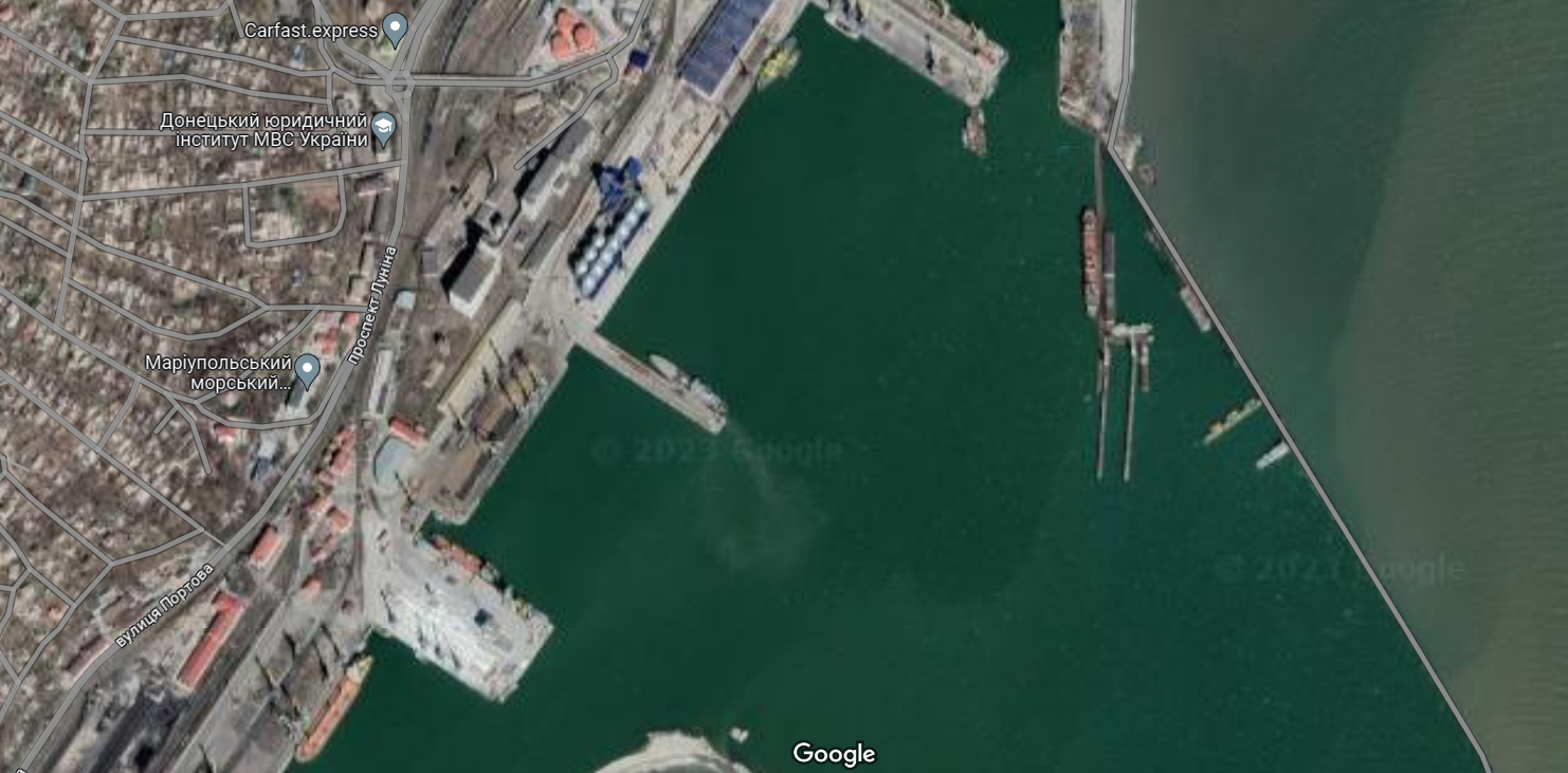
The seaport in the city of Mariupol in the pictures in Google Maps boasts several large ships standing at the piers. But this is clearly not the amount for which this transport hub is designed; grain and steel were exported through it before the invasion.
But the piers for yachts in Mariupol in the pictures are almost completely empty. Only one boat is visible. It’s hard to say what has happened to them. Perhaps they were taken by the occupiers, or perhaps they simply burned down as a result of the fighting.
People in Mariupol
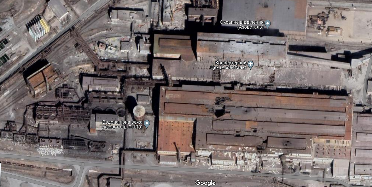
In Google Maps, you can properly see the most famous object in Mariupol — the Azovstal Metallurgical Combine. It was there that the last Ukrainian defenders held the defense. Giant holes in the roofs of the workshops allow us to assess what hellish conditions they had to be in.
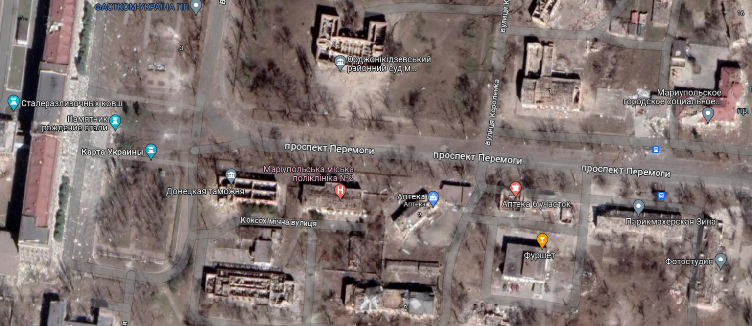
No less eloquent are the pictures of houses in front of the main entrance to the complex of the combine. Many peaceful administrative buildings were located here: customs, court, polyclinic, social services. All of them in the Google Maps images are badly destroyed.
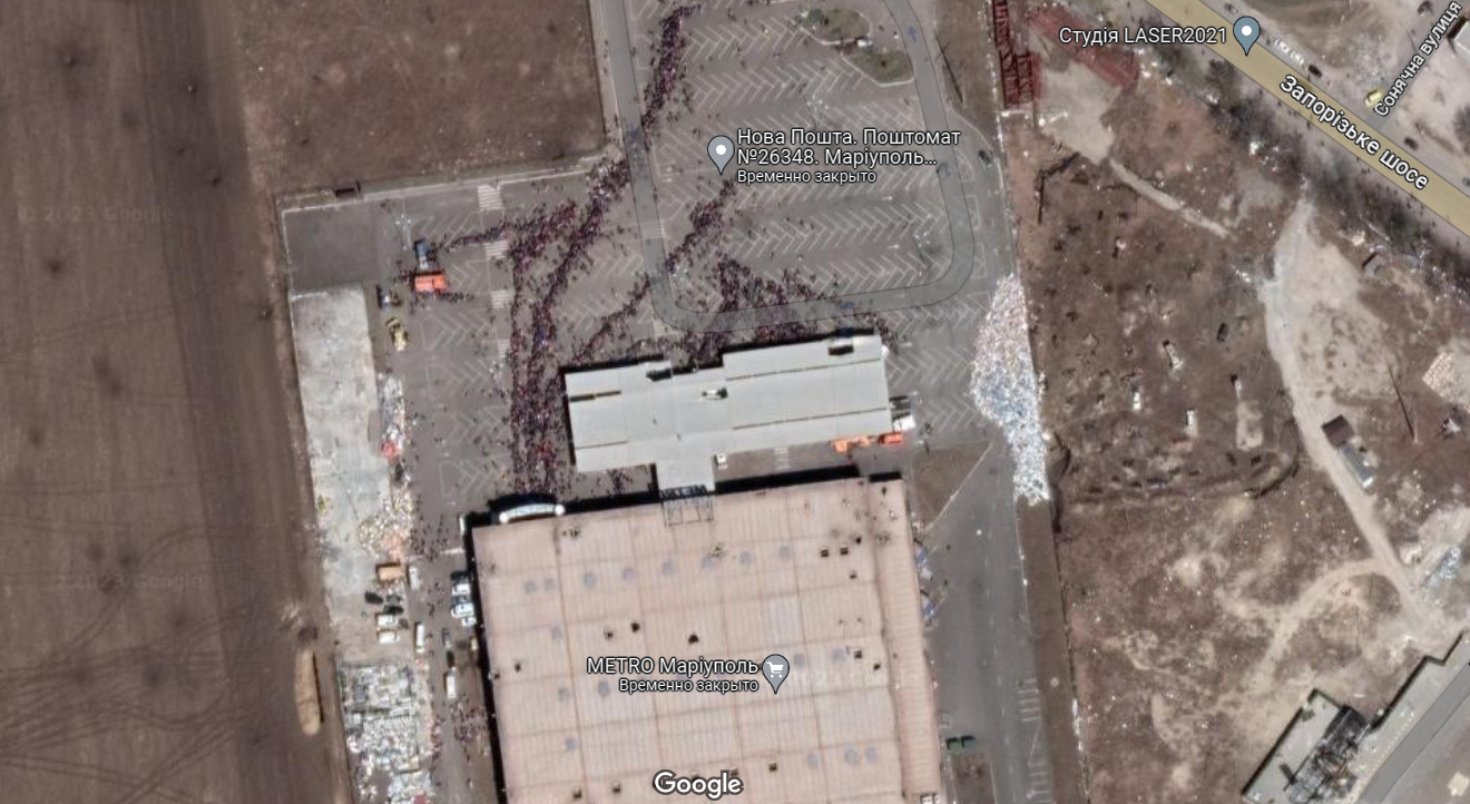
Looking at satellite images of Mariupol, you can pay attention to the fact that there are practically no people and cars on its streets. But there is one place where there are so many people that it is difficult not to notice them even from orbit.
This is a parking lot in front of another large city supermarket — METRO. It was here that the distribution of humanitarian aid to residents took place. And perhaps these long queues for food are the best evidence of how people live in the occupation.
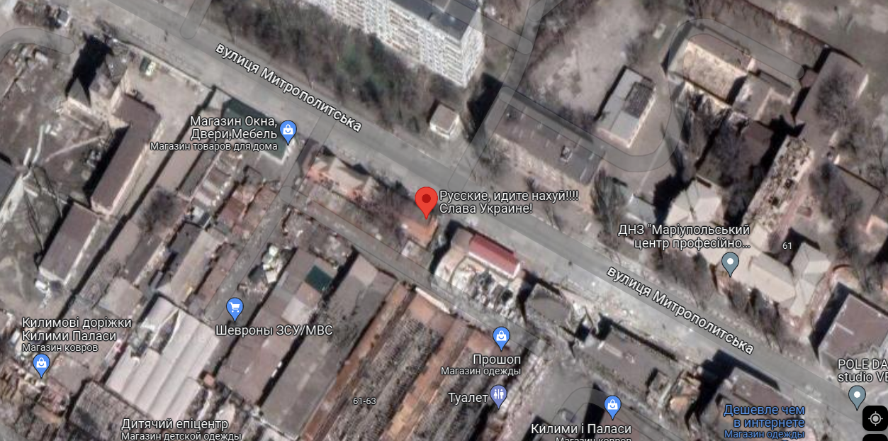
In general, Mariupol on Google Maps creates an extremely depressing impression. However, many marks remind that this city is still Ukraine. And the best illustration of this can be the way a small commission shop on Mytropolytska Street is designated.
Follow us on Twitter to get the most interesting space news in time
https://twitter.com/ust_magazine
