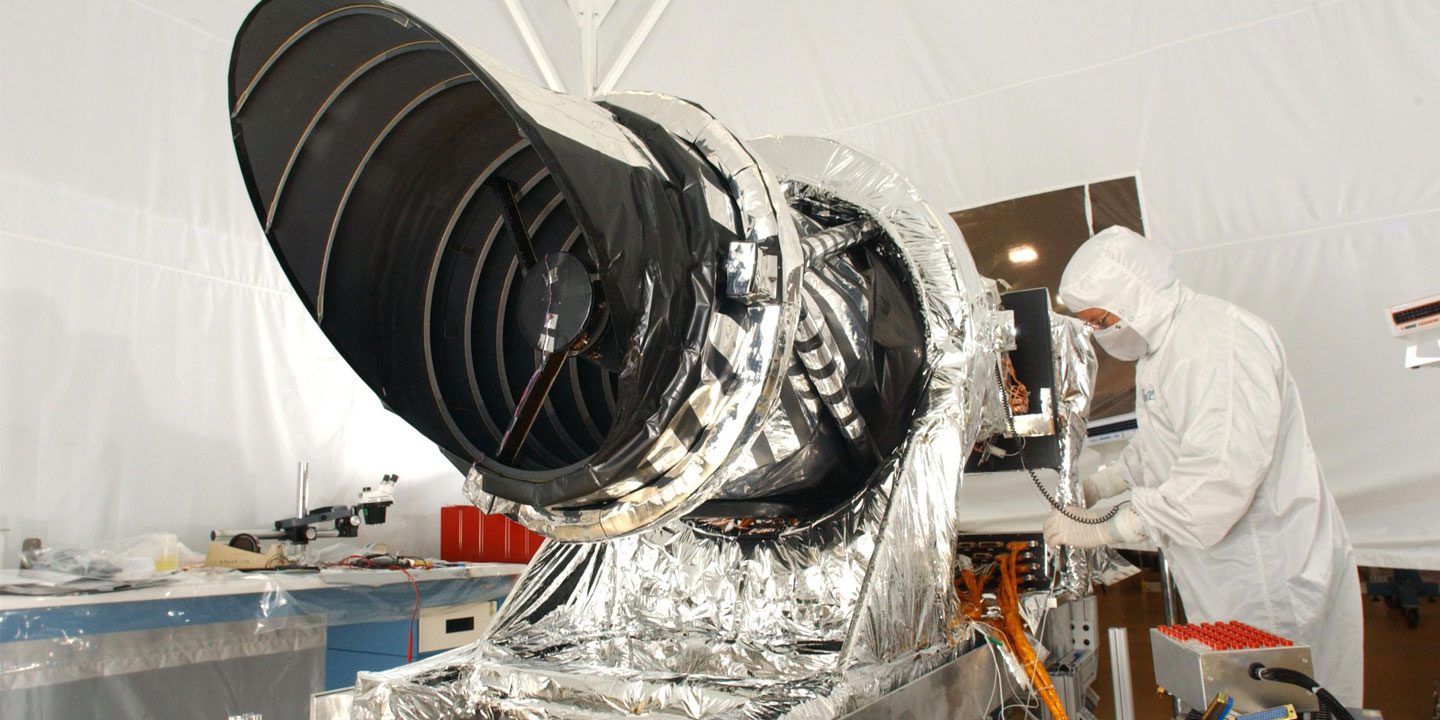
The HiRISE (High Resolution Imaging Science Experiment) camera on board the Mars Reconnaissance Orbiter sent an exciting photo of the surface of Mars. The photo shows the Danielson Crater, north to the equator of the planet. This area is of great interest to space geologists because of the stratified deposits lining the crater.
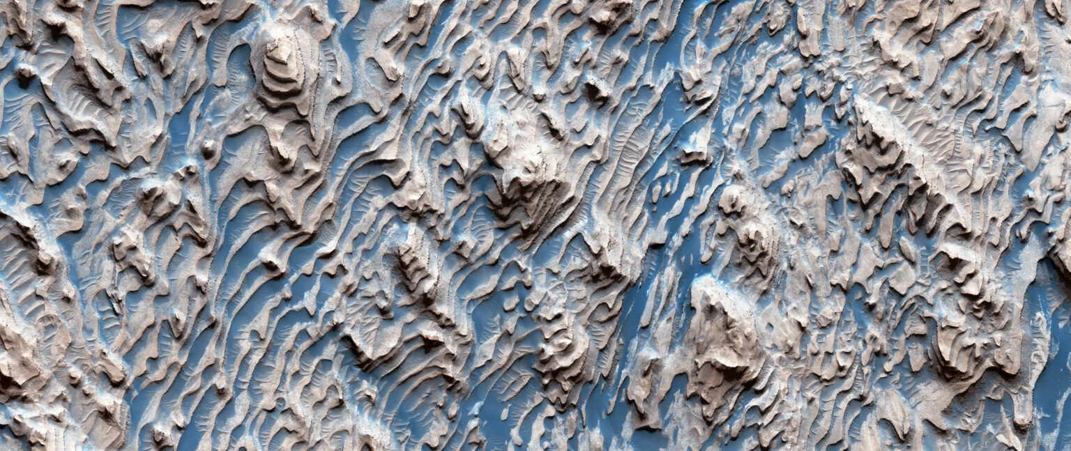
Stratified deposits can be found all over Mars. But the Danielson Crater contains some of the most impressive and best preserved. Even more interesting is that they resemble terraces with different levels of erosion. Stronger layers form ladders, and weaker matters are in the middle of it. The evenness of all the layers means that they could not be created by random processes like collisions. Scientists think that the layers were deposited as a result of processes that were regularly repeated in the past.
“Cyclical changes in the properties of deposits made some layers more resistant to erosion than others. Because of eons of time, these stronger layers came out like steps. Winds blow sand along these steps, which leads to the appearance of patterns similar to zebra stripes”, NASA explains.
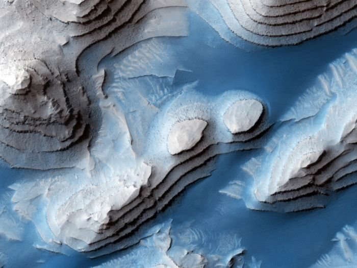
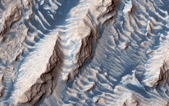
Areas of rocks covered with cracks were found when zooming in the photo. Scientists studied these faults and determined that since the pieces fit perfectly together, this happened after the sediments had already become rock. However, it remains unclear how the deposits were formed.
Some scientists have suggested that the periodic process could be the result of climate changes associated with variations in the orbit of Mars. Another study suggests that the cause may be the rise of groundwater. Meanwhile, orbiters with high-quality cameras, like HiRISE, are helping to discover the fascinating history of Mars.