The researcher used open satellite data to establish what damage Russia’s invasion caused to Ukrainian forests. In particular, he found that during the summer, the Svyati Hory National Park received severe damage, and the Kinburn Spit remained relatively intact.
OSINT and Ukrainian forests
Researchers from all over the world continue to study the damage caused to Ukraine by Russia’s large-scale invasion. Earlier, NASA has already published data on the impact of the destruction of the Kakhovka hydroelectric dam on agriculture in the Kherson region and Zaporizhzhia. Now it’s the turn of the forests. A study by OSINT reporter Christopher Giles, published recently on the Bellingcat website, is devoted to their condition.
Its start was the fact that in September 2022, Ukrainian scientists tried for the first time to assess the damage to nature from the invasion, but it was impossible to get to many places because of the ongoing hostilities there. Meanwhile, open sources showed numerous foci that arose as a result of the fighting.
How to assess the state of Ukrainian forests using satellite data
Therefore, Giles decided to use the OSINT Forest Area Tracker tool. It uses a collection of Sentinel-2 satellite images. They provide data in the near-infrared and short-wave infrared ranges. They best reflect the radiation of the leaves.
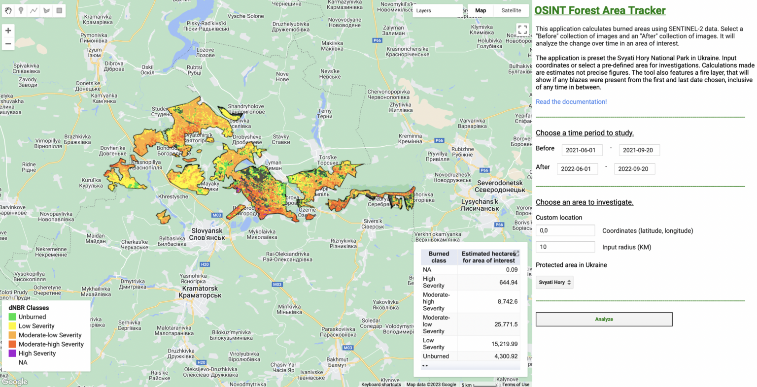
Based on these data, the tool generates a normalized ratio of fires — a kind of averaged parameter that allows scientists to assess how much the forest has suffered from fire. The researcher decided to use it to assess the damage caused by the fighting.
However, it is necessary to take into account a number of other factors. For example, the fact that fires and deforestation occur in peacetime, as well as the fact that there are much fewer leaves in winter than in summer.
Therefore, the researcher took data for the same periods of the year before and after the invasion and, based on them, determined how much the forests were affected. In addition, he was primarily interested in nature conservation areas, which at the same time are not gardens and city parks. Simply put, we are talking about protected forests.
Forests in the Svyati Hory
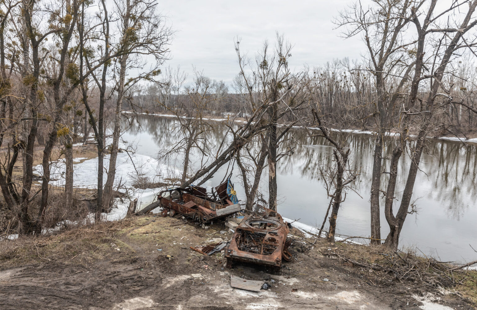
The first object that Giles explored was the Svyati Hory National Park and the forests surrounding it. This environmental protection facility is located in the north of Donetsk region along the Siverskyi Donets river. The nearest major settlements are Slovyansk and Lyman. And fierce battles were fought for this territory throughout the spring and summer.
This area is characterized by a complex landscape, because limestone deposits come to the surface here, which form fairly high and steep hills, where the river forms entire canyons. To investigate how these protected areas were affected by the war, Giles compared data from June 1 to September 20, 2021, with the same period in 2022.
The comparison showed that the forests underwent very strong and catastrophic changes, mainly in the floodplain of the Siverskyi Donets, exactly where there were fierce battles. In other territories, the normalized ratio of fires shows damage rather average and above average. At the same time, there are practically no areas where the damage would be completely invisible.
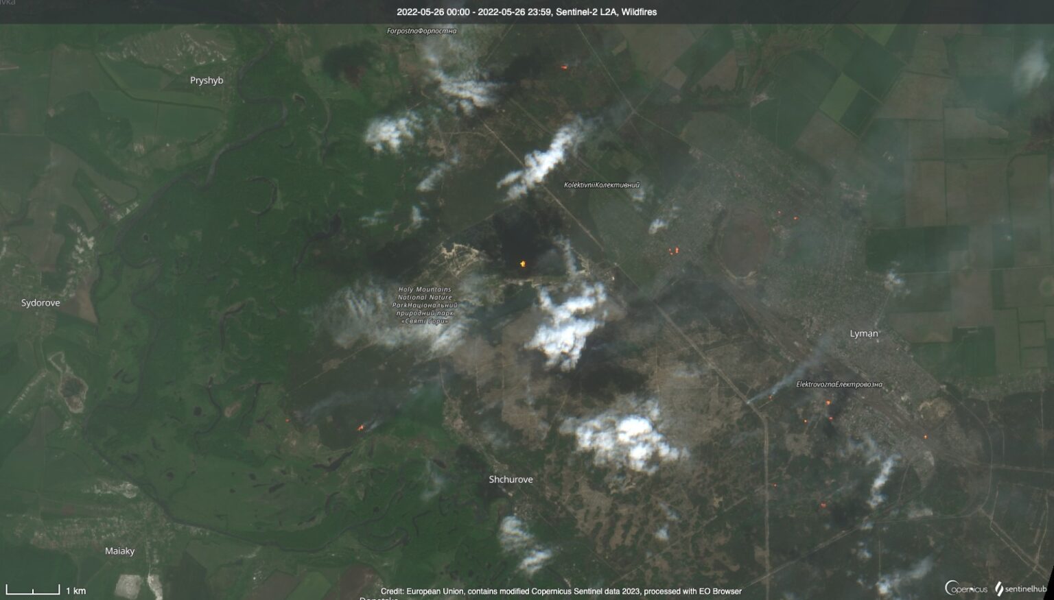
To understand the situation in more detail, the researcher took the data obtained in April 2022 and compared them with June of the same year. The result shows minor changes during this period in the Donets floodplain, but quite large in the national park. This is in good agreement with the numerous reports of fires as a result of shelling that were received in May 2022.
Kinburn Spit
Another important facility that Giles explored on the territory of Ukraine was the Kinburn Spit. This elongated peninsula in the Kherson region separates the Dnieper Estuary from Mykolaiv. It is of great importance both from the point of view of military strategy and from the point of view of the ecology of the Black Sea region.
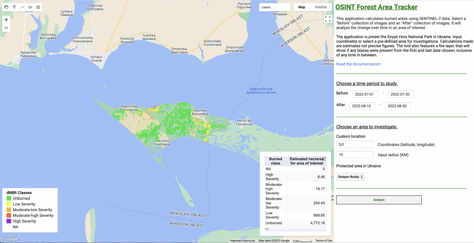
Giles applied the same technique to it. This time, the source of information about what to pay attention to was the Eyes On Russia group, which tracks the destruction caused by Russia. Almost all summer they reported on the shelling of the Kinburn Spit, and the presence of fires in this area was confirmed by satellite images.
Giles compared the data for June 2022 with August of the same year. They showed that the majority of the spit’s territory remained rather poorly damaged, although in some areas the damage was catastrophic.
According to www.bellingcat.com.
Follow us on Twitter to get the most interesting space news in time
https://twitter.com/ust_magazine
