
ESA has published a new image obtained by the Mars Express spacecraft. The centerpiece of the image is an amazing feature: a dark uneven “scar” cutting through the terrain at the foot of a giant volcano.
“Snake” at the foot of the supervolcano
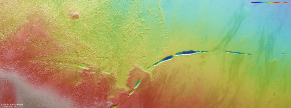
This “scar” is known as Aganippe Fossa. Its length is about 600 kilometers. It is a graben — a lowered area relative to the surrounding terrain with steep walls on either side.
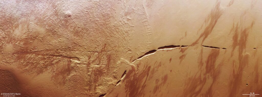
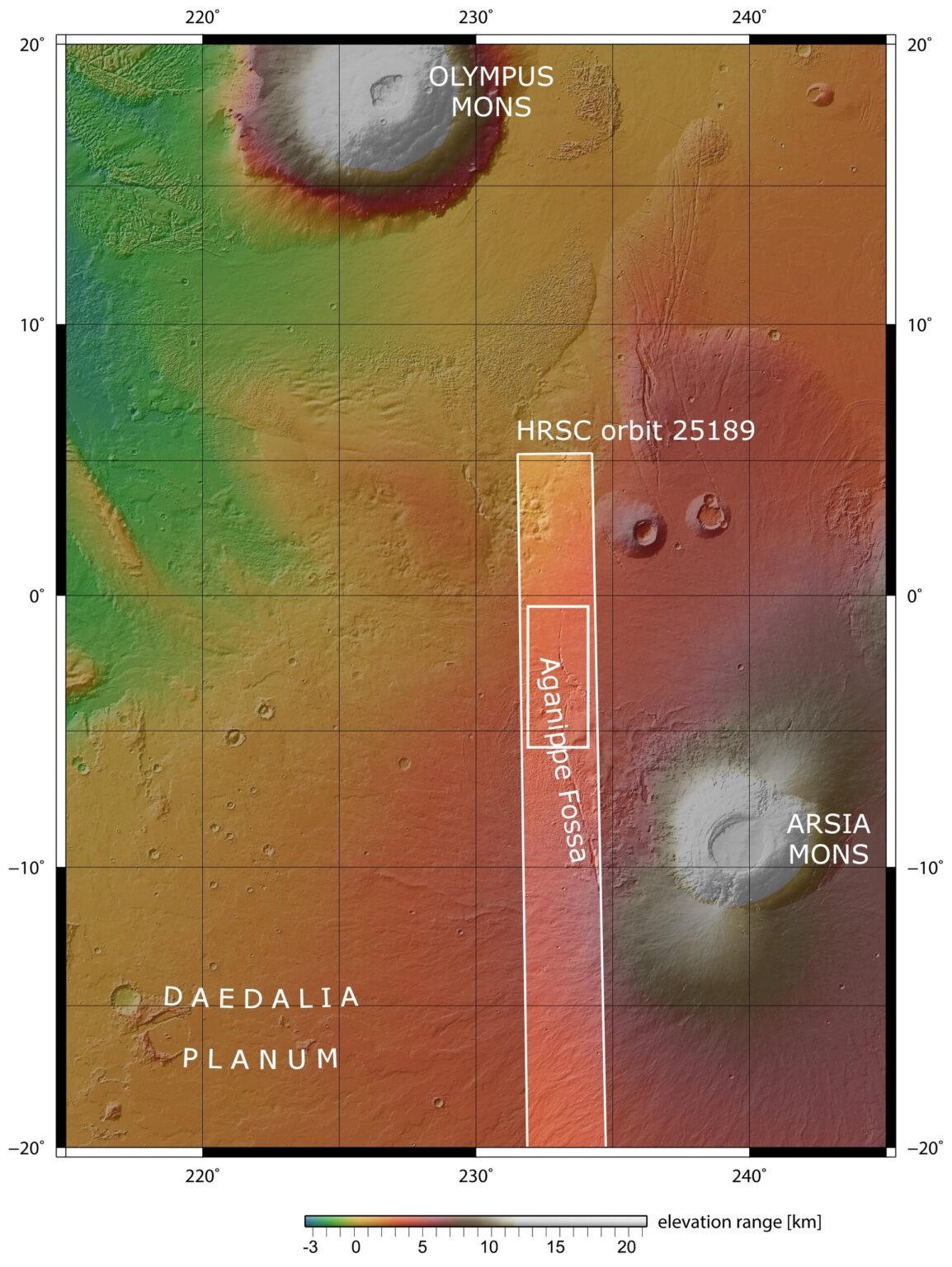
Aganippe Fossa crosses the foot of one of the largest volcanoes on Mars, Arsia Mons. It is located in the region of the Tharsis: a vast highland that is home to the Red Planet’s largest supervolcanoes.
Arsia Mons has a base diameter of 435 km and rises above the surrounding plains by more than 9 km. And if measurements are made relative to the zero altitude of Mars, it will be 19 km. In comparison, the highest dormant volcano on Earth, Ojos del Salado (it is located on the border of Argentina and Chile) reaches a height of less than 7 kilometers.
Seeping lava
Scientists still don’t know how and when the Aganippe Fossa originated. But it seemed likely that it was formed when magma beneath the colossal mass of volcanoes in the Tharsis caused the crust of Mars to stretch and crack.
The Mars Express image captures two different types of terrain: so-called hummocky terrain, consisting of many irregularly shaped hills and valleys clustered together, and lobate terrain, consisting of gentle cliffs and rocky debris.
These reliefs are characteristic of the ring-shaped “aureole” of Arsia Mons, a 100,000 km2 disk around the base of the volcano, possibly associated with ancient glaciers. Interestingly, the aureole only formed on the northwestern flank of the volcano, probably because prevailing winds from the opposite direction influenced where the ice settled over time.
Wind-blown dust and sand has also impacted this region of Mars, creating interesting zebra-like patterns. They occurred when dark material was deposited on lighter colored soil and vice versa. The surface also shows traces of lava flows formed during volcanic activity.
Earlier we told you about how the Mars Express photographed the “inhabitants” of Inca City.
According to ESA
