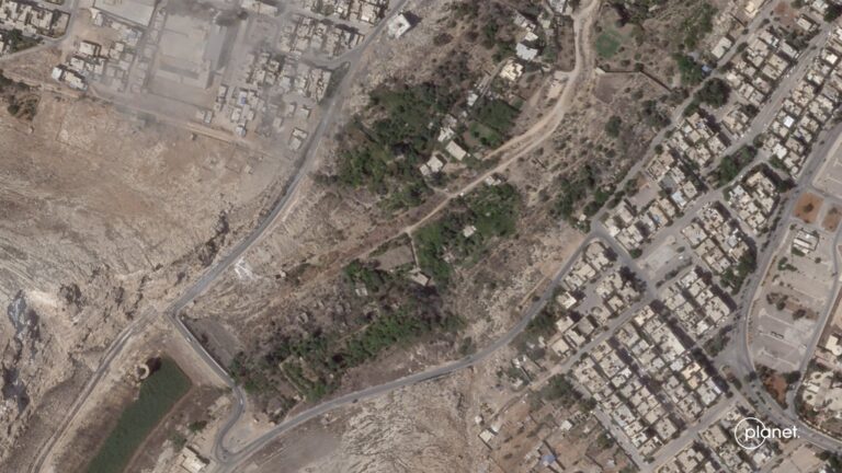
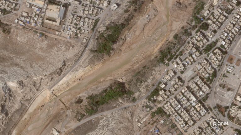
Planet has published a number of satellite images of the city of Derna in Libya. They demonstrate the scale of the destruction caused by the recent flooding.
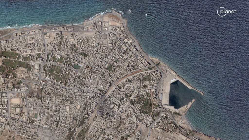
On September 10, Hurricane Daniel hit the coast of Libya, which had previously caused record flooding in Greece. The main blow fell on the port city of Derna, located in the east of the country. Heavy rains led to the breakthrough of two dams, which led to the release of about 30 million cubic meters of water.
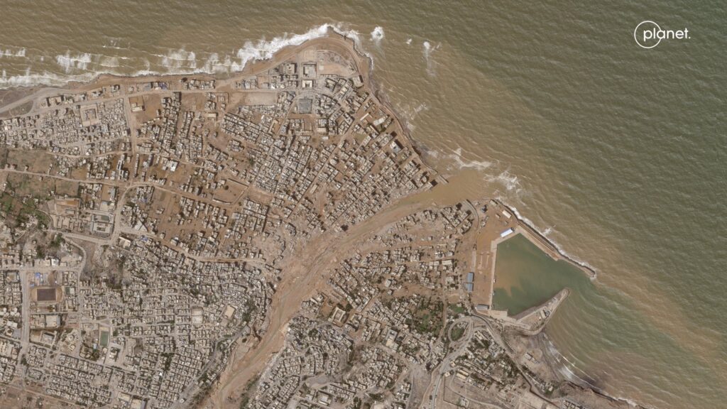
The satellite images of the Planet company were taken on September 2 and 12. They allow us to assess the scale of the destruction. According to representatives of local authorities, a quarter of the Derna has practically disappeared. The water literally washed entire residential neighborhoods into the sea.
The exact number of victims is still unknown. According to recent estimates, the disaster claimed the lives of two to five thousand people. At least 10 thousand more are still missing.
Earlier we talked about how the Meteosat satellite captured the Earth’s thunderstorm activity.
Follow us on Twitter to get the most interesting space news in time
https://twitter.com/ust_magazine
