Meteorological satellites are monitoring the rare Hurricane Daniel raging over the Mediterranean region. It has already caused significant flooding in Greece and Libya. The spacecraft received stunning images of it.
Mediterranean hurricane
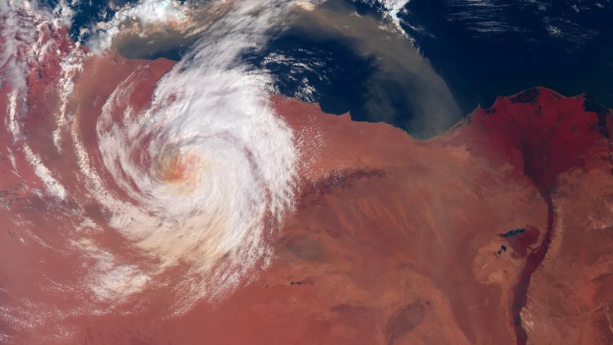
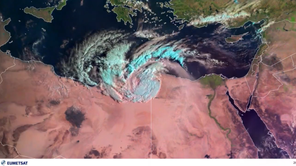
Hurricanes can also form over the Mediterranean Sea, and one of them is raging over North Africa right now. We are talking about Storm Daniel, stunning photos of which were recently taken by the Sentinel-3 surface observation satellite and the Meteosat 11 meteorological apparatus.
Hurricane Daniel formed on September 4 over Greece. There, it only caused the same amount of precipitation in the first 24 hours of its existence as in the previous 18 months. Then it began to move to the southeast, drawing energy from the heated waters of the Mediterranean Sea.
It was a complete surprise for Libya, located on the northern coast of the Mediterranean Sea. According to estimates of the meteorological services of the country on Sunday, September 10, Daniel reached the peak of its power. The wind speed in it ranged from 70 to 80 km/h.
On this day, a new precipitation record was set in Libya. During the day, 414 mm fell out there. It is reported that two dams collapsed near the city of Derna due to rains. Thousands of people died as a result.
Mediterranean hurricanes may become more powerful
Usually, when hurricanes are mentioned, we are talking about systematically destroying the east coast of the United States and the Caribbean. However, the Mediterranean Sea may well generate storms that are quite equal in strength to their Atlantic ones. However, there are only from 1 to 3 of them per year and they are formed mainly over the western part of the region.
However, this time the hurricane even reached the arid northern regions of the Sahara, as confirmed by a satellite photo of a colossal vortex with a characteristic orange color. The reason for this is climate change. It is very difficult to doubt its reality after July 2023 became the hottest month in the history of observations.
According to experts, climate change will lead not only to an increase in heat, but also to the fact that storms will become angrier. Oddly enough that in the case of Mediterranean hurricanes, this may lead to a decrease in their number. However, the strength of each individual will increase and it will be able to do much more harm.
According to www.space.com
Follow us on Twitter to get the most interesting space news in time
https://twitter.com/ust_magazine
