The European Space Agency (ESA) has published a new mineralogical map of Mars. It demonstrates the location of deposits of clay and salts of aquatic origin.
Minerals of water origin
On Earth, the interaction of water with various rocks leads to the formation of various types of minerals. For example, substances such as smectite and vermiculite are formed with the participation of a relatively small amount of water and basically retain the same chemical elements as the original volcanic rocks. When there is a lot of water, rocks can be changed more. Soluble elements are carried away, leaving behind aluminum-rich clays — for example, kaolin.

In this respect, Mars is no different from Earth. When in the distant past it had a full hydrosphere, water actively interacted with rocks, leaving a number of sedimentary deposits. Ten years ago, planetary scientists knew about a thousand sites covered with minerals of aquatic origin. However, a new mineralogical map of the Red Planet, published in a recent issue of the journal Icarus, can change the perception of its past. It contains information about hundreds of thousands of areas with hydrated minerals located in various locations.
Traces of Martian water
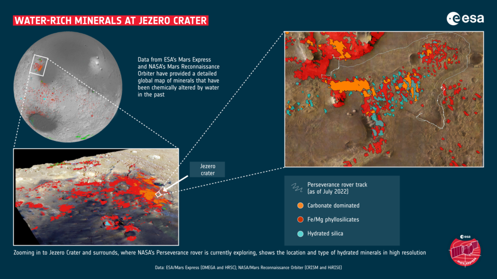
The map was created based on data collected by OMEGA and CRISM spectrometers installed on Mars Express and MRO devices. These tools are ideal for a similar task. CRISM has the ability to obtain detailed images of the surface with a resolution of up to 15 m/pixel, while OMEGA is able to make global images of Mars.
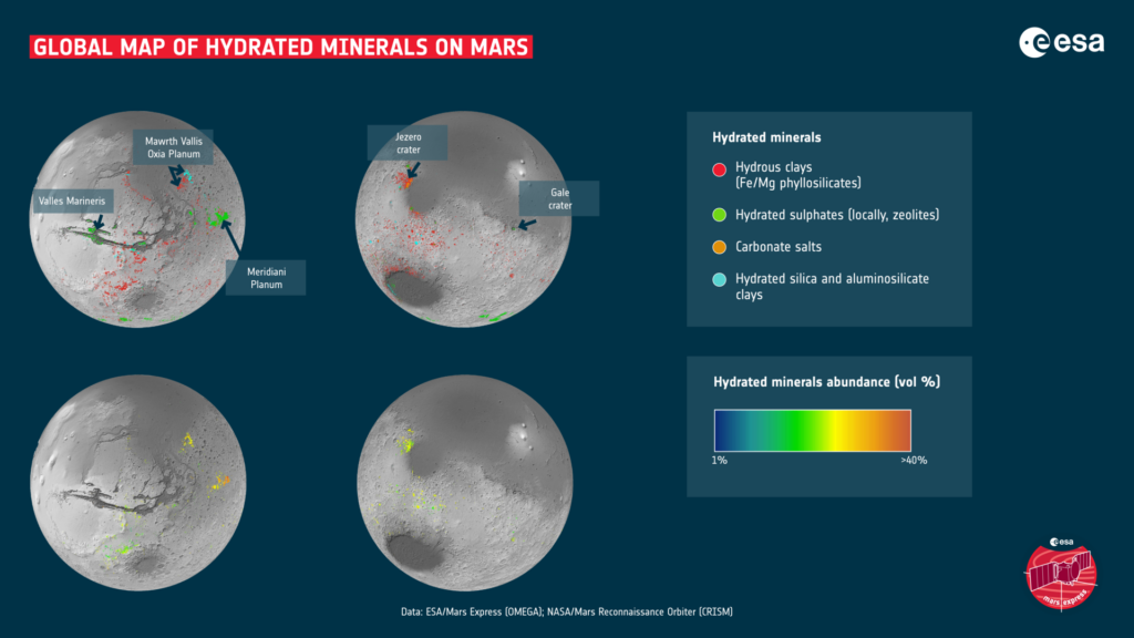
The new map clearly demonstrates that in the past, water played an important role in the mineralogy of the Red Planet, actively interacting with its surface. This is evidenced by numerous deposits of clays, salts and other hydrated minerals.
Previously, scientists believed that only a few types of clays appeared on Mars during the wet period, and then, when the water gradually dried up, salts formed all over the planet. However, judging by the new map, this process was much more complicated. It demonstrates the mixing of salts and clays, as well as areas where salt is presumably older than clays. This suggests that the Martian water disappeared not at once, but during a long process.
According to scientists, the map allows planners of future missions to choose the most suitable places for the landing of manned expeditions. Hydrated minerals still contain water. It can be extracted and used for drinking, obtaining oxygen and rocket fuel components.

If we talk about short-range missions, then clay-rich places are considered the best candidates for searching for traces of potential Martian life. That is why ESA chose the Oxia Plateau as the landing site of the Rosalind Franklin rover.
According to https://www.esa.int
Follow us on Twitter to get the most interesting space news in time
https://twitter.com/ust_magazine
