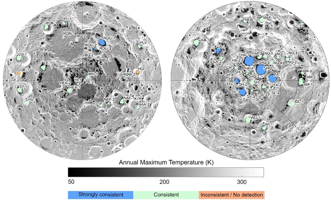
The experts from the LRO mission have published several maps showing potential locations of water ice deposits as well as the most favorable areas for manned expeditions.
The south pole of the Moon has gained significant attention from both space agencies and private companies. This is because certain polar craters contain deposits of water ice at their bottoms, which are permanently in shadow,. These deposits could greatly facilitate the establishment of permanent settlements by providing water for drinking, oxygen for breathing, and components for rocket fuel.
However, the situation is not straightforward. Even with data indicating the presence of water ice and other volatile substances in the crater bottoms, scientists cannot be certain about their quantity, exact locations, and depth. Another part of the problem lies in accessing these deposits. This means that engineers need to find relatively flat landing sites near them that receive sufficient sunlight for energy generation and are within direct line of sight from Earth to maintain radio communication.
To address this issue, the LRO mission experts have prepared several maps. The first map demonstrates the resource potential of the Moon’s north and south poles.
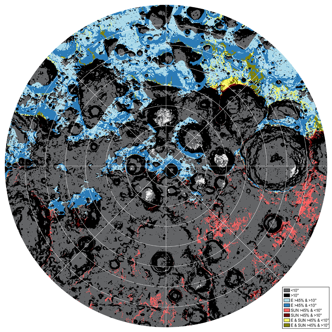
The second map is entirely dedicated to the southern polar region of the Moon. It allows for the assessment of the suitability of different areas for manned landings. The modeling was done for the expected period of the Artemis III mission, from July 9, 2024, to June 11, 2025. Ideal surface activity conditions (slope <10° and >45% sunlight (SUN) and direct line of sight to Earth (E)) are marked in light yellow. Areas indicating potential surface water ice are shown in light pink. The map has a resolution of 500 m per pixel.
It is also worth noting that the south pole of the Moon is currently being studied by the South Korean spacecraft Danuri. The camera onboard the spacecraft, called ShadowCam, has 200 times greater light sensitivity than the famous LROC camera on the LRO probe. Scientists are using it to capture images of craters within the eternal shadow zone in order to map their floors and search for exposed water ice deposits.
Source: https://www.lroc.asu.edu
