Launching satellites often opens up new perspectives. The new satellite, created by a consortium of European companies and agencies, allows us to take a fresh look at one of the most powerful and fleeting natural phenomena – lightning.
The Meteostat Third Generation (MTG) satellite was launched back in December, and actually contains not one, but two new imaging tools. The flexible combined thermal imager creates crystal clear images that can be combined into impressive videos — the first of them were released in April.
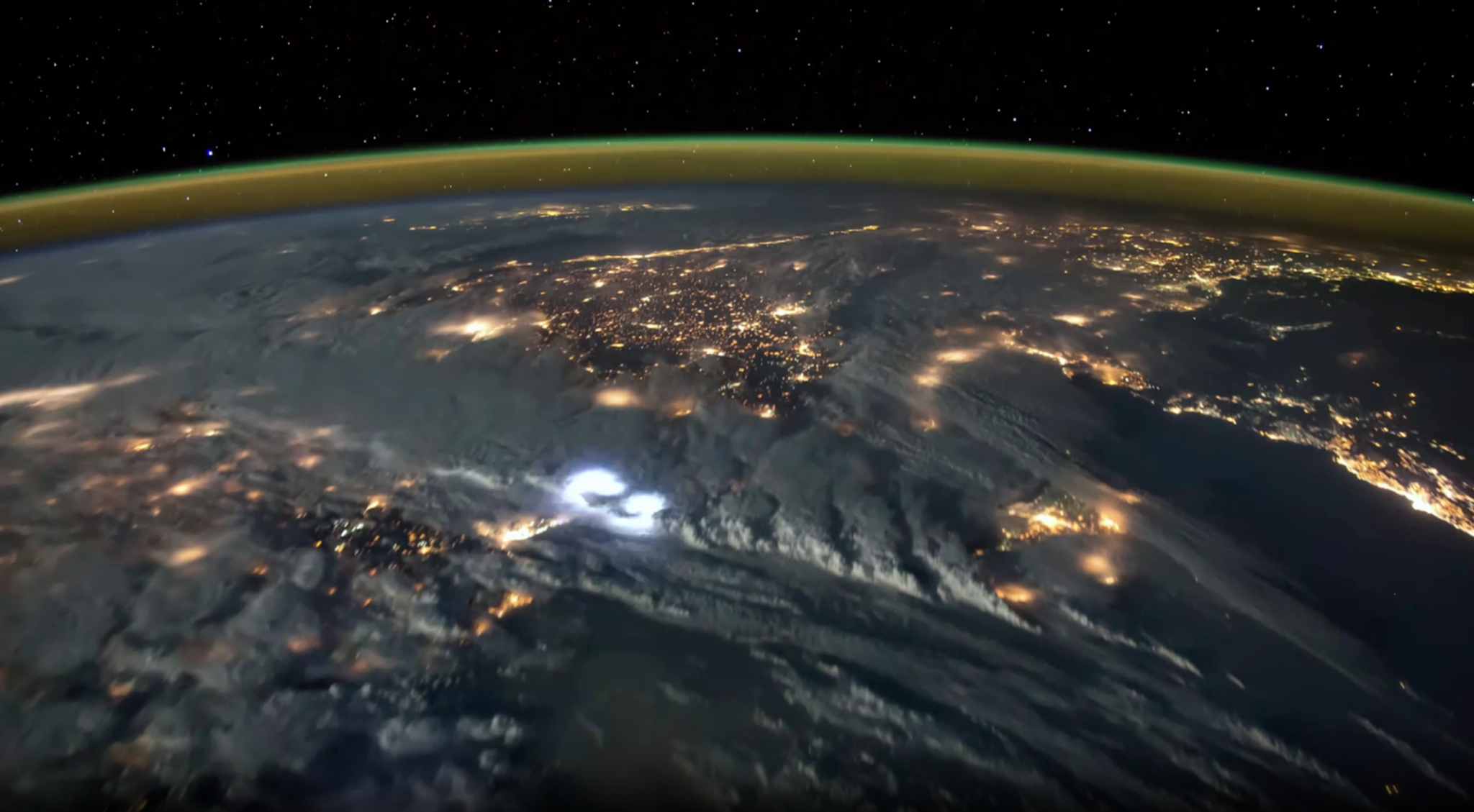
But recently, the team of ESA and the European Organization for the Exploitation of Meteorological Satellites (Eumetsat) published a series of images from another MTG – Lightning sensor. The results include impressive freeze frames, which are then combined into an even more impressive video.
The thermal imager consists of four different cameras. Together they cover Europe, Africa, the Middle East and part of South America from an altitude of about 36 thousand km. Thus, more than 84% of the earth’s surface is covered from the side to which it is turned. Each camera can take 1000 pictures per second, which allows to see even the shortest flashes of lightning.
The magic really happens when MTG combines data from Lightning with data from a flexible combined thermal imager. Thanks to these two powerful tools, it is possible to create really impressive images. But besides the fact that these data are just pleasant to view, they can also be used for both scientific and meteorological purposes. It is now much easier to track storms and warn regions that may be threatened by bad weather. Over time, these weather models will also become clearer, which will allow meteorologists to more accurately predict the development of thunderstorms.
But for now, this is just the beginning of MTG’s journey. Even though it is releasing these impressive images, technically it is still at the commissioning stage. Full deployment is planned in early 2024. And even more impressively, it is planned to work for more than 20 years, providing this data on severe storms and weather conditions.
Earlier, we reported on how ESA was preparing to take the weather satellite out of orbit.
Follow us on Twitter to get the most interesting space news in time
https://twitter.com/ust_magazine
