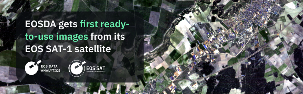
EOS Data Analytics (EOSDA), a global provider of AI-powered satellite imagery analytics founded by Dr. Max Polyakov, processed the first commercial images from EOS SAT-1, the initial satellite of the company’s EOS SAT constellation launched into a low Earth orbit by SpaceX’s Falcon 9 rocket on January 3, 2023.
EOS SAT is a constellation comprising seven small optical satellites designed to support the implementation of sustainable agriculture methods and forestland monitoring with high-quality data and analysis. After reaching full operation by 2025, the constellation will cover up to 100% of countries with the largest areas of farmlands and forestlands, amounting to 98.5% of such lands across the globe. The EOS SAT-1 satellite is a proprietary development of Max Polyakov’s Noosphere companies. The full-cycle operational process is established through the vertical integration of companies in the Noosphere ecosystem — EOS Data Analytics, Dragonfly Aerospace, SETS, Flight Control Propulsion.
EOS SAT-1 is a small optical agri-focused satellite that is able to monitor up to one million square kilometers daily using 11 agri-related bands.
Right after the launch, the EOSDA team successfully established stable communication with the satellite and started sending telemetry data to a ground station. The next task was to make sure that the onboard computer manages the data correctly both on the firmware and software levels. Finally, once all the tasks of the calibration and validation campaign were done and payload performance was commissioned, EOSDA obtained the first ready-to-use images provided by EOS SAT-1.
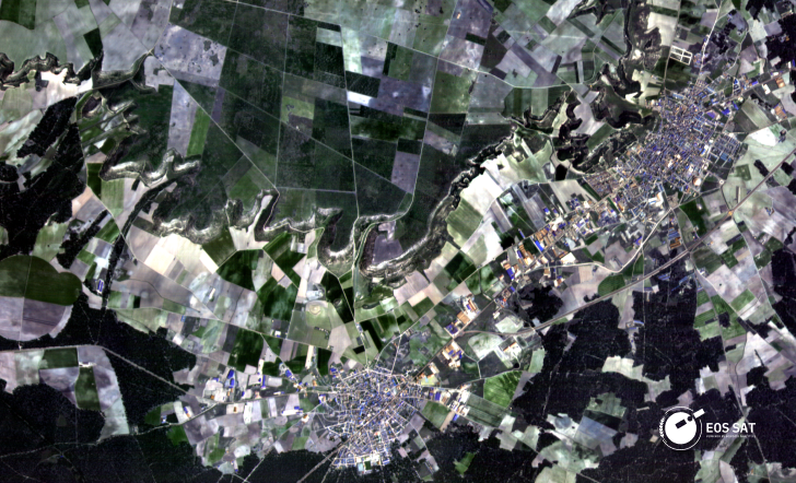
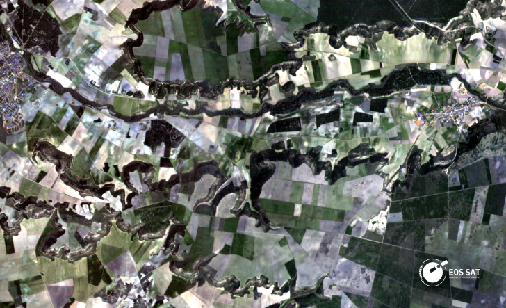

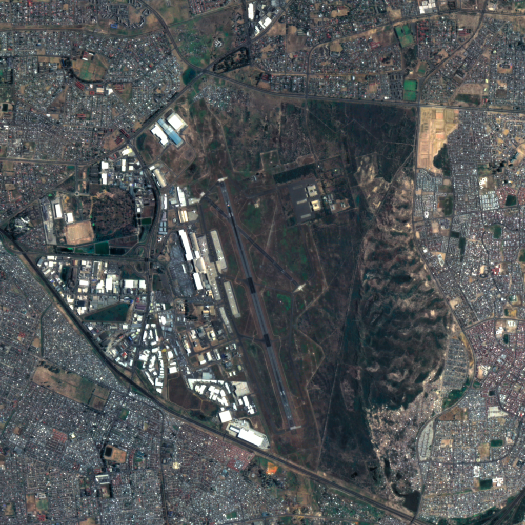
The first satellite’s pan-sharpened images have a resolution of 1.5 meters and cover a total area of 2,550 square kilometers in the Spanish province of Segovia. The images were processed within DEIMOS Ground Segment solution gs4EO.
Prior to receiving the first images, the EOSDA team made sure the satellite’s bus structures, optical modules, communication modules, and power systems along with subsystems like thermal, AOCS and OBDH payload are working properly and pass the necessary tests. More tests and checks are scheduled to be performed during the commissioning phase before the satellite data will be used in the EOSDA solutions.
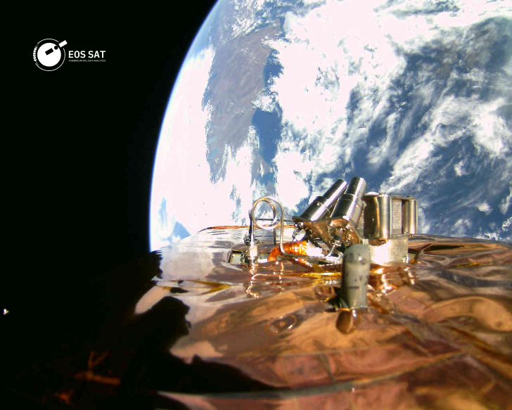
The images are obtained using two high-precision Dragon Eye cameras installed on the satellite and developed by Dragonfly Aerospace, which is also part of Max Polyakov’s Noosphere ecosystem.
„We are incredibly proud of EOS SAT-1’s performance and the quality of the images it has produced. As the world’s first agri-focused satellite, launching it was the culmination of everything that we’ve done at Dragonfly Aerospace to this point. Having been intimately involved in designing and manufacturing every subsystem of the satellite ourselves, we couldn’t be more proud to have created one of the top-performing satellites ever launched“, adds Bryan Dean, CEO of Dragonfly Aerospace.
The technical characteristics of the EOS SAT constellation allow addressing such issues of existing satellites as limited spectral capacities and low sensor resolution to help reach food security and advance with other pressing global challenges.
For reference
Max Polyakov — International space technology and IT business entrepreneur, investor, economist and philanthropist. Founder and owner of the Noosphere Ventures investment fund, as well as founder of Firefly Aerospace, EOS Data Analytics, SETS, Renatus, Maxpay and others. The ideological founder of the NGO “Noosphere Association”. Max Polyakov was born in Zaporizhia, Ukraine.
For his entrepreneurial activity, he received a number of awards: “Ernst & Young Entrepreneur of the Year” in 2009; Honorary Commander of the International Aviation Federation (FAI) in 2017; “Person of the Year in Ukraine” in 2019.
EOS Data Analytics (EOSDA) is a global artificial intelligence-based satellite image analytics provider founded by Max Polyakov. The company operates worldwide and cooperates with government, commercial and scientific organizations.
The company uses remote sensing technologies to make effective decisions in 22 industries, paying special attention to agriculture and forestry. EOSDA combines satellite data with artificial intelligence technologies and proprietary algorithms to analyze the state of crops and forest plantations, to support business and implement sustainable methods globally. EOSDA’s mission is to use the capabilities of satellite technology to provide enterprises with fast and accurate data-based solutions.
The main product of EOSDA in the agricultural industry is EOSDA Crop Monitoring, an online satellite field monitoring service that collects all important information about the state of crops in one place.
Dragonfly Aerospace is a leading supplier of optical equipment for Earth observation and satellite platforms. The company was founded in 2019 by a group of expA group of seven satellites will survey the same territories every 5-6 days.erienced aerospace engineers led by CEO Bryan Dean, and is based in Stellenbosch, South Africa. The company has a modern design and production complex with an area of 3000 m2 and is a proven global supplier of equipment for space technologies.
EOS SAT is the first satellite grouping focused on agriculture among companies engaged in remote sensing of the Earth, created by EOS Data Analytics (EOSDA). This group is designed to support the implementation of sustainable agriculture and environmental monitoring of forest lands by providing high-quality data for analysis.
The constellation will include 7 small optical (178 kg) satellites that fly in a low sun-synchronous orbit and generate panchromatic and multispectral images. By 2025, when all satellites are put into orbit, EOS SAT will cover 100% of the countries with the largest areas of agricultural and forest lands, which will amount to 98.5% of such lands worldwide. The grouping will monitor about 8.6-9.4 million square kilometers daily; there is a technical possibility to increase the coverage to 12 million square kilometers.
The end users will be able to make a request for the results of analytics in 16–24 hours from the moment of receiving the data. In addition, the data processing cycle can be reduced to three hours as part of the priority setting of tasks.
EOS SAT will help agricultural enterprises to track the growth of crops and identify threats to plantings such as heat and cold stress, moisture deficiency, drought, weed spread and pest attack. Customers will also be able to optimize the use of resources using vegetation and productivity maps, check the effectiveness of new plant protection products or fertilizers, avoid unnecessary inspections of fields and thereby reduce fuel consumption, optimize irrigation, accurately assess yields and much more.
A group of seven satellites will survey the same territories every 5-6 days. In addition, daily images of certain territories for tasks at the field level will be available at the request of the customer. Obtaining images for tasks at the country level can take up to 4 days, since the time depends on the area of the state, the geographical location and the length of the satellite’s orbit above the surface of the area of interest. The EOSDA team can also perform anomaly detection tasks for one day.
EOS SAT satellite cameras will take pictures in special ranges for agriculture: RGB, 2 bands of NIR, 3 bands of RedEdge, WaterVapor, Aerosol, Pan and SWIR. The EOS SAT-1 satellite will be equipped with 11 spectral bands, with the exception of SWIR. The EOS SAT-2 satellite and subsequent satellites will have 13 bands (two additional SWIR).
EOSDA launched EOS SAT-1, the first of a constellation of satellites, in January 2023. The other six satellites will be put into operation by 2025.
To learn more, visit the website eos.com/uk/eossat
Follow us on Twitter to get the most interesting space news in time
https://twitter.com/ust_magazine
