The European Space Agency (ESA) has just released new images obtained by the Mars Express satellite. These impressive photos contain evidence of ancient landslides and tumultuous events that are part of the history of the largest volcano in the Solar System — Olympus Mons.
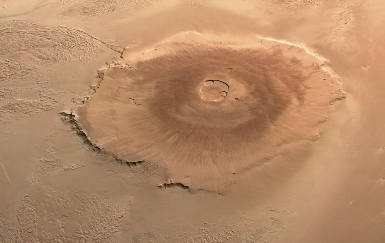
In the past, Mars experienced colossal volcanic activity, with its volcanoes being true giants. Among them stands out Olympus Mons, whose height reaches 21 km. This is approximately 2.5 times higher than the highest point on Earth — Mount Everest (measured from sea level).
Earlier, we had images of Olympus Mons, also obtained by the Mars Express satellite, which has been in an areocentric orbit since 2003. However, the new photos provide us with more information about the true scale of this colossal volcano. Its slopes spread over a vast territory that exceeds the area of the entire Hawaiian volcanic archipelago.
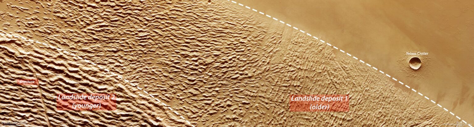
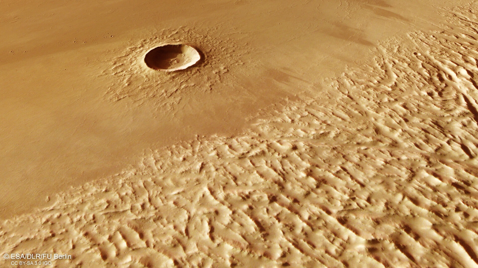
Part of the new photographs depicts the Yelwa crater and a much larger structure known as Lycus Sulci. These images not only help understand how the terrain has changed over time but also reveal the scale of Olympus Mons. Particularly striking is the size of the volcano in a photograph of the Yelwa crater, even though it is smaller compared to the massive Lycus Sulci — its diameter exceeds 8 km.
The Yelwa crater is located over 1000 km from the summit of Olympus Mons. This indicates how far lava eruptions from the volcano spread. The photographs provide scientists with a better understanding of its history – for example, they contain evidence that about 100 million years ago, the lower slopes of Olympus Mons experienced a major collapse.
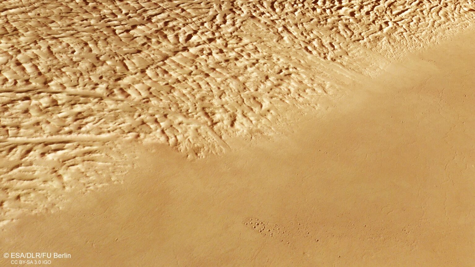
According to ESA data, a significant amount of lava once flowed from the volcano, triggering landslides that collided with rocky bases containing ice. The hot lava melted this ice, making it unstable. As a result, part of Olympus Mons separated and began to collapse. This event was accompanied by massive rockfalls and landslides that spread through the surrounding plains.
Over time, as these landslides moved away from the volcano, they compressed and stretched, creating distinctive landscape features that can be observed in the new images.
These impressive images were obtained thanks to the High-Resolution Stereo Camera (HRSC) of the Mars Express, which is capable of capturing the Martian surface in color and with a resolution of about 10 meters, revealing the incredible history of the planet.
Previously, we reported on the comfortable climate for life that existed on Mars for billions of years.
Source: ESA
