On October 16, the Lucy probe performed a gravitational maneuver in the vicinity of the Earth. The mission staff took this opportunity to check the operation of its scientific instruments — including the L’LORRI camera.
During the flyby, Lucy took a number of pictures of our planet. But Earth wasn’t the only celestial body photographed by Lucy that day. The probe also captured the Moon. By combining the photos transmitted to them, the mission staff received a number of extensive mosaics of its surface.
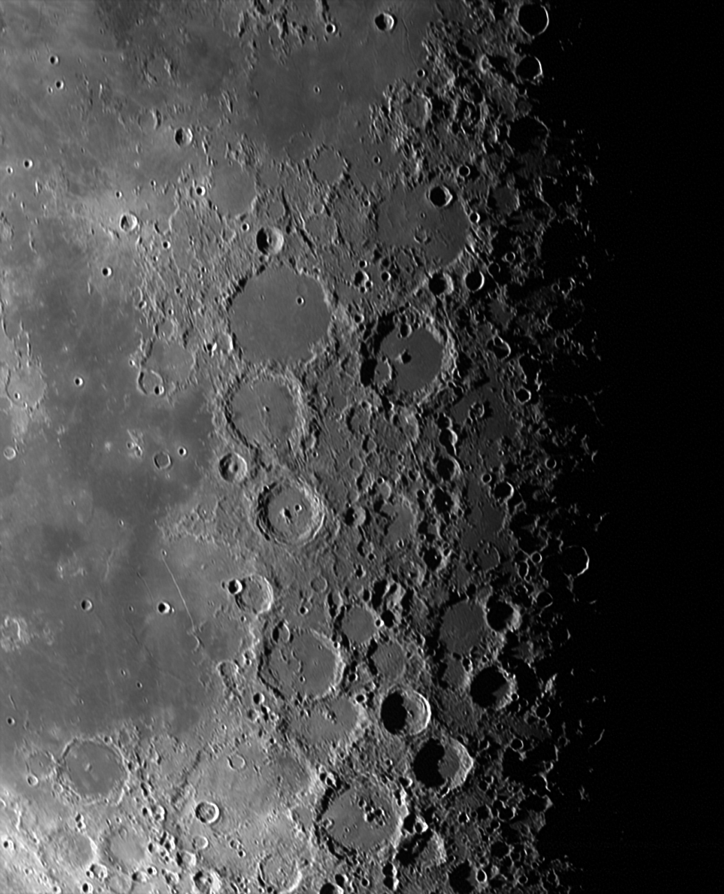
High mountain region of the Moon
The first of them consists of ten separate images taken with a shutter speed of two milliseconds. The image resolution is 1.3 km, the shooting was conducted from a distance of 260 thousand km. It demonstrates a high-altitude section with a length of about 1200 km. It is covered with numerous shock formations. Slightly to the left of the center of the mosaic, you can see the Arzachel crater. Its diameter is 96 km, by lunar standards it was formed relatively recently.
Copernicus Crater
The second mosaic is made up of five images taken with an exposure of one millisecond from a distance of 230 thousand km. Its resolution is 1.2 km. The image shows the eastern part of the visible side of the moon. It captures a lot of lunar structures that are well known to all lovers of astronomy. Surrounded by a ray system, the brightest crater is called Copernicus. Its diameter is 93 km, it was formed 800 million years ago.
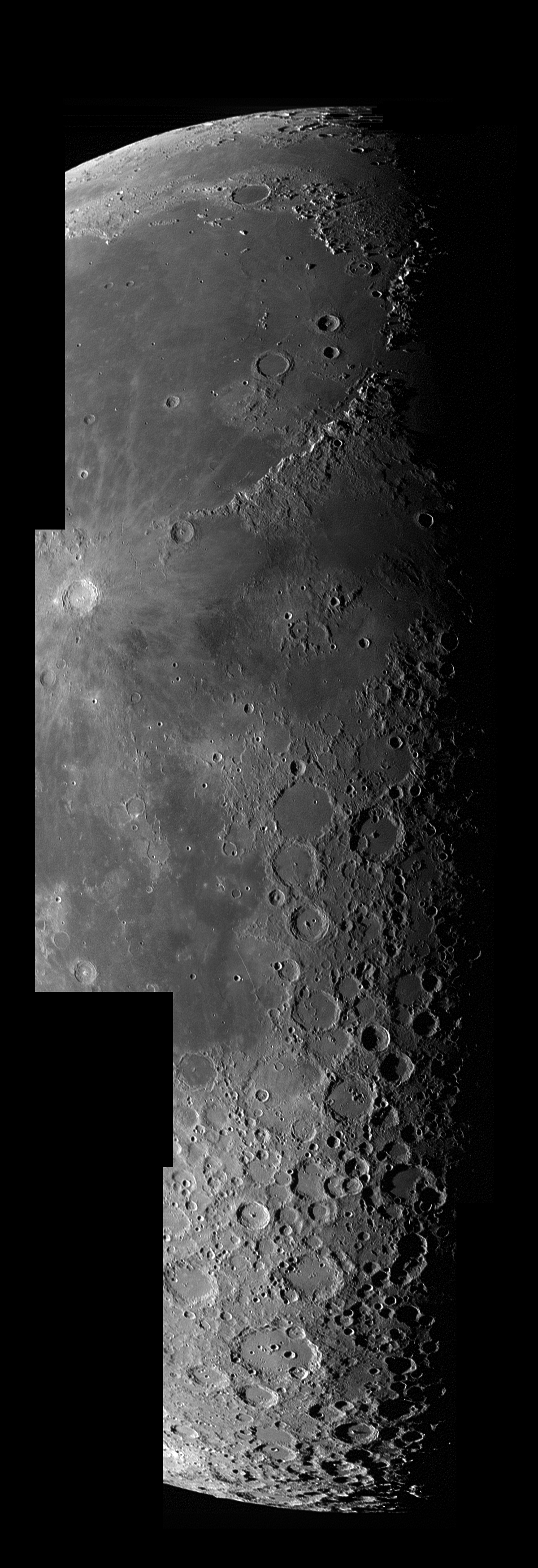
Mare Imbrium
The last image captures a section of the lunar surface about 1000 km wide, dominated by a giant basalt plain known as the Mare Imbrium. It is a huge impact crater that was once completely filled with lava.

In the lower right part of the image, you can see a mountain range that is part of the shaft of this crater. It is known as the Apennine Mountains. Its length is about 600 km, and its maximum height is up to 5400 m, which makes it one of the highest mountains on the visible side of the Moon. In 1971, the Apollo 15 expedition landed in this area.
According to https://www.nasa.gov
Follow us on Twitter to get the most interesting space news in time
https://twitter.com/ust_magazine
