
Scientists have taught artificial intelligence to look for roads on satellite images that are hidden by trees in the forest. Uncontrolled infrastructure construction causes significant damage to the environment and wildlife.
Analysis of satellite images
Satellite images analyzed with the help of artificial intelligence are becoming a new tool for finding uncharted roads that damage the environment and wildlife.
Bill Laurance, Distinguished Professor at James Cook University, co-authored a study that analyzed the reliability of an automated approach to large-scale road mapping using convolutional neural networks trained on road data using satellite imagery.
According to him, the Earth is experiencing an unprecedented wave of road construction, and about 25 million kilometers of new paved roads are expected by the middle of the century. Approximately 90 per cent of all road construction takes place in developing countries, in particular in many tropical and subtropical regions with exceptional biodiversity.
Tracking road construction
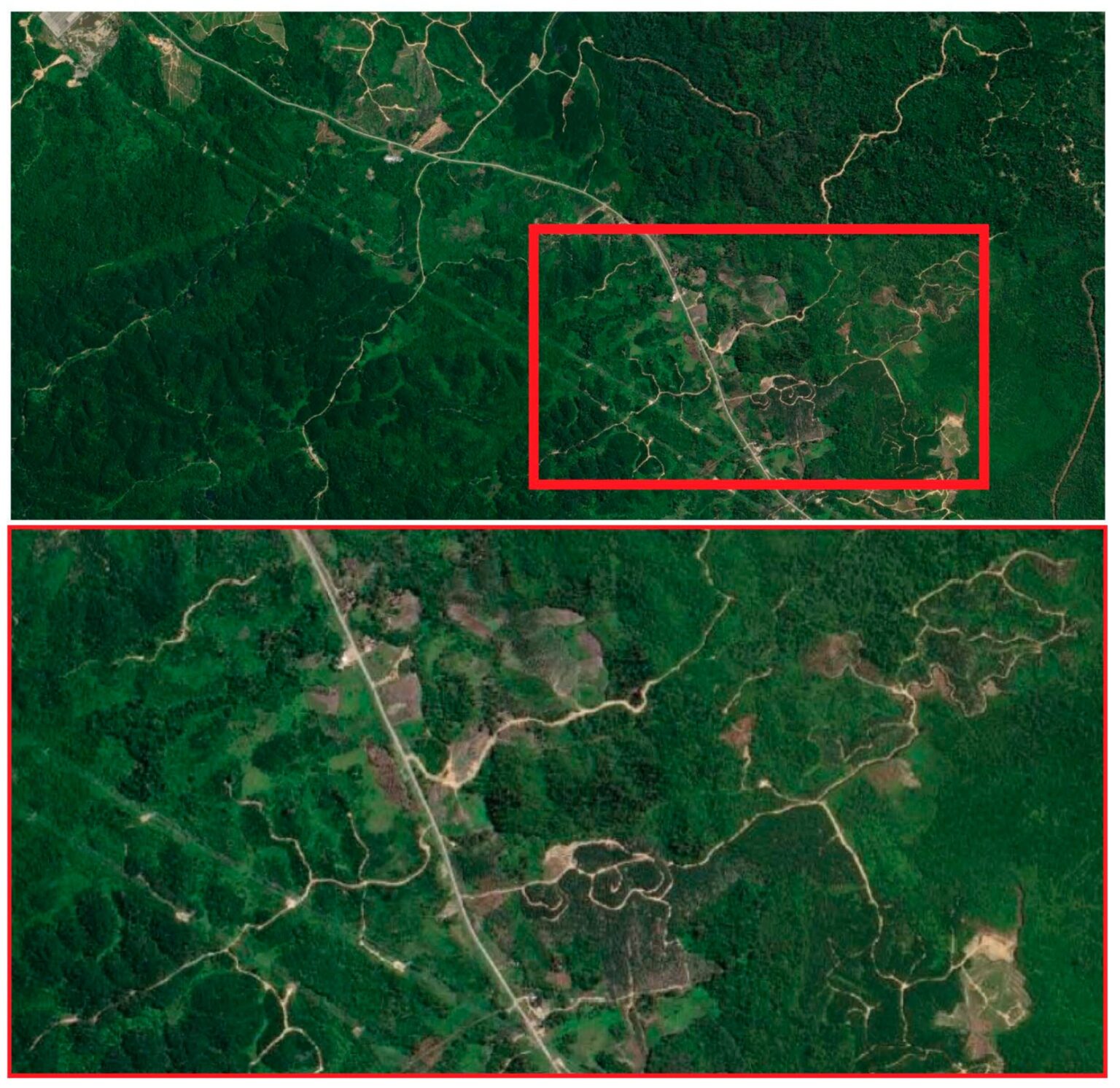
“Many roads in such regions, both legal and illegal, are unmapped, with road-mapping studies in the Brazilian Amazon, Asia-Pacific and elsewhere regularly finding up to 13 times more road length than reported in government or road databases,” notes Professor Laurance.
Traditionally, road mapping has meant tracking road objects manually using satellite imagery. This is incredibly slow, which makes it almost impossible to obtain timely and objective data on the state of road construction.
What can artificial intelligence do?
The researchers taught three machine learning models to automatically map road features on high-resolution satellite images covering rural, generally remote and often forested areas of Papua New Guinea, Indonesia and Malaysia. This study demonstrates the great potential of artificial intelligence to solve such large-scale tasks as global road mapping.
The expansion of the road network is perhaps the most important direct threat to tropical forests globally. In a few years, artificial intelligence may give us the means to map and monitor roads in the most environmentally critical regions of the world.
According to phys.org
Follow us on Twitter to get the most interesting space news in time
https://twitter.comne/ust_magazine
