
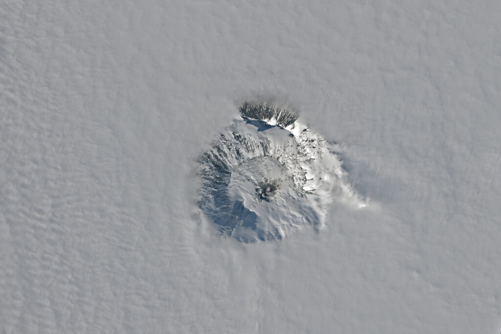
NASA published an image taken by the Landsat-9 satellite. It demonstrates Erebus, the southernmost active volcano on Earth.
Contrary to popular misconceptions, there are a significant number of volcanoes in the Antarctic region. However, since most of the region is covered with a thick layer of ice and there is no wood available for radiocarbon analysis, scientists have significant problems determining which eruptions occurred in the relatively recent past by geological standards and which can already be considered extinct.
Erebus is one of the few volcanoes in Antarctica that have erupted since the discovery of the continent. It is located on Ross Island in the sea of the same name. The height of the mountain is 3974 meters, and it is located 35 kilometers from McMurdo Station, which is the largest settlement in Antarctica.
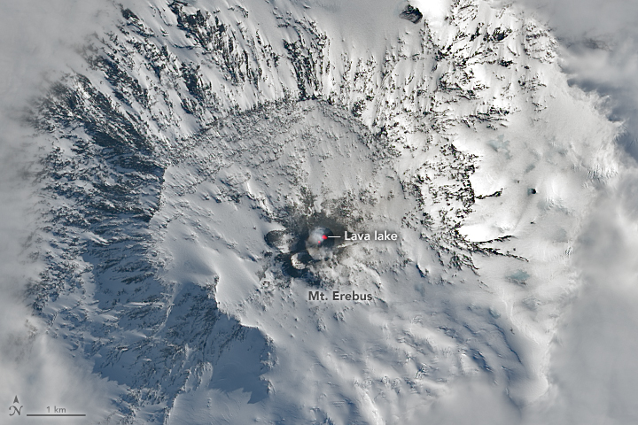
In the Landsat-9 image, you can see a characteristic red area inside the crater of the volcano. It corresponds to the infrared radiation recorded by the satellite. Its source is a lava lake. This is the name of wide depressions with steep walls that are constantly filled with fiery liquid lava
It is worth saying that lava lakes are a rather rare phenomenon. Only a few volcanoes on Earth have stable lakes. And Erebus is one of them. Its lava lake was discovered in the early 1970s, but it most likely formed even earlier.
You can also read our article about the ten most destructive volcanoes in recent history.
According to https://earthobservatory.nasa.gov
Follow us on Twitter to get the most interesting space news in time
https://twitter.com/ust_magazine
