Satellites observing the Earth in the last few decades have seen a lot of facts that indicate that humanity affects the climate of our planet through its actions. This is a story about the 5 biggest climate changes that can be seen from space.
Problems that can be seen from orbit
Human activity affects the Earth’s climate. Many try to deny this statement, but the changes are too large in scope. Therefore, they are fully visible only from orbit and only after long-term observations.
During the last decades, quite a large number of satellites were launched precisely for the purpose of monitoring climate changes. As a result scientists receive not only evidence that human carelessness destroys ecosystems, but also the opportunity to see in detail how exactly this happens. So, probably, in the future, it is these studies that will allow developing measures to overcome the situation.
1. Change in river sediments
Based on satellite images and archival data, scientists studied how the amount of river sediments changed between 1984 and 2018. This process has a complex and ambiguous impact on the environment.
On the one hand, it destroys agricultural lands and just areas comfortable for living, on the other hand, along with soil particles, organic remains are carried into the sea. In this way, the cycle of carbon processing is carried out, the disruption of which threatens to increase the flow of carbon dioxide into the atmosphere and increase the greenhouse effect.
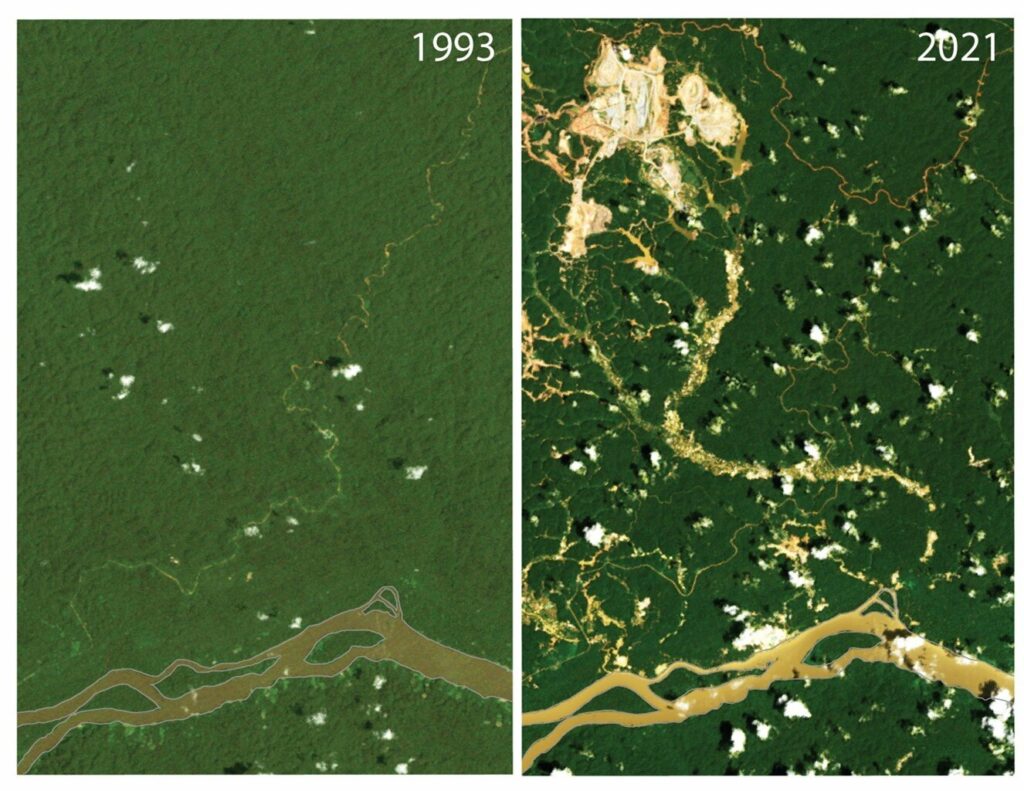
Satellite images show not only that many rivers have become turbid over the past 20 years from excessive bank erosion, but also allow us to see the details of this process.
For example, in the Southern Hemisphere, the volume of river sediments has increased by 36 percent over the past 35 years. And the analysis of images from satellites clearly shows that this happens precisely in those regions where forests are cleared for pastures and tree roots can no longer hold the soil. Or where the open-cut mining is taking place and a large amount of barren rock is thrown into the rivers.
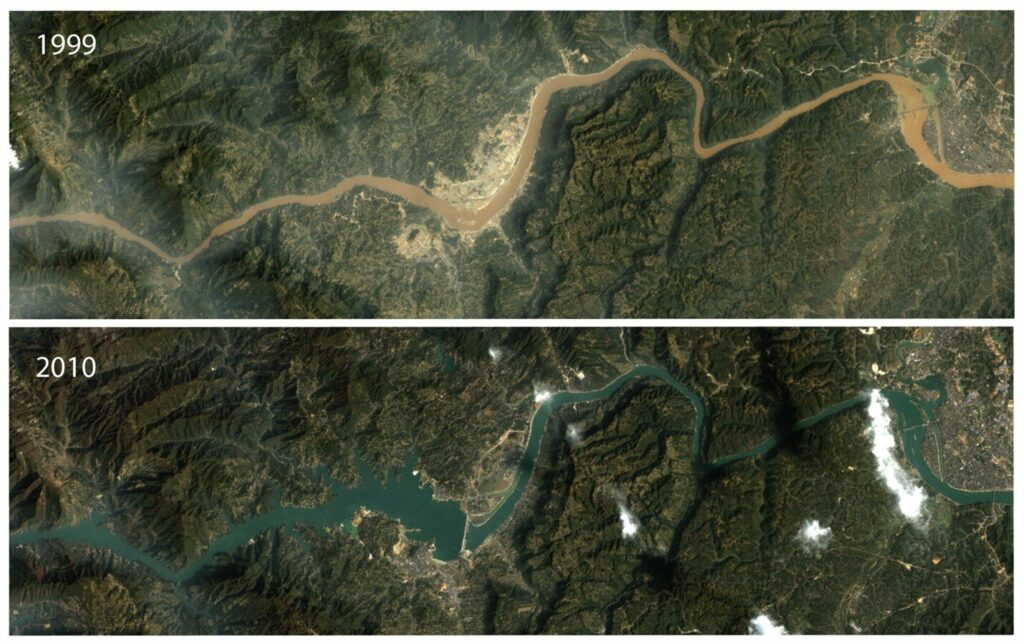
At the same time, in the Northern Hemisphere, the volume of coastal erosion during the same period, on the contrary, decreased. This happened due to the large-scale construction of dams, which slow down erosion processes. It is interesting that at the same time, the changes mainly fall not on the countries of North America and Europe, where these engineering works were completed several decades ago, but on East Asia, where this process is still ongoing.
2. Destruction of marshy meadows
Building dams could be seen as a good way to combat coastal erosion, but they limit this process too much, causing other river ecosystems to suffer.
A study of satellite images taken between 1999 and 2019 showed that the area of marshy meadows by the shores of seas and oceans — similar to those at the deltas of Danube and Dnipro rivers — decreased by 4,000 km2.
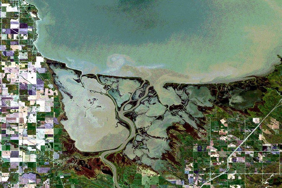
Wetlands just seem unnecessary. In fact, it is because of them that a significant amount of carbon is buried and the atmosphere is most actively saturated with oxygen. In addition, they are home to many species of birds and animals.
Nearly 70 percent of all of marshy meadows destruction take place in East Asia. China, Vietnam and Myanmar are precisely those countries that have been increasing their economic power in recent decades, in particular through the construction of hydraulic structures. As a result, some wet ecosystems dried up and some were simply washed away.
3. Changes in the Alps
Although green is the color of life, blue lakes are far from the only thing whose greening means very unpleasant climate changes. Recently, scientists studied satellite images of the Alps from 1984 to 2021 and found that in many areas where there used to be only rocks and snow, bushes and grass are now greening up.
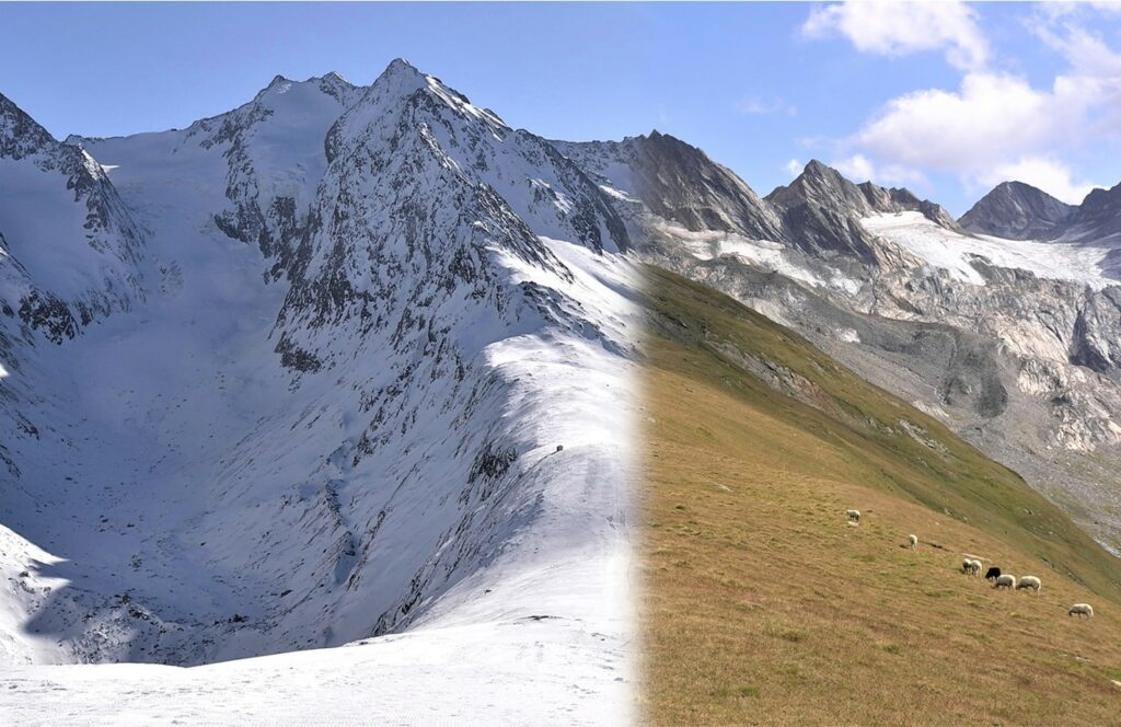
While the area of glaciers decreased by only a tenth, the volume of plant mass increased by 77 percent during the same period. Grass appeared where it was not there, and it became thicker where it grew earlier. In addition, plants, which in the past could only be found at the foot of the Alps, now appeared on the highlands.
Dense vegetation in the highlands is not good at all. Plants prevent the formation of a thick snow cover in winter and, unlike the snow, they do not reflect most of the radiation, but accumulate and then release it into the environment. Because of this, the temperature in the Alps is gradually increasing.
In addition to green, brown areas began to appear In satellite images of the Alps. These are the places where the retreat of glaciers and the reduction of snow cover led to drought and complete disappearance of vegetation. So far, they occupy less than 1 percent of the mountain area, but scientists believe that in the future they will begin to spread to those areas that are now greening.
4. Greenland’s glaciers are melting
Glaciers are melting not only in the Alps. In 2019, an article was published in the journal Nature, which was co-authored by 89 scientists, including those from NASA and ESA. It contains data from satellite observations of the Greenland glaciers from 1992 to 2018.
Research results indicate negative changes. During the observation period, the largest island of the Earth, which plays the role of “air conditioner” for its Northern Hemisphere, lost 3.8 trillion tons of ice. Due to this, the level of the World Ocean rose by 10.6 mm. The melting peak was observed in 2011.
These figures correspond to the worst forecasts of climatologists. If the rate of disappearance of Greenland’s glaciers continues, then by the end of this century the water level in the ocean will rise by 7-14 cm.
In addition, the glaciers in Antarctica continue to melt. And there, the volume of melting ice is much higher. If the rate of this phenomenon does not decrease, then by the end of the century, the water level in the oceans will rise by another 60 cm. As a result, territories currently inhabited by 400 million people may be flooded.
5. Changes in the Earth’s albedo
Our planet usually reflects 30 percent of the radiation it receives from the Sun into space. But data collected by satellites from 1998 to 2018 show that this value has decreased by 0.5 percent.
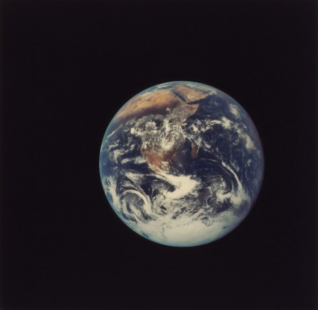
The reason for this is warming along the coasts of North and South America. As a result, the cloud cover, which reflected a significant part of the sunlight, was significantly reduced. Instead, it now falls on the dark surface of the ocean, which absorbs it.
According to scientists’ calculations, each meter of the Earth’s surface absorbs 0.5 W of heat more than in 1998. During the same period, due to all other human impacts on the environment combined, heat absorption increased by 0.6 W/m2.
All this energy accumulates on our planet and accelerates the melting of glaciers, which also reflect a large amount of heat into space. That is, the more our planet heats up, the more the rate of temperature increase increases.

