Modern satellite data allows you to see the position of large icebergs. Scientists compared them with the testimonies of the navigators of the XVIII century, including James Cook. They remained where they were 300 years ago.
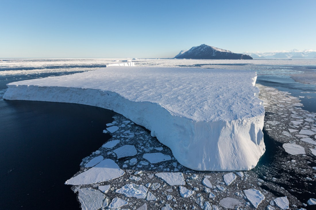
Are large icebergs standing still?
Researchers from Brigham Young University, the Jet Propulsion Research Laboratory and the Oceanographic School of the University of Washington decide to check whether the largest icebergs of Antarctica have changed their position over the past 300 years.
The researchers determined their current position thanks to two of the most advanced satellite data sets to date: BYU/National Ice Center and the Alfred Wegener Institute. The first of them is based on radar reflectometric data and does not differ in high resolution. The second one is based on observations in the visible, infrared and radio bands and is clearer.
Together they made it possible to determine where icebergs are located in the Antarctic seas of Weddell, Ross and Amundsen. Then they compared this data with the records of the XVIII navigators, who left records of where they had seen the “ice mountains”.
The researchers had at their disposal the court records of Edmond Halley in 1700, Lozier Bouvet in 1739 and Edward Riou in 1789. However, the most informative were the records of the famous captain James Cook, who during his second circumnavigation of Antarctica in 1772-177.
Captain Cook’s Notes
Captain Cook, like the rest of the navigators of the XVIII century, did not have modern satellite navigation systems on board. So there is no question of comparing the accuracy of their observations with satellite images.
However, on the trip he used a high-precision Larcum Kendall K1 chronometer and a sextant. Thanks to this, he measured the onset of noon or the middle of the night with an accuracy of a second and determined the height of the Sun or stars at that moment.
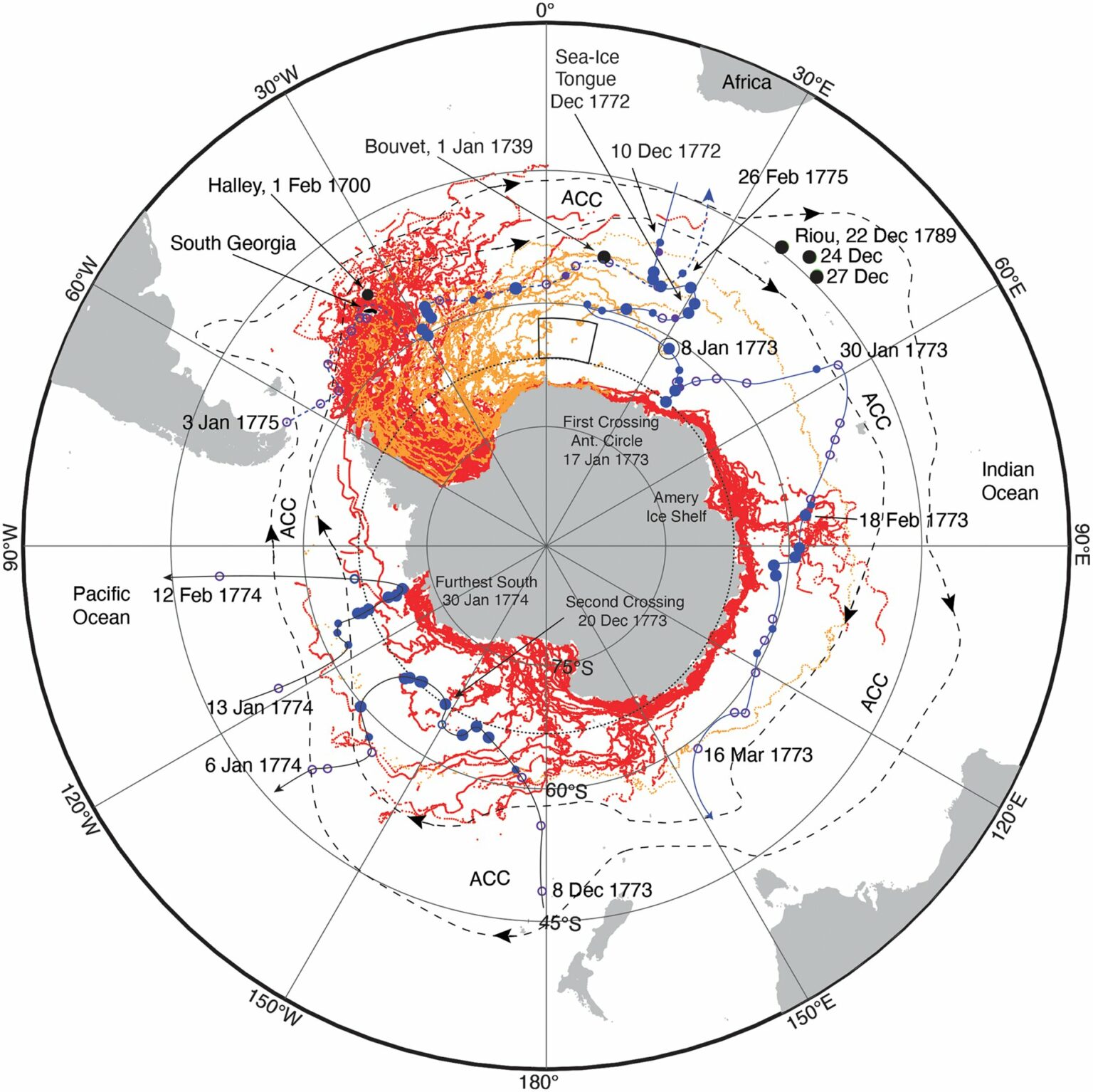
And James Cook meticulously kept a journal, so researchers can connect messages about “mountains of ice” and “hills of ice” with specific coordinates. However, from time to time the sailor simply reported that he saw a lot of ice. But then the gaps can be filled with the notes of astronomer William Wells, who was also on board Resolution.
Icebergs stayed where they were
Finally, the accuracy of the recordings was sufficient for the researchers to compare it with satellite data. And it turned out that icebergs, for the most part, were still located exactly where they were seen by the navigators of the XVIII century.
The study is not only interesting, but also important for understanding the Antarctic climate. The researchers related the fact that the icebergs mostly remained in their places to their size. They are too big and heavy for ocean currents to carry them away.
All this is also important from the point of view of global warming research. From the study, it could be concluded that it did not affect the “ice mountains” in any way. But the researchers pay attention to the fact that they have seen only the most massive icebergs, which it should not greatly affect.
According to phys.org
Follow us on Twitter to get the most interesting space news in time
https://twitter.com/ust_magazine
