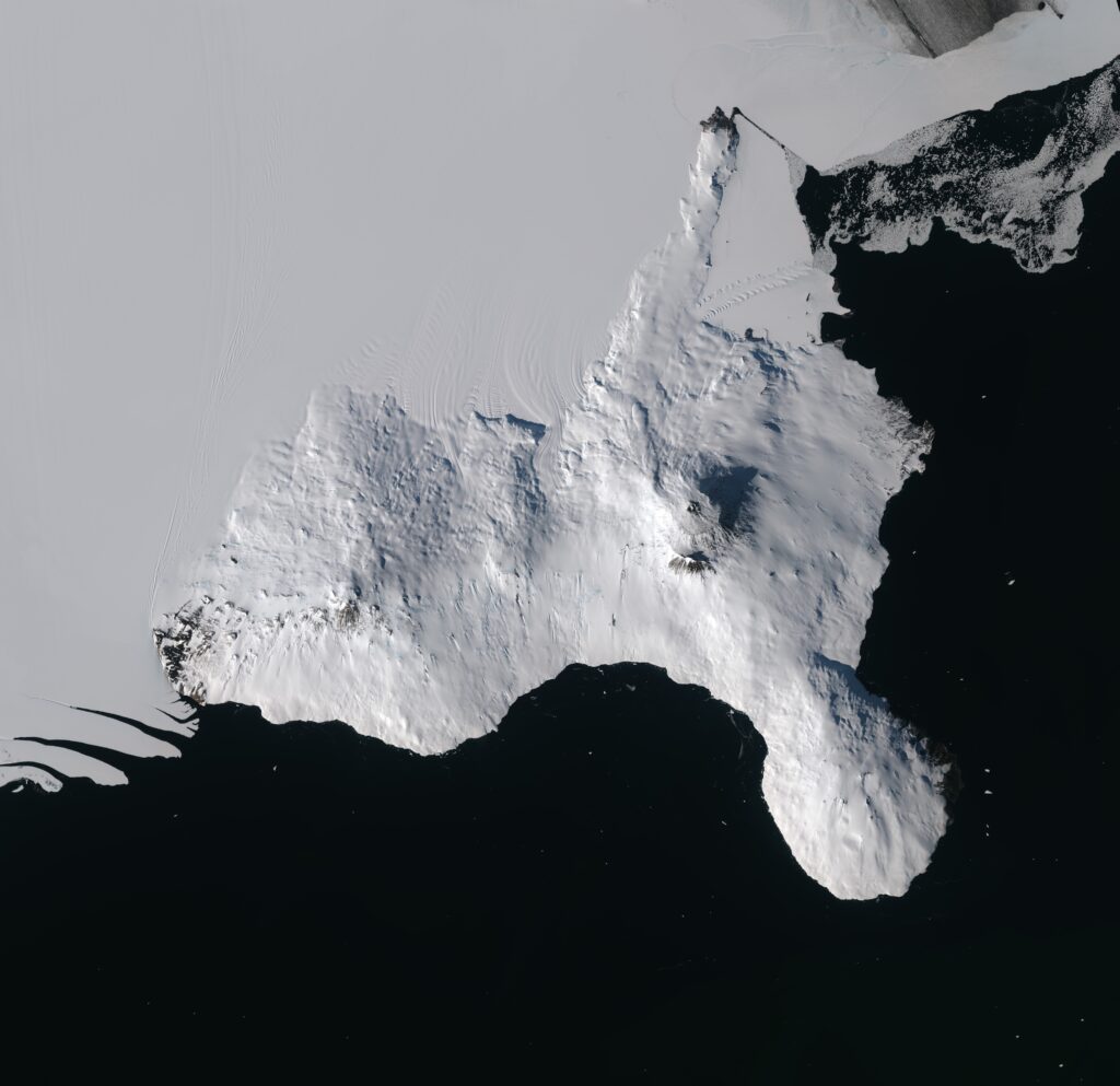
The European Space Agency (ESA) has published an image taken by the Sentinel-2 satellite. It shows Ross Island, home to the southernmost active volcano on Earth and also the largest settlement in Antarctica.

Ross Island has dimensions of 70 by 72 km. It is located in East Antarctica at the edge of the huge Ross Ice Shelf, a small part of which is visible in the upper part of the image. The island was named after British explorer Sir James Clark Ross, who discovered it in 1841 while searching for the magnetic South Pole.
There are four volcanoes on Ross Island: Mount Bird, Mount Terra Nova, Mount Terror and Mount Erebus. Two of them are clearly visible on the Sentinel-2 image. Mount Terror is on the left and the largest of the volcanoes, Erebus, is on the right. They were named after the Ross Expedition ships HMS Terror and HMS Erebus. These ships later took part in the infamous Franklin Expedition, all of whose members died while searching for the Northwest Passage. The shipwrecks were found between 2014 and 2016.

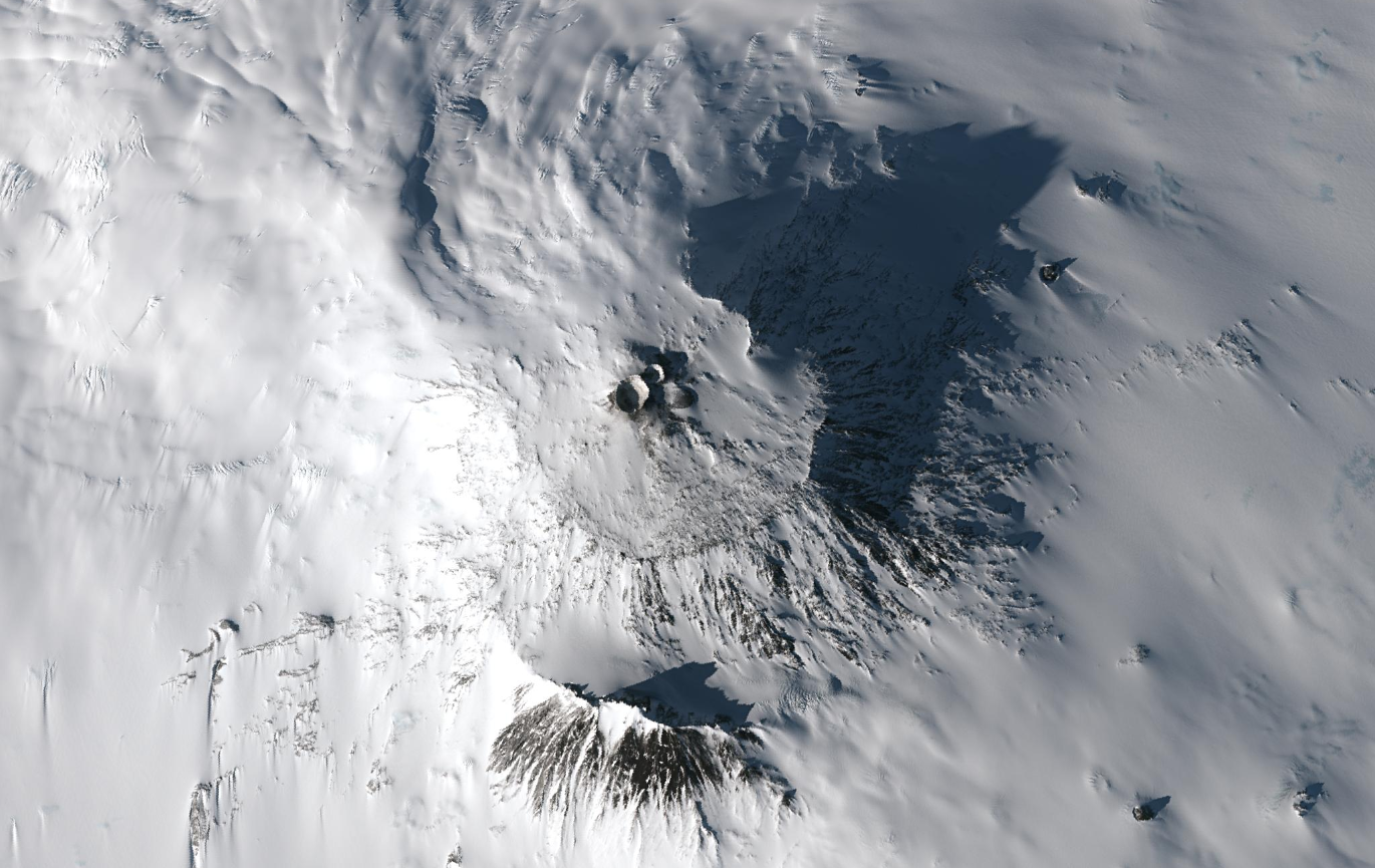
Mount Erebus is still active and is considered the southernmost active volcano in the world. Its height is 3,276 meters. It is one of the few volcanoes on Earth that has a lava lake. The caldera forms a plateau at the top of the volcano, where two craters can be seen. While the smaller crater is inactive, the main crater contains a smaller, inner crater that contains a lava lake.
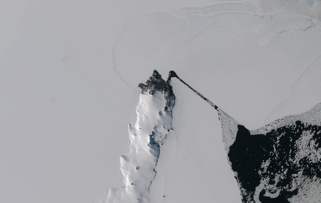
Ross Island is also one of the most important centers of scientific research on the ice continent. It is home to the U.S. McMurdo Station, the largest settlement, port, transportation node and research center in Antarctica. In summer it can support stays of up to 1,500 people. Therefore, McMurdo is sometimes called the unofficial capital of Antarctica.

McMurdo is at the extreme tip of the long and narrow Hut Point Peninsula, seen at the top of the photo. If you look closely, you can see on the image the path broken through the ice by ships bringing supplies and people to the station.
Antarctica was not always an icy continent. In the distant past, forests grew on its territory. Earlier we told you when Antarctica started to be covered with ice.
Provided by ESA


